TopoQuest Logo
Do you find TopoQuest useful?
Help keep TopoQuest running and adding new maps/features by donating!
Bitcoin:  19c7KJd3qBynnjoSw5npx9KScwjBe4ifkT
Litecoin:  LXs6TkuXGGXo1vDsWCkWVdjQX94eUKd6ui
Home View Maps Find Maps Find Places Resources & Links


Opelika East, Alabama Topographic Map

USGS Map Title: Opelika East, AL
USGS Map MRC: 32085F3
DRG (GeoTIFF) Download: o32085f3.tif


Neighboring USGS Topographic Map Quads:


  Moorefield, AL  
32085G4
 

  Cusseta, AL  
32085G3
 

  Lanett South, AL  
32085G2
 

  Opelika West, AL  
32085F4
 

  Opelika East, AL  
32085F3
 

  Beulah, AL  
32085F2
 

  Auburn, AL  
32085E4
 

  Parkers Crossroads, AL  
32085E3
 

  Bleecker, AL  
32085E2


Map MRC Location:

N33°
W86°
N33°
W85°
H8 H7 H6 H5 H4 H3 H2 H1
G8 G7 G6 G5 G4 G3 G2 G1
F8 F7 F6 F5 F4 F3 F2 F1
E8 E7 E6 E5 E4 E3 E2 E1
D8 D7 D6 D5 D4 D3 D2 D1
C8 C7 C6 C5 C4 C3 C2 C1
B8 B7 B6 B5 B4 B3 B2 B1
A8 A7 A6 A5 A4 A3 A2 A1
N32°
W86°
N32°
W85°

Opelika East, AL USGS 1:24K Topographic Map Preview:
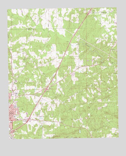
Opelika East, AL USGS Topographic Map
Click on map above to begin viewing in our Map Viewer.

This topographic map contains these locations and features:
Feature Name Type Latitude Longitude GNIS ID View Map
Alabama State Police DepartmentBuildingN32.6508°W85.3525°2751752View Map
Alabama State Troopers Troop GBuildingN32.6508°W85.3521°2752094View Map
Andrews (historical)LocaleN32.6990°W85.3472°138099View Map
Beans MillPopulated PlaceN32.6971°W85.2674°156039View Map
Bethel ChurchChurchN32.6729°W85.3263°114055View Map
Bethel School (historical)SchoolN32.6721°W85.3258°138114View Map
Bethesda Baptist ChurchChurchN32.6504°W85.3736°138115View Map
Condy DamDamN32.6785°W85.3599°130893View Map
Condy LakeReservoirN32.6786°W85.3600°138136View Map
Crooked CreekPopulated PlaceN32.6474°W85.3572°138141View Map
Darden High SchoolSchoolN32.6468°W85.3683°154450View Map
Ferguson Christian Methodist Episcopal ChapelChurchN32.6490°W85.3722°150886View Map
Fox Run Industrial ParkLocaleN32.6529°W85.3544°138170View Map
Gethsemane ChurchChurchN32.7174°W85.2513°138173View Map
Halie Turner SchoolSchoolN32.6674°W85.3672°119570View Map
Hephzibah Primitive Baptist ChurchChurchN32.6874°W85.2519°164066View Map
Household of Faith ChurchChurchN32.6868°W85.3047°163476View Map
Interchange 60CrossingN32.6318°W85.3722°155622View Map
Interchange 62CrossingN32.6435°W85.3530°155623View Map
Interchange 64CrossingN32.6726°W85.3316°155624View Map
Interchange 70CrossingN32.7462°W85.2811°155625View Map
Jackie Osment DamDamN32.6985°W85.2799°130910View Map
Jefferson Church (historical)ChurchN32.7101°W85.3727°138200View Map
Jeter Street Elementary SchoolSchoolN32.6557°W85.3680°169331View Map
Jimmerson Mill (historical)LocaleN32.6962°W85.2555°138203View Map
Liberty Baptist ChurchChurchN32.6757°W85.3252°152038View Map
Liberty CemeteryCemeteryN32.6760°W85.3241°138215View Map
Little Halawaka CreekStreamN32.6924°W85.2613°154511View Map
Memory Hill CemeteryCemeteryN32.6376°W85.3111°122650View Map
Miriam Brown Elementary SchoolSchoolN32.6418°W85.3730°165367View Map
Morris MineMineN32.6835°W85.3724°157682View Map
Mount JeffersonPopulated PlaceN32.7096°W85.3724°156746View Map
Mount Zion ChurchChurchN32.6943°W85.2883°123471View Map
Oak DalePopulated PlaceN32.6915°W85.3711°138247View Map
Opelika Fire and Rescue Station 4BuildingN32.6698°W85.3673°2691393View Map
Opelika High SchoolSchoolN32.6682°W85.3699°138249View Map
Opelika Post OfficePost OfficeN32.6457°W85.3734°167690View Map
Opelika State Technical CollegeSchoolN32.6690°W85.3666°164194View Map
Open Door ChurchChurchN32.6871°W85.3044°138251View Map
Osment PondReservoirN32.6998°W85.2786°130909View Map
Pine GrovePopulated PlaceN32.7162°W85.2519°124773View Map
Pine Grove United Methodist ChurchChurchN32.7074°W85.2577°138262View Map
Ridge Grove ChurchChurchN32.6365°W85.2674°125628View Map
Ridge Road ChurchChurchN32.6743°W85.2827°125629View Map
Roanoke JunctionPopulated PlaceN32.6796°W85.3699°125681View Map
Rocky Ridge School (historical)SchoolN32.6351°W85.2683°138280View Map
Rough and Ready (historical)LocaleN32.6937°W85.3566°138281View Map
Saint Mark ChurchChurchN32.7029°W85.3508°126155View Map
Saint Marks School (historical)SchoolN32.7029°W85.3505°138288View Map
Saint Peter Church (historical)ChurchN32.6557°W85.2633°138291View Map
Scott CemeteryCemeteryN32.7071°W85.3588°126481View Map
Shady Grove CemeteryCemeteryN32.6940°W85.2916°138301View Map
Shady Grove Christian ChurchChurchN32.6937°W85.2941°153382View Map
Sommerset StripAirportN32.7178°W85.3665°2676328View Map
Sweet Hope CemeteryCemeteryN32.7458°W85.2752°2647115View Map
Sweet Pilgrim Church (historical)ChurchN32.6660°W85.3208°138315View Map
Thompsons African Methodist Episcopal Zion ChapelChurchN32.6432°W85.3705°150889View Map
Union Grove Baptist ChurchChurchN32.6282°W85.3374°153778View Map
Union Grove CemeteryCemeteryN32.6287°W85.3374°138326View Map
Wallace Chapel ChurchChurchN32.7101°W85.2572°138331View Map
West RidgePopulated PlaceN32.6676°W85.3422°138338View Map

Note: Coordinates in the location and feature list above are referenced to NAD83 datum.


Copyright (C) 2008-2025 Ryan Niemi / Sunset Dynamics ... All Rights Reserved