TopoQuest Logo
Do you find TopoQuest useful?
Help keep TopoQuest running and adding new maps/features by donating!
Bitcoin:  19c7KJd3qBynnjoSw5npx9KScwjBe4ifkT
Litecoin:  LXs6TkuXGGXo1vDsWCkWVdjQX94eUKd6ui
Home View Maps Find Maps Find Places Resources & Links


Bleecker, Alabama Topographic Map

USGS Map Title: Bleecker, AL
USGS Map MRC: 32085E2
DRG (GeoTIFF) Download: o32085e2.tif


Neighboring USGS Topographic Map Quads:


  Opelika East, AL  
32085F3
 

  Beulah, AL  
32085F2
 

  Bartletts Ferry Dam, GA  
32085F1
 

  Parkers Crossroads, AL  
32085E3
 

  Bleecker, AL  
32085E2
 

  Smiths Station, AL  
32085E1
 

  Marvyn, AL  
32085D3
 

  Crawford, AL  
32085D2
 

  Phenix City, AL  
32085D1


Map MRC Location:

N33°
W86°
N33°
W85°
H8 H7 H6 H5 H4 H3 H2 H1
G8 G7 G6 G5 G4 G3 G2 G1
F8 F7 F6 F5 F4 F3 F2 F1
E8 E7 E6 E5 E4 E3 E2 E1
D8 D7 D6 D5 D4 D3 D2 D1
C8 C7 C6 C5 C4 C3 C2 C1
B8 B7 B6 B5 B4 B3 B2 B1
A8 A7 A6 A5 A4 A3 A2 A1
N32°
W86°
N32°
W85°

Bleecker, AL USGS 1:24K Topographic Map Preview:
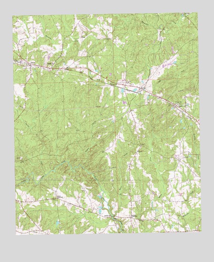
Bleecker, AL USGS Topographic Map
Click on map above to begin viewing in our Map Viewer.

This topographic map contains these locations and features:
Feature Name Type Latitude Longitude GNIS ID View Map
Alnoname Two DamDamN32.5751°W85.1766°130711View Map
Antioch CemeteryCemeteryN32.5196°W85.2222°138101View Map
Antioch Methodist ChurchChurchN32.5204°W85.2224°113145View Map
Bethelpore ChurchChurchN32.5471°W85.1658°114098View Map
BleeckerPopulated PlaceN32.5824°W85.1641°154443View Map
Bonita Farms LakeReservoirN32.5814°W85.1765°130727View Map
Church of ChristChurchN32.5737°W85.1369°138126View Map
Concord Baptist ChurchChurchN32.5862°W85.1733°116491View Map
Concord CemeteryCemeteryN32.5946°W85.1733°138135View Map
Concord ChurchChurchN32.5874°W85.1905°116492View Map
Dunken CreekStreamN32.5379°W85.2036°117670View Map
Friendship Firefighters Association Station 1BuildingN32.5625°W85.1264°2691390View Map
Good Hope ChurchChurchN32.5071°W85.1630°119121View Map
Goodhope School (historical)SchoolN32.5187°W85.2447°138182View Map
Great FallsFallsN32.5087°W85.1842°138184View Map
Gullatte DamDamN32.5151°W85.1916°130650View Map
Hubbard DamDamN32.5218°W85.1933°130655View Map
Hubbard LakeReservoirN32.5211°W85.1931°130656View Map
Jerusalem ChurchChurchN32.5718°W85.1388°138201View Map
Meadows CemeteryCemeteryN32.5200°W85.2318°141888View Map
Meadows CrossroadsPopulated PlaceN32.5088°W85.1719°156690View Map
Moffits MillPopulated PlaceN32.5101°W85.1852°156726View Map
MottsPopulated PlaceN32.5724°W85.1385°154475View Map
Mount Gilead Church (historical)ChurchN32.5224°W85.1738°163218View Map
New Hope ChurchChurchN32.5993°W85.2466°123818View Map
Peters CreekStreamN32.5101°W85.1849°124644View Map
Pleasant View ChurchChurchN32.5965°W85.2397°138267View Map
Prince CrossroadsPopulated PlaceN32.5207°W85.2216°156937View Map
Saint Marks ChurchChurchN32.5740°W85.1380°126161View Map
Saint Peter School (historical)SchoolN32.5424°W85.2458°138292View Map
Saint Peters ChurchChurchN32.5424°W85.2455°126202View Map
SalemPopulated PlaceN32.5968°W85.2386°126233View Map
Salem CemeteryCemeteryN32.5985°W85.2416°138293View Map
Salem ChurchChurchN32.5962°W85.1491°163483View Map
Salem ChurchChurchN32.5962°W85.2236°164196View Map
Salem Post OfficePost OfficeN32.5967°W85.2407°167693View Map
Salem SchoolSchoolN32.5954°W85.2333°163484View Map
Salem United Methodist ChurchChurchN32.5985°W85.2408°138294View Map
Salem Volunteer Fire DepartmentBuildingN32.5981°W85.2404°2691401View Map
Salem-Shotwell Covered BridgeBridgeN32.6099°W85.2086°138295View Map
Self DamDamN32.5068°W85.2233°130640View Map
ShotwellPopulated PlaceN32.5843°W85.1836°153443View Map
Smiths Station DivisionCivilN32.5771°W85.1429°165850View Map
Stroud CemeteryCemeteryN32.5504°W85.1644°127475View Map
Strouds Cross RoadLocaleN32.5501°W85.1649°138312View Map
Sturkie CreekStreamN32.5340°W85.2288°153594View Map
W B Cogdell DamDamN32.5818°W85.1766°130726View Map
Wacoochee High SchoolSchoolN32.5974°W85.2233°164142View Map
Wetumpka Council House (historical)LocaleN32.5093°W85.1755°154167View Map

Note: Coordinates in the location and feature list above are referenced to NAD83 datum.


Copyright (C) 2008-2024 Ryan Niemi / Sunset Dynamics ... All Rights Reserved