TopoQuest Logo
Do you find TopoQuest useful?
Help keep TopoQuest running and adding new maps/features by donating!
Bitcoin:  19c7KJd3qBynnjoSw5npx9KScwjBe4ifkT
Litecoin:  LXs6TkuXGGXo1vDsWCkWVdjQX94eUKd6ui
Home View Maps Find Maps Find Places Resources & Links


Oregon, Wisconsin Topographic Map

USGS Map Title: Oregon, WI
USGS Map MRC: 42089H4
DRG (GeoTIFF) Download: o42089h4.tif


Neighboring USGS Topographic Map Quads:


  Middleton, WI  
43089A5
 

  Madison West, WI  
43089A4
 

  Madison East, WI  
43089A3
 

  Verona, WI  
42089H5
 

  Oregon, WI  
42089H4
 

  Rutland, WI  
42089H3
 

  Belleville, WI  
42089G5
 

  Attica, WI  
42089G4
 

  Evansville, WI  
42089G3


Map MRC Location:

N43°
W90°
N43°
W89°
H8 H7 H6 H5 H4 H3 H2 H1
G8 G7 G6 G5 G4 G3 G2 G1
F8 F7 F6 F5 F4 F3 F2 F1
E8 E7 E6 E5 E4 E3 E2 E1
D8 D7 D6 D5 D4 D3 D2 D1
C8 C7 C6 C5 C4 C3 C2 C1
B8 B7 B6 B5 B4 B3 B2 B1
A8 A7 A6 A5 A4 A3 A2 A1
N42°
W90°
N42°
W89°

Oregon, WI USGS 1:24K Topographic Map Preview:
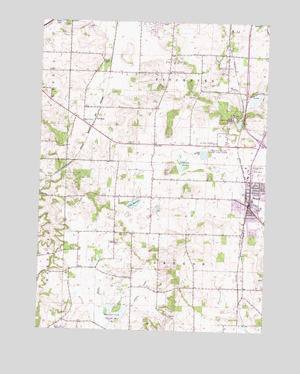
Oregon, WI USGS Topographic Map
Click on map above to begin viewing in our Map Viewer.

This topographic map contains these locations and features:
Feature Name Type Latitude Longitude GNIS ID View Map
Barney SwampSwampN42.9431°W89.4198°1561185View Map
Carandale FarmLocaleN42.9128°W89.4353°2516918View Map
City of FitchburgCivilN42.9859°W89.4255°1583204View Map
EplegaardenLocaleN42.9742°W89.4769°2516921View Map
Faith Evangelical Lutheran ChurchChurchN42.9242°W89.3837°1842416View Map
First United Presbyterian ChurchChurchN42.9275°W89.3837°1842428View Map
Fisher ValleyValleyN42.8795°W89.4574°1565021View Map
FitchburgPopulated PlaceN42.9608°W89.4698°1565032View Map
Fitchburg Center SchoolSchoolN42.9800°W89.4287°1565033View Map
Hann's Christmas FarmLocaleN42.9000°W89.4422°2629139View Map
Holy Mother of Consolation Catholic ChurchChurchN42.9358°W89.3840°1842469View Map
Lake BarneyLakeN42.9466°W89.4096°1561186View Map
Lake Harriet CemeteryCemeteryN42.9288°W89.4478°2781259View Map
Lake HarriettLakeN42.9265°W89.4479°1566084View Map
Maher PondLakeN42.9248°W89.4343°2761899View Map
Maples Corners SchoolSchoolN42.9597°W89.4768°1569007View Map
Netherwood Knoll Elementary SchoolSchoolN42.9290°W89.3822°1842578View Map
Oak HallPopulated PlaceN42.9506°W89.4371°1570632View Map
Oak Hall CemeteryCemeteryN42.9509°W89.4514°1570633View Map
Oakhill Correctional InstitutionBuildingN42.9614°W89.3932°1842591View Map
Oakhill Correctional Institution SchoolSchoolN42.9511°W89.3978°1576910View Map
OregonPopulated PlaceN42.9261°W89.3846°1570854View Map
Oregon Area Fire and Emergency Medical Services DistrictBuildingN42.9267°W89.3834°2697955View Map
Oregon Middle SchoolSchoolN42.9132°W89.3762°2716294View Map
Oregon Police DepartmentBuildingN42.9249°W89.3775°2759505View Map
Oregon Post OfficePost OfficeN42.9267°W89.3821°1842601View Map
Oregon Public LibraryBuildingN42.9261°W89.3826°1842602View Map
Oregon State Camp and FarmLocaleN42.9525°W89.3968°1570856View Map
Oregon Village HallBuildingN42.9261°W89.3835°1842603View Map
Oregon Water TowerTowerN42.9253°W89.3839°2358089View Map
Outhouse FarmLocaleN42.8936°W89.3972°2629138View Map
Peoples United Methodist ChurchChurchN42.9292°W89.3843°1842614View Map
Peterson FieldAirportN42.9270°W89.4211°1582126View Map
Prairie Mound CemeteryCemeteryN42.9422°W89.3819°1571885View Map
Prairie View Elementary SchoolSchoolN42.9301°W89.3815°1842623View Map
Rome Corners Intermediate SchoolSchoolN42.9180°W89.3904°2716219View Map
Saint Mary's Catholic CemeteryCemeteryN42.9514°W89.4027°1566611View Map
Saint Mary's CemeteryCemeteryN42.9404°W89.3826°1573275View Map
Stoner SchoolSchoolN42.9842°W89.4654°1574935View Map
Stony Hill FarmLocaleN42.9267°W89.4711°2629140View Map
StoryLocaleN42.9000°W89.4737°1574961View Map
Storytown AirfieldAirportN42.9086°W89.4502°1582127View Map
Storytown CemeteryCemeteryN42.8966°W89.4531°1574962View Map
Syvrud AirportAirportN42.8811°W89.3977°1581903View Map
Town of OregonCivilN42.8965°W89.4329°1583868View Map
Village of OregonCivilN42.9252°W89.3887°1583867View Map
WIBA-AM (Madison)TowerN42.9994°W89.4298°1582316View Map
Winterland NurseryBuildingN42.9131°W89.4364°2629202View Map
WMGN-FM (Madison)TowerN42.9628°W89.3796°1582406View Map
Wolf Mink RanchLocaleN42.9878°W89.4747°2710251View Map

Note: Coordinates in the location and feature list above are referenced to NAD83 datum.


Copyright (C) 2008-2025 Ryan Niemi / Sunset Dynamics ... All Rights Reserved