TopoQuest Logo
Do you find TopoQuest useful?
Help keep TopoQuest running and adding new maps/features by donating!
Bitcoin:  19c7KJd3qBynnjoSw5npx9KScwjBe4ifkT
Litecoin:  LXs6TkuXGGXo1vDsWCkWVdjQX94eUKd6ui
Home View Maps Find Maps Find Places Resources & Links


Orkney Springs, Virginia Topographic Map

USGS Map Title: Orkney Springs, VA
USGS Map MRC: 38078G7
DRG (GeoTIFF) Download: o38078g7.tif


Neighboring USGS Topographic Map Quads:


  Lost River State Park, WV  
38078H8
 

  Lost City, WV  
38078H7
 

  Wolf Gap, WV  
38078H6
 

  Bergton, VA  
38078G8
 

  Orkney Springs, VA  
38078G7
 

  Conicville, VA  
38078G6
 

  Fulks Run, VA  
38078F8
 

  Timberville, VA  
38078F7
 

  New Market, VA  
38078F6


Map MRC Location:

N39°
W79°
N39°
W78°
H8 H7 H6 H5 H4 H3 H2 H1
G8 G7 G6 G5 G4 G3 G2 G1
F8 F7 F6 F5 F4 F3 F2 F1
E8 E7 E6 E5 E4 E3 E2 E1
D8 D7 D6 D5 D4 D3 D2 D1
C8 C7 C6 C5 C4 C3 C2 C1
B8 B7 B6 B5 B4 B3 B2 B1
A8 A7 A6 A5 A4 A3 A2 A1
N38°
W79°
N38°
W78°

Orkney Springs, VA USGS 1:24K Topographic Map Preview:
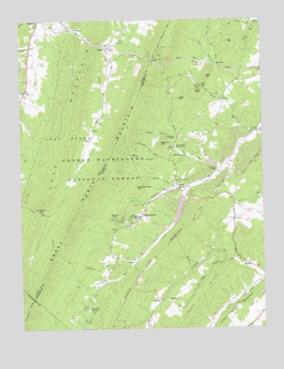
Orkney Springs, VA USGS Topographic Map
Click on map above to begin viewing in our Map Viewer.

This topographic map contains these locations and features:
Feature Name Type Latitude Longitude GNIS ID View Map
Alum RunStreamN38.8168°W78.7756°1481300View Map
Anderson RunStreamN38.7779°W78.8264°1481317View Map
Barb GapGapN38.8473°W78.7800°1481450View Map
Barb RunStreamN38.8307°W78.7525°1481452View Map
BasorePopulated PlaceN38.8637°W78.8303°1553809View Map
Basore Schoolhouse (historical)SchoolN38.8637°W78.8286°1718537View Map
BasyePopulated PlaceN38.8071°W78.7922°1481487View Map
Basye Census Designated PlaceCensusN38.8181°W78.7659°2389177View Map
Basye Post OfficePost OfficeN38.8070°W78.7894°2766335View Map
Bean HollowValleyN38.7776°W78.7693°1481503View Map
Bean RunStreamN38.8582°W78.7761°1481504View Map
Bear RunStreamN38.8573°W78.7731°1481529View Map
Beetle RunStreamN38.8151°W78.7700°1481601View Map
Bird HavenLocaleN38.8198°W78.7909°1481811View Map
Broad HollowValleyN38.8193°W78.8043°1482010View Map
Bryce MountainSummitN38.8065°W78.7722°1496819View Map
Bryce ResortLocaleN38.8175°W78.7660°2575694View Map
Bull GapGapN38.8573°W78.7731°1482155View Map
Bull RunStreamN38.8573°W78.7731°1482157View Map
Cove ChapelChurchN38.8643°W78.8292°1550801View Map
Cove ChurchChurchN38.8309°W78.8367°1550802View Map
Cullers RunStreamN38.8459°W78.8711°1550858View Map
Ervin May SpringSpringN38.8484°W78.8300°1678120View Map
Fat MountainSummitN38.8662°W78.7667°1483383View Map
Freds MountainSummitN38.8659°W78.7572°1496912View Map
Furnace KnobSummitN38.8276°W78.7953°1496913View Map
HepnersPopulated PlaceN38.7618°W78.8034°1484047View Map
High Head KnobSummitN38.8246°W78.8031°1496941View Map
Hunkerson GapGapN38.7979°W78.8647°1551523View Map
Hunkerson Gap TrailTrailN38.7762°W78.8489°1551524View Map
Hunkerson Gap TrailTrailN38.7765°W78.8489°1484282View Map
Kelly RunStreamN38.8071°W78.7922°1484543View Map
Lake CarrollReservoirN38.8171°W78.7759°1490839View Map
Lake Carroll DamDamN38.8168°W78.7714°1490838View Map
Lake LauraReservoirN38.7980°W78.7932°1490837View Map
Little MountainSummitN38.8432°W78.7925°1484940View Map
Little North MountainSummitN38.7546°W78.7678°1496993View Map
Lower Cove SpringSpringN38.8632°W78.8372°1678118View Map
MacaniePopulated PlaceN38.7759°W78.7575°1497003View Map
Morning Star CemeteryCemeteryN38.7618°W78.7997°1673881View Map
Morning Star ChurchChurchN38.7618°W78.7995°1485555View Map
Mount Hermon CemeteryCemeteryN38.7940°W78.7653°1673885View Map
Mount Hermon ChurchChurchN38.7943°W78.7653°1485590View Map
Orkney SpringsPopulated PlaceN38.7954°W78.8145°1485992View Map
Orkney Springs Post OfficePost OfficeN38.7952°W78.8145°2766406View Map
Persimmon Pond HollowValleyN38.8192°W78.8007°1486154View Map
Powder Springs CemeteryCemeteryN38.8098°W78.7931°1673900View Map
Powder Springs ChurchChurchN38.8098°W78.7939°1486402View Map
Powder Springs MountainSummitN38.8071°W78.8142°1488525View Map
Rinker RunStreamN38.7773°W78.8156°1486623View Map
Saltpeter RunStreamN38.8073°W78.7872°1486911View Map
Segar MountainSummitN38.8521°W78.7789°1486993View Map
Shenandoah Alum SpringsSpringN38.8236°W78.7948°1487177View Map
Shenandoah County Fire and Rescue Station 18 - Orkney Springs Fire and RescueBuildingN38.8037°W78.7999°2085907View Map
Shrine Mont Church CampLocaleN38.7946°W78.8222°1487227View Map
Sky Bryce AirportAirportN38.8161°W78.7696°1498588View Map
Snyder RunStreamN38.8646°W78.8670°1552960View Map
Spring MountainSummitN38.7962°W78.8242°1497160View Map
Stoney Creek CemeteryCemeteryN38.8301°W78.7520°1673928View Map
Stony Creek ChurchChurchN38.8301°W78.7522°1487618View Map
Stony Creek Number Nine DamDamN38.8034°W78.7931°1490836View Map
Sugar KnobSummitN38.8459°W78.7850°1497170View Map
Timber RidgeRidgeN38.7512°W78.7950°1487084View Map
Tomahawk PondReservoirN38.7581°W78.8404°1487945View Map
Tomahawk Pond CampgroundLocaleN38.7565°W78.8389°1488526View Map
Upper Cove SpringSpringN38.8666°W78.8229°1678119View Map
Whitmer School (historical)SchoolN38.8301°W78.8370°1556879View Map
Wildcat HollowValleyN38.8293°W78.7974°1488370View Map
Woodland ChurchChurchN38.8429°W78.7703°1488475View Map

Note: Coordinates in the location and feature list above are referenced to NAD83 datum.


Copyright (C) 2008-2025 Ryan Niemi / Sunset Dynamics ... All Rights Reserved