TopoQuest Logo
Do you find TopoQuest useful?
Help keep TopoQuest running and adding new maps/features by donating!
Bitcoin:  19c7KJd3qBynnjoSw5npx9KScwjBe4ifkT
Litecoin:  LXs6TkuXGGXo1vDsWCkWVdjQX94eUKd6ui
Home View Maps Find Maps Find Places Resources & Links


Lost River State Park, West Virginia Topographic Map

USGS Map Title: Lost River State Park, WV
USGS Map MRC: 38078H8
DRG (GeoTIFF) Download: o38078h8.tif


Neighboring USGS Topographic Map Quads:


  Rig, WV  
39079A1
 

  Moorefield, WV  
39078A8
 

  Needmore, WV  
39078A7
 

  Petersburg East, WV  
38079H1
 

  Lost River State Park, WV  
38078H8
 

  Lost City, WV  
38078H7
 

  Milam, WV  
38079G1
 

  Bergton, VA  
38078G8
 

  Orkney Springs, VA  
38078G7


Map MRC Location:

N39°
W79°
N39°
W78°
H8 H7 H6 H5 H4 H3 H2 H1
G8 G7 G6 G5 G4 G3 G2 G1
F8 F7 F6 F5 F4 F3 F2 F1
E8 E7 E6 E5 E4 E3 E2 E1
D8 D7 D6 D5 D4 D3 D2 D1
C8 C7 C6 C5 C4 C3 C2 C1
B8 B7 B6 B5 B4 B3 B2 B1
A8 A7 A6 A5 A4 A3 A2 A1
N38°
W79°
N38°
W78°

Lost River State Park, WV USGS 1:24K Topographic Map Preview:
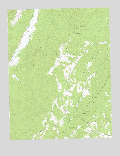
Lost River State Park, WV USGS Topographic Map
Click on map above to begin viewing in our Map Viewer.

This topographic map contains these locations and features:
Feature Name Type Latitude Longitude GNIS ID View Map
Big Ridge Lookout TowerTowerN38.9140°W78.8953°1557809View Map
Buckhorn ChurchChurchN38.9034°W78.9178°1536600View Map
Cabin RunStreamN38.8954°W78.9247°1536834View Map
Cheeks RocksCliffN38.8984°W78.9061°1537230View Map
Cranny Crow OverlookLocaleN38.9012°W78.9056°1537807View Map
East RidgeRidgeN38.8809°W78.9234°1538514View Map
Harness Ford BridgeBridgeN38.9783°W78.9769°2646967View Map
Helmick RockCliffN38.9757°W78.9156°1540131View Map
Hunting RidgeRidgeN38.9448°W78.9045°1540602View Map
Lee Sulphur SpringSpringN38.8957°W78.9275°1678103View Map
Little MountainSummitN38.9451°W78.9689°1554969View Map
Lost River State ParkParkN38.9229°W78.8895°1551946View Map
Miller RockCapeN38.9259°W78.8839°1543392View Map
South Fork Structure One DamDamN38.9368°W78.9914°1558879View Map
Strawderman School (historical)SchoolN38.8865°W78.8931°1556874View Map
Topsy School (historical)SchoolN38.9529°W78.9389°1556877View Map
Wilkins School (historical)SchoolN38.8918°W78.9397°1556880View Map

Note: Coordinates in the location and feature list above are referenced to NAD83 datum.


Copyright (C) 2008-2024 Ryan Niemi / Sunset Dynamics ... All Rights Reserved