TopoQuest Logo
Do you find TopoQuest useful?
Help keep TopoQuest running and adding new maps/features by donating!
Bitcoin:  19c7KJd3qBynnjoSw5npx9KScwjBe4ifkT
Litecoin:  LXs6TkuXGGXo1vDsWCkWVdjQX94eUKd6ui
Home View Maps Find Maps Find Places Resources & Links


Fulks Run, Virginia Topographic Map

USGS Map Title: Fulks Run, VA
USGS Map MRC: 38078F8
DRG (GeoTIFF) Download: o38078f8.tif


Neighboring USGS Topographic Map Quads:


  Milam, WV  
38079G1
 

  Bergton, VA  
38078G8
 

  Orkney Springs, VA  
38078G7
 

  Cow Knob, VA  
38079F1
 

  Fulks Run, VA  
38078F8
 

  Timberville, VA  
38078F7
 

  Rawley Springs, VA  
38079E1
 

  Singers Glen, VA  
38078E8
 

  Broadway, VA  
38078E7


Map MRC Location:

N39°
W79°
N39°
W78°
H8 H7 H6 H5 H4 H3 H2 H1
G8 G7 G6 G5 G4 G3 G2 G1
F8 F7 F6 F5 F4 F3 F2 F1
E8 E7 E6 E5 E4 E3 E2 E1
D8 D7 D6 D5 D4 D3 D2 D1
C8 C7 C6 C5 C4 C3 C2 C1
B8 B7 B6 B5 B4 B3 B2 B1
A8 A7 A6 A5 A4 A3 A2 A1
N38°
W79°
N38°
W78°

Fulks Run, VA USGS 1:24K Topographic Map Preview:
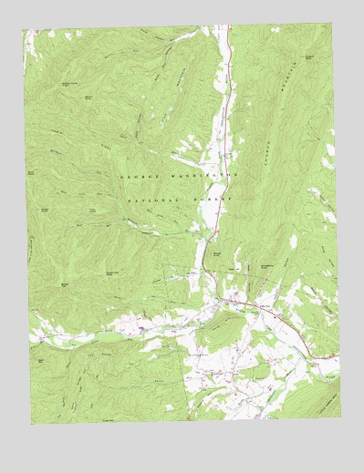
Fulks Run, VA USGS Topographic Map
Click on map above to begin viewing in our Map Viewer.

This topographic map contains these locations and features:
Feature Name Type Latitude Longitude GNIS ID View Map
Bible RunStreamN38.6521°W78.9920°1481689View Map
Blue Lick RunStreamN38.6957°W78.9631°1481858View Map
Broad TopSummitN38.6682°W78.9864°1482016View Map
Buffalo Clover KnobSummitN38.7323°W78.9850°1494858View Map
Cabin RidgeRidgeN38.7132°W78.9784°1482213View Map
Cabin Ridge DairyLocaleN38.6906°W78.9236°2675358View Map
Camp HollowValleyN38.7136°W78.9541°1482260View Map
Capon RunStreamN38.7446°W78.9206°1550632View Map
Capon RunStreamN38.7446°W78.9206°1482316View Map
Church MountainSummitN38.7229°W78.8964°1482536View Map
Church RockSummitN38.7393°W78.8859°1482537View Map
Claycomb DamDamN38.6418°W78.9431°1490002View Map
Clover Lick HollowValleyN38.6710°W78.9340°1482596View Map
Clover Lick KnobSummitN38.6723°W78.9689°1494883View Map
Cross MountainSummitN38.6251°W78.9689°1494894View Map
Fawley HollowValleyN38.6611°W78.9052°1483385View Map
First PointCliffN38.6923°W78.9748°1483422View Map
Fulks RunPopulated PlaceN38.6601°W78.9061°1494950View Map
Fulks Run ChurchChurchN38.6621°W78.9175°1483555View Map
Fulks Run Elementary SchoolSchoolN38.6571°W78.9006°1779323View Map
Fulks Run Post OfficePost OfficeN38.6636°W78.9209°2766211View Map
Fulks Run School (historical)SchoolN38.6560°W78.9398°1806024View Map
Gate RidgeRidgeN38.6340°W78.9806°1483596View Map
Gate RunStreamN38.6493°W78.9814°1483597View Map
GenoaPopulated PlaceN38.6404°W78.9178°1494953View Map
Genoa School (historical)SchoolN38.6329°W78.9125°1806025View Map
Grindstone KnobSummitN38.6735°W78.9064°1494973View Map
Grove HollowValleyN38.7448°W78.9414°1483854View Map
Hebron ChurchChurchN38.6285°W78.9072°1488497View Map
Lairs RunStreamN38.7029°W78.9203°1484645View Map
Little Dry RiverStreamN38.6618°W78.9228°1484900View Map
Little MountainSummitN38.7240°W78.9403°1495037View Map
Little North MountainSummitN38.6285°W78.8803°1495038View Map
Marshall RunStreamN38.6823°W78.9272°1485198View Map
Middle PointCliffN38.6932°W78.9942°1485383View Map
Millers KnobSummitN38.6776°W78.9253°1495063View Map
Mount Carmel ChurchChurchN38.6457°W78.9311°1485580View Map
Mount Pleasant School (historical)SchoolN38.6579°W78.8989°1806027View Map
Mountain Grove ChurchChurchN38.6404°W78.9261°1485678View Map
Mud Lick RunStreamN38.6851°W78.9373°1485724View Map
Nash HillSummitN38.6735°W78.9145°1495072View Map
Nash HollowValleyN38.6636°W78.9121°1485800View Map
Pentacostal ChurchChurchN38.6490°W78.9117°1806031View Map
Reedy RunStreamN38.6382°W78.8964°1486565View Map
Ritchie HillRidgeN38.6321°W78.9295°1486626View Map
Riverside ChurchChurchN38.7087°W78.9197°1486641View Map
Rocky Sprur HollowValleyN38.7455°W78.9373°1486753View Map
Root RunStreamN38.6893°W78.9600°1486766View Map
Shoemaker RiverStreamN38.6368°W78.8797°1487210View Map
Smith CreekStreamN38.6546°W78.9306°1487339View Map
Stony RunStreamN38.6629°W78.9247°1487636View Map
The KnobsRangeN38.6465°W78.9723°1487833View Map
Third HillSummitN38.6554°W78.9217°1487858View Map
Trumbo CemeteryCemeteryN38.6509°W78.8900°1805810View Map
Turner RunStreamN38.6323°W78.9111°1488041View Map
Wetzel KnobSummitN38.7282°W78.9756°1488265View Map
YankeetownPopulated PlaceN38.6848°W78.9478°1495120View Map

Note: Coordinates in the location and feature list above are referenced to NAD83 datum.


Copyright (C) 2008-2024 Ryan Niemi / Sunset Dynamics ... All Rights Reserved