TopoQuest Logo
Do you find TopoQuest useful?
Help keep TopoQuest running and adding new maps/features by donating!
Bitcoin:  19c7KJd3qBynnjoSw5npx9KScwjBe4ifkT
Litecoin:  LXs6TkuXGGXo1vDsWCkWVdjQX94eUKd6ui
Home View Maps Find Maps Find Places Resources & Links


Bergton, Virginia Topographic Map

USGS Map Title: Bergton, VA
USGS Map MRC: 38078G8
DRG (GeoTIFF) Download: o38078g8.tif


Neighboring USGS Topographic Map Quads:


  Petersburg East, WV  
38079H1
 

  Lost River State Park, WV  
38078H8
 

  Lost City, WV  
38078H7
 

  Milam, WV  
38079G1
 

  Bergton, VA  
38078G8
 

  Orkney Springs, VA  
38078G7
 

  Cow Knob, VA  
38079F1
 

  Fulks Run, VA  
38078F8
 

  Timberville, VA  
38078F7


Map MRC Location:

N39°
W79°
N39°
W78°
H8 H7 H6 H5 H4 H3 H2 H1
G8 G7 G6 G5 G4 G3 G2 G1
F8 F7 F6 F5 F4 F3 F2 F1
E8 E7 E6 E5 E4 E3 E2 E1
D8 D7 D6 D5 D4 D3 D2 D1
C8 C7 C6 C5 C4 C3 C2 C1
B8 B7 B6 B5 B4 B3 B2 B1
A8 A7 A6 A5 A4 A3 A2 A1
N38°
W79°
N38°
W78°

Bergton, VA USGS 1:24K Topographic Map Preview:
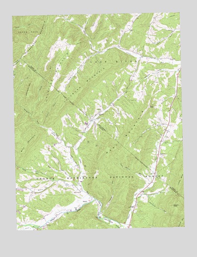
Bergton, VA USGS Topographic Map
Click on map above to begin viewing in our Map Viewer.

This topographic map contains these locations and features:
Feature Name Type Latitude Longitude GNIS ID View Map
Bald KnobSummitN38.8207°W78.8995°1550157View Map
Bennett RunStreamN38.7726°W78.9498°1481631View Map
BergtonPopulated PlaceN38.7657°W78.9489°1492558View Map
Bergton Elementary SchoolSchoolN38.7615°W78.9550°1481644View Map
Bergton Emergency SquadBuildingN38.7809°W78.9521°2085949View Map
Bergton Gospel CenterChurchN38.7623°W78.9114°1481643View Map
Bergton Post OfficePost OfficeN38.7701°W78.9465°2780318View Map
Bergton Volunteer Fire CompanyBuildingN38.7806°W78.9518°2086021View Map
Blue HoleBayN38.7562°W78.9381°1481856View Map
Blue Hole CampgroundLocaleN38.7568°W78.9386°1488801View Map
Brushy RunStreamN38.7598°W78.9370°1482083View Map
Caldwell School (historical)SchoolN38.8423°W78.8884°1556826View Map
Cleaves School (historical)SchoolN38.8590°W78.9603°1556829View Map
Crab RunStreamN38.7679°W78.9409°1550815View Map
Crab RunStreamN38.7676°W78.9406°1482786View Map
Crab Run CemeteryCemeteryN38.8193°W78.9350°1550816View Map
Crab Run ChurchChurchN38.8165°W78.9364°1550817View Map
Crab Run School (historical)SchoolN38.8276°W78.9178°1556830View Map
Culler Run School (historical)SchoolN38.8523°W78.9367°1556832View Map
Fallbush MountainSummitN38.8329°W78.9475°1554434View Map
Fallbush MountainSummitN38.8262°W78.9589°1483350View Map
Feathers HollowValleyN38.8108°W78.9778°1483391View Map
Flattop MountainSummitN38.8476°W78.9634°1554470View Map
Flattop MountainSummitN38.8396°W78.9675°1488494View Map
German RiverStreamN38.7682°W78.9414°1483611View Map
Gobblebark MountainSummitN38.8318°W78.9884°1483681View Map
Halterman HollowValleyN38.8412°W78.8792°1551332View Map
Halterman School (historical)SchoolN38.7990°W78.8922°1556841View Map
Jenkins ChapelChurchN38.8654°W78.9125°1551566View Map
Martin Lick RunStreamN38.7512°W78.9231°1485205View Map
Martin Luther ChurchChurchN38.7721°W78.9598°1488495View Map
Mine MountainSummitN38.8001°W78.9895°1493298View Map
Mongold HollowValleyN38.8010°W78.9652°1485517View Map
Mount Hermon ChurchChurchN38.7926°W78.8922°1552204View Map
Moyers CemeteryCemeteryN38.8107°W78.9447°1485712View Map
Overly RunStreamN38.7790°W78.9711°1486020View Map
Rader RunStreamN38.7729°W78.9509°1486482View Map
Rattlesnake RunStreamN38.7684°W78.9011°1486518View Map
Saint Johns Church (historical)ChurchN38.8529°W78.9100°1556868View Map
Shipe HollowValleyN38.8523°W78.9372°1552872View Map
Siever RunStreamN38.7521°W78.9823°1487238View Map
Sirks RunStreamN38.7959°W78.9531°1487266View Map
Snyder Springs School (historical)SchoolN38.8615°W78.8989°1556872View Map
Spring RunStreamN38.8173°W78.9878°1487458View Map
Spring RunStreamN38.8173°W78.9875°1553008View Map
Spruce RunStreamN38.7671°W78.9122°1487490View Map
Spruce RunStreamN38.7671°W78.9125°1553029View Map
Teams Hollow RunStreamN38.7771°W78.8984°1487802View Map
Weavers KnobSummitN38.7629°W78.8831°1488220View Map
West MountainSummitN38.7965°W78.9297°1493774View Map
Wetzel HollowValleyN38.8501°W78.9067°1553412View Map

Note: Coordinates in the location and feature list above are referenced to NAD83 datum.


Copyright (C) 2008-2025 Ryan Niemi / Sunset Dynamics ... All Rights Reserved