TopoQuest Logo
Do you find TopoQuest useful?
Help keep TopoQuest running and adding new maps/features by donating!
Bitcoin:  19c7KJd3qBynnjoSw5npx9KScwjBe4ifkT
Litecoin:  LXs6TkuXGGXo1vDsWCkWVdjQX94eUKd6ui
Home View Maps Find Maps Find Places Resources & Links


Osage, West Virginia Topographic Map

USGS Map Title: Osage, WV
USGS Map MRC: 39080F1
DRG (GeoTIFF) Download: o39080f1.tif


Neighboring USGS Topographic Map Quads:


  Oak Forest, PA  
39080G2
 

  Garards Fort, PA  
39080G1
 

  Masontown, PA  
39079G8
 

  Blacksville, WV  
39080F2
 

  Osage, WV  
39080F1
 

  Morgantown North, WV  
39079F8
 

  Grant Town, WV  
39080E2
 

  Rivesville, WV  
39080E1
 

  Morgantown South, WV  
39079E8


Map MRC Location:

N40°
W81°
N40°
W80°
H8 H7 H6 H5 H4 H3 H2 H1
G8 G7 G6 G5 G4 G3 G2 G1
F8 F7 F6 F5 F4 F3 F2 F1
E8 E7 E6 E5 E4 E3 E2 E1
D8 D7 D6 D5 D4 D3 D2 D1
C8 C7 C6 C5 C4 C3 C2 C1
B8 B7 B6 B5 B4 B3 B2 B1
A8 A7 A6 A5 A4 A3 A2 A1
N39°
W81°
N39°
W80°

Osage, WV USGS 1:24K Topographic Map Preview:
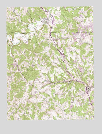
Osage, WV USGS Topographic Map
Click on map above to begin viewing in our Map Viewer.

This topographic map contains these locations and features:
Feature Name Type Latitude Longitude GNIS ID View Map
Alternative Learning CenterSchoolN39.6395°W80.0332°2088116View Map
Arkwright-Sears Amd PondReservoirN39.6334°W80.0915°1559140View Map
Bacon RunStreamN39.7315°W80.0884°1168564View Map
Bailey A M D Treatment Facility DamDamN39.6784°W80.1131°1559151View Map
Bald HillPopulated PlaceN39.7440°W80.0165°1168631View Map
Bald Hill ChurchChurchN39.7334°W80.0151°1213084View Map
Barrackman CemeteryCemeteryN39.6792°W80.0873°1535275View Map
Berry CemeteryCemeteryN39.6820°W80.0951°1535663View Map
Berry HollowValleyN39.6751°W80.1015°1535668View Map
Bethel United Methodist ChurchChurchN39.6898°W80.0017°1535718View Map
BowlbyPopulated PlaceN39.7115°W80.0167°1536261View Map
Bradford CemeteryCemeteryN39.6561°W80.0504°2586236View Map
Brand CemeteryCemeteryN39.6273°W80.0501°1536305View Map
Brewster CemeteryCemeteryN39.6591°W80.0250°2586237View Map
Browns HillSummitN39.7217°W80.1184°1170390View Map
Calvin RunStreamN39.7448°W80.0615°1170955View Map
Cass District Junior High School (historical)SchoolN39.6590°W80.0065°1728294View Map
Cass Elementary School (historical)SchoolN39.6585°W80.0061°2088155View Map
CassvillePopulated PlaceN39.6656°W80.0637°1554085View Map
Cassville - Scotts Run Volunteer Fire DepartmentBuildingN39.6644°W80.0594°2577556View Map
Cassville Census Designated PlaceCensusN39.6750°W80.0678°2389284View Map
Cassville Junior High School (historical)SchoolN39.6676°W80.0637°1728222View Map
Cassville Post OfficePost OfficeN39.6651°W80.0616°1728223View Map
Cedar Grove CemeteryCemeteryN39.7359°W80.0739°1171367View Map
ChaplinPopulated PlaceN39.6506°W80.0285°2750094View Map
Chisler KnobSummitN39.6437°W80.0342°1537321View Map
Clarence Fetty SpringSpringN39.7131°W80.0920°1678374View Map
CorePopulated PlaceN39.6801°W80.1073°1537682View Map
Core Elementary School (historical)SchoolN39.6792°W80.1073°1728226View Map
Core Post OfficePost OfficeN39.6795°W80.1087°1728227View Map
Cunningham CemeteryCemeteryN39.6712°W80.1037°1537912View Map
Dents Run CemeteryCemeteryN39.6312°W80.0409°1728234View Map
Dolls RunStreamN39.7081°W80.1148°1538261View Map
Dolls Run Christian ChurchChurchN39.6804°W80.1081°1728235View Map
Dooley RunStreamN39.7487°W80.0448°1173386View Map
Dooley RunStreamN39.7487°W80.0456°1538269View Map
Dunkard Methodist Protestant ChurchChurchN39.7140°W80.0938°1536583View Map
Dunkard RidgeRidgeN39.7031°W80.0815°1538441View Map
FairchancePopulated PlaceN39.7462°W80.0609°1197602View Map
Fleming CemeteryCemeteryN39.6626°W80.0670°1539078View Map
Fox RunStreamN39.7462°W80.1140°1175108View Map
Frank O'Brad SpringSpringN39.7159°W80.0026°1678377View Map
Greeley SchoolSchoolN39.7340°W80.1056°1176054View Map
Guston RunStreamN39.6681°W80.0298°1539799View Map
Higgins KnobSummitN39.6534°W80.0542°1540241View Map
Hobbs RunStreamN39.7331°W80.0742°1177150View Map
Hollywood - Stadium 12BuildingN39.6522°W80.0006°2725056View Map
HolmanPopulated PlaceN39.7159°W80.1023°1728241View Map
House of Refuge Power in Praise MinistriesChurchN39.6754°W80.0215°1728256View Map
Interchange 155CrossingN39.6551°W80.0101°1728338View Map
JerePopulated PlaceN39.6670°W80.0353°1554804View Map
John Petrovich SpringSpringN39.6526°W80.0637°1678391View Map
Lemley CemeteryCemeteryN39.7240°W80.0816°1179186View Map
Liming CemeteryCemeteryN39.6815°W80.0681°1541984View Map
Little Shannon RunStreamN39.7342°W80.1037°1179679View Map
Lough-Teagarden-Cordray CemeteryCemeteryN39.6418°W80.0664°2586271View Map
Meadow Ponds Golf and Country ClubLocaleN39.6711°W80.0743°2634135View Map
Meyers CemeteryCemeteryN39.7181°W80.0909°1543147View Map
Monongalia CountyCivilN39.6303°W80.0465°1550037View Map
Morris CemeteryCemeteryN39.6456°W80.1081°1543523View Map
Mount MorrisPopulated PlaceN39.7331°W80.0678°1181752View Map
Mount Morris Census Designated PlaceCensusN39.7342°W80.0755°2631289View Map
Mount Morris Community Volunteer Fire Department Company 18BuildingN39.7327°W80.0681°2644875View Map
Mount Morris Emergency Medical ServicesBuildingN39.7347°W80.0676°2719583View Map
Mount Morris Post OfficePost OfficeN39.7322°W80.0697°2779829View Map
Mountaineer Golf and Country ClubLocaleN39.7006°W80.0351°2634141View Map
Mylan Park Elementary SchoolSchoolN39.6424°W80.0304°2487454View Map
New HillPopulated PlaceN39.6684°W80.0715°1555208View Map
OsagePopulated PlaceN39.6587°W80.0076°1544449View Map
PedlarPopulated PlaceN39.6665°W80.1212°1544685View Map
Pedlar RunStreamN39.6801°W80.1090°1544686View Map
Pleasant Valley United Methodist ChurchChurchN39.7142°W80.0606°1545036View Map
PursglovePopulated PlaceN39.6676°W80.0262°1555424View Map
Pursglove Post OfficePost OfficeN39.6671°W80.0236°1728263View Map
Pursglove Presbyterian Church (historical)ChurchN39.6679°W80.0265°1728264View Map
Ralph Tennant SpringSpringN39.6584°W80.0990°1678402View Map
Ripleys RunStreamN39.7184°W80.1228°1545759View Map
Scottdale School (historical)SchoolN39.6665°W80.0342°1728270View Map
Scotts RunPopulated PlaceN39.6671°W80.0488°2749914View Map
Scotts Run Refuse DamDamN39.6717°W80.0548°1559160View Map
Shannon RunStreamN39.7317°W80.0909°1193327View Map
Shannon Run ChurchChurchN39.7409°W80.1059°1187360View Map
Simpson CemeteryCemeteryN39.6815°W80.0495°1546813View Map
Smoky DrainStreamN39.6779°W80.1067°1547014View Map
Snider CemeteryCemeteryN39.6276°W80.0659°1547031View Map
Stan McElroy SpringSpringN39.6306°W80.0965°1678408View Map
Sugar Grove Presbyterian ChurchChurchN39.6454°W80.0570°1547637View Map
Sutton CemeteryCemeteryN39.6731°W80.0778°1547781View Map
Sutton KnobSummitN39.6848°W80.0887°1555763View Map
University Towne CenterLocaleN39.6488°W80.0018°2646944View Map
Wade CemeteryCemeteryN39.6887°W80.0573°1548695View Map
Wade SpringSpringN39.6731°W80.0687°1678411View Map
Wades RunStreamN39.6667°W80.0184°1548700View Map
WAJR-AM (Morgantown)TowerN39.6762°W80.0031°1559728View Map
Watkins RunStreamN39.7456°W80.0637°1209350View Map
Zoar ChurchChurchN39.6304°W80.0412°1549505View Map

Note: Coordinates in the location and feature list above are referenced to NAD83 datum.


Copyright (C) 2008-2024 Ryan Niemi / Sunset Dynamics ... All Rights Reserved