TopoQuest Logo
Do you find TopoQuest useful?
Help keep TopoQuest running and adding new maps/features by donating!
Bitcoin:  19c7KJd3qBynnjoSw5npx9KScwjBe4ifkT
Litecoin:  LXs6TkuXGGXo1vDsWCkWVdjQX94eUKd6ui
Home View Maps Find Maps Find Places Resources & Links


Garards Fort, Pennsylvania Topographic Map

USGS Map Title: Garards Fort, PA
USGS Map MRC: 39080G1
DRG (GeoTIFF) Download: o39080g1.tif


Neighboring USGS Topographic Map Quads:


  Waynesburg, PA  
39080H2
 

  Mather, PA  
39080H1
 

  Carmichaels, PA  
39079H8
 

  Oak Forest, PA  
39080G2
 

  Garards Fort, PA  
39080G1
 

  Masontown, PA  
39079G8
 

  Blacksville, WV  
39080F2
 

  Osage, WV  
39080F1
 

  Morgantown North, WV  
39079F8


Map MRC Location:

N40°
W81°
N40°
W80°
H8 H7 H6 H5 H4 H3 H2 H1
G8 G7 G6 G5 G4 G3 G2 G1
F8 F7 F6 F5 F4 F3 F2 F1
E8 E7 E6 E5 E4 E3 E2 E1
D8 D7 D6 D5 D4 D3 D2 D1
C8 C7 C6 C5 C4 C3 C2 C1
B8 B7 B6 B5 B4 B3 B2 B1
A8 A7 A6 A5 A4 A3 A2 A1
N39°
W81°
N39°
W80°

Garards Fort, PA USGS 1:24K Topographic Map Preview:
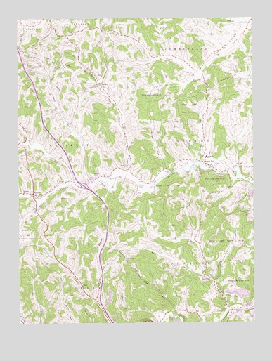
Garards Fort, PA USGS Topographic Map
Click on map above to begin viewing in our Map Viewer.

This topographic map contains these locations and features:
Feature Name Type Latitude Longitude GNIS ID View Map
Asbury ChurchReservoirN39.7651°W80.0915°1168439View Map
Bell RunStreamN39.7695°W80.0270°1169152View Map
Bowlby ShaftMineN39.8495°W80.0314°1170059View Map
Cowell CemeteryCemeteryN39.7914°W80.0862°1172557View Map
DavistownPopulated PlaceN39.7687°W80.0240°1172995View Map
Dutch RunStreamN39.8056°W80.0862°1173660View Map
Dyers ForkStreamN39.8076°W80.0967°1173681View Map
FordycePopulated PlaceN39.8476°W80.0809°1174960View Map
Frosty RunStreamN39.8117°W80.0651°1175301View Map
Frosty Run ShaftLocaleN39.8140°W80.0659°1175302View Map
Garards FortPopulated PlaceN39.8159°W80.0264°1175428View Map
Garards Fort Post OfficePost OfficeN39.8151°W80.0242°2779964View Map
Garards Fort ShaftLocaleN39.8179°W80.0251°1175429View Map
Glade RunStreamN39.7520°W80.0423°1175654View Map
Highland CemeteryCemeteryN39.7555°W80.0188°1177024View Map
Johnson CemeteryCemeteryN39.7670°W80.0492°1178108View Map
KirbyPopulated PlaceN39.8029°W80.1170°1178539View Map
Kirby ShaftLocaleN39.7951°W80.1001°1178541View Map
Long ShaftMineN39.8706°W80.0484°1179903View Map
Mason Ridge CemeteryCemeteryN39.7758°W80.0685°1180528View Map
Meadow RunStreamN39.7556°W80.0126°1180828View Map
Minor RunStreamN39.8156°W80.0278°1209314View Map
North Branch Calvin RunStreamN39.7592°W80.0837°1193032View Map
Roberts RunStreamN39.7665°W80.0206°1185211View Map
State Game Lands Number 223ParkN39.7834°W80.0153°1193445View Map
Steele CemeteryCemeteryN39.7717°W80.0201°1188583View Map
Township of GreeneCivilN39.8228°W80.0255°1216491View Map
Township of PerryCivilN39.7521°W80.1139°1215257View Map
Whiteley Chapel CemeteryCemeteryN39.8102°W80.0828°1191329View Map
Woods RunStreamN39.8117°W80.0437°1191763View Map

Note: Coordinates in the location and feature list above are referenced to NAD83 datum.


Copyright (C) 2008-2025 Ryan Niemi / Sunset Dynamics ... All Rights Reserved