TopoQuest Logo
Do you find TopoQuest useful?
Help keep TopoQuest running and adding new maps/features by donating!
Bitcoin:  19c7KJd3qBynnjoSw5npx9KScwjBe4ifkT
Litecoin:  LXs6TkuXGGXo1vDsWCkWVdjQX94eUKd6ui
Home View Maps Find Maps Find Places Resources & Links


Blacksville, West Virginia Topographic Map

USGS Map Title: Blacksville, WV
USGS Map MRC: 39080F2
DRG (GeoTIFF) Download: o39080f2.tif


Neighboring USGS Topographic Map Quads:


  Holbrook, PA  
39080G3
 

  Oak Forest, PA  
39080G2
 

  Garards Fort, PA  
39080G1
 

  Wadestown, WV  
39080F3
 

  Blacksville, WV  
39080F2
 

  Osage, WV  
39080F1
 

  Mannington, WV  
39080E3
 

  Grant Town, WV  
39080E2
 

  Rivesville, WV  
39080E1


Map MRC Location:

N40°
W81°
N40°
W80°
H8 H7 H6 H5 H4 H3 H2 H1
G8 G7 G6 G5 G4 G3 G2 G1
F8 F7 F6 F5 F4 F3 F2 F1
E8 E7 E6 E5 E4 E3 E2 E1
D8 D7 D6 D5 D4 D3 D2 D1
C8 C7 C6 C5 C4 C3 C2 C1
B8 B7 B6 B5 B4 B3 B2 B1
A8 A7 A6 A5 A4 A3 A2 A1
N39°
W81°
N39°
W80°

Blacksville, WV USGS 1:24K Topographic Map Preview:
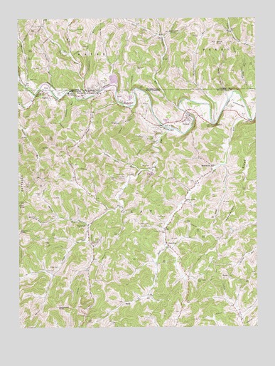
Blacksville, WV USGS Topographic Map
Click on map above to begin viewing in our Map Viewer.

This topographic map contains these locations and features:
Feature Name Type Latitude Longitude GNIS ID View Map
BehlerPopulated PlaceN39.6459°W80.1398°1549586View Map
Bethel Wesleyan Methodist ChurchChurchN39.6534°W80.2115°1728212View Map
Blacks RunStreamN39.7173°W80.1387°1536064View Map
Blacks RunStreamN39.7173°W80.1387°1192158View Map
Blacks SchoolSchoolN39.7445°W80.1376°1192159View Map
BlacksvillePopulated PlaceN39.7201°W80.2120°1553918View Map
Blacksville Baptist ChurchChurchN39.7190°W80.2153°1728215View Map
Blacksville CemeteryCemeteryN39.7237°W80.2053°1192161View Map
Blacksville Elementary School (historical)SchoolN39.7190°W80.2156°1728213View Map
Blacksville Post OfficePost OfficeN39.7207°W80.2124°1728214View Map
Blacksville United Methodist ChurchChurchN39.7206°W80.2134°1728217View Map
Blacksville Volunteer Fire DepartmentBuildingN39.7207°W80.2117°2577746View Map
Brewer CemeteryCemeteryN39.6673°W80.1859°1536324View Map
BrockPopulated PlaceN39.7426°W80.1728°1192190View Map
Building RunStreamN39.6692°W80.2287°1536679View Map
Burl Spragg SpringSpringN39.6654°W80.2109°1678371View Map
Cam Harker SpringSpringN39.7031°W80.1612°1678372View Map
Catherines KnobSummitN39.6334°W80.2290°1537103View Map
Chisler CemeteryCemeteryN39.6498°W80.2334°1537320View Map
Clay Batelle Public LibraryBuildingN39.7192°W80.2156°2727351View Map
Clay Battelle High School (historical)SchoolN39.7198°W80.2232°1728225View Map
Conner CemeteryCemeteryN39.6479°W80.2326°1537580View Map
Coopers RunStreamN39.7145°W80.1912°1537663View Map
Cowells RunStreamN39.7181°W80.2198°1537749View Map
DaybrookPopulated PlaceN39.6665°W80.2131°1554269View Map
Daybrook CemeteryCemeteryN39.6676°W80.2127°2586238View Map
Daybrook Church of ChristChurchN39.6648°W80.2140°1728230View Map
Daybrook Elementary SchoolSchoolN39.6668°W80.2123°1728231View Map
Daybrook High School (historical)SchoolN39.6670°W80.2117°1728232View Map
Days RunStreamN39.7054°W80.1712°1538080View Map
Devines KnobSummitN39.6640°W80.2484°1538164View Map
Dunkard Valley Golf CourseLocaleN39.7195°W80.2289°2634076View Map
Eddy Chapel CemeteryCemeteryN39.6440°W80.1562°1538546View Map
Foley CemeteryCemeteryN39.7017°W80.1803°1539112View Map
Fort KnobSummitN39.6748°W80.2490°1554496View Map
Hackelbender RunStreamN39.7079°W80.1454°1192573View Map
Headley CemeteryCemeteryN39.7431°W80.1547°1192596View Map
Henderson CemeteryCemeteryN39.6601°W80.2098°1540145View Map
Henderson RidgeRidgeN39.6773°W80.1356°1540148View Map
Huckleberry RunStreamN39.7081°W80.1453°1540545View Map
Husk SpringSpringN39.7042°W80.2165°1678388View Map
Indian Camp RunStreamN39.6887°W80.1865°1540668View Map
Jakes RunPopulated PlaceN39.6581°W80.1712°1540800View Map
Jakes RunStreamN39.7084°W80.1267°1540805View Map
Jakes Run Assembly of GodChurchN39.6728°W80.1644°2586428View Map
Jakes Run Early Childhood CenterSchoolN39.6766°W80.1615°1540807View Map
Jakes Run Methodist ChurchChurchN39.6576°W80.1701°1728244View Map
James Hillberry SpringSpringN39.6723°W80.2437°1678390View Map
JohnLocaleN39.6890°W80.1803°1540947View Map
Jones CemeteryCemeteryN39.6254°W80.2451°1534766View Map
Kings RunStreamN39.7162°W80.1970°1541225View Map
Lantz CemeteryCemeteryN39.7257°W80.2442°1192736View Map
Lick RunStreamN39.7012°W80.1751°1541931View Map
Long DrainStreamN39.6912°W80.1426°1542366View Map
MacdalePopulated PlaceN39.7192°W80.2331°1555020View Map
MacDale Church of ChristChurchN39.7181°W80.2337°1728248View Map
Marshall CemeteryCemeteryN39.7153°W80.1812°1542794View Map
McCoy CemeteryCemeteryN39.6604°W80.2092°1542965View Map
Minnie KnobSummitN39.7404°W80.1453°1192949View Map
Minor BridgeBridgeN39.7067°W80.1742°1557864View Map
Minor CemeteryCemeteryN39.7040°W80.1762°1543447View Map
Miracle RunStreamN39.7201°W80.2415°1543448View Map
Moore CemeteryCemeteryN39.6903°W80.1809°1543513View Map
MooresvillePopulated PlaceN39.6901°W80.1481°1543522View Map
Mooresville Church of ChristChurchN39.6840°W80.1570°1728254View Map
Mooresville Church of Christ CemeteryCemeteryN39.6845°W80.1572°2586251View Map
Morris RunStreamN39.7226°W80.2462°1192963View Map
Mount Harmon DamDamN39.6634°W80.1381°1559158View Map
New Life Harvest CenterChurchN39.7073°W80.1608°2586437View Map
Olive United Methodist ChurchChurchN39.7106°W80.1556°1728258View Map
Olive United Methodist Church CemeteryCemeteryN39.7105°W80.1563°2586269View Map
PentressPopulated PlaceN39.7104°W80.1603°1544708View Map
Pentress Census Designated PlaceCensusN39.7101°W80.1684°2586865View Map
Pentress Post OfficePost OfficeN39.7087°W80.1622°2774623View Map
Pentress Primary School (historical)SchoolN39.7079°W80.1648°1728262View Map
PricePopulated PlaceN39.7081°W80.1284°1549883View Map
Price CemeteryCemeteryN39.7103°W80.1312°1545256View Map
Ralph Eddy SpringSpringN39.6262°W80.1720°1678400View Map
Ripleys RunStreamN39.7209°W80.1251°1193192View Map
Roberts RunStreamN39.7184°W80.2126°1193199View Map
Rudolf RunStreamN39.7137°W80.1656°1192051View Map
Rudolph RunStreamN39.7137°W80.1656°1546138View Map
Rush RunStreamN39.7359°W80.2220°1193238View Map
SandyPopulated PlaceN39.6354°W80.1948°1546401View Map
Sharp RunStreamN39.7431°W80.1748°1193329View Map
Sheppards RunStreamN39.7184°W80.2128°1546675View Map
Sheppards RunStreamN39.7256°W80.2151°1193341View Map
Sherman Wright SpringSpringN39.6712°W80.1626°1678407View Map
Shriver CemeteryCemeteryN39.7145°W80.1381°1546750View Map
Shriver RunStreamN39.6656°W80.2129°1546751View Map
Strosnider CemeteryCemeteryN39.7301°W80.1870°1193492View Map
Tennant CemeteryCemeteryN39.6445°W80.2084°1547974View Map
Tennant CemeteryCemeteryN39.6867°W80.1940°1547976View Map
Tennant Memorial CemeteryCemeteryN39.6645°W80.1731°1547977View Map
Tennant Memorial Chapel Methodist Church (historical)ChurchN39.6651°W80.1734°1728275View Map
Tennant SpringSpringN39.6501°W80.1484°1678409View Map
The CliffCliffN39.7192°W80.2395°1547998View Map
Tom Walker SpringSpringN39.6823°W80.2137°1678410View Map
Town of BlacksvilleCivilN39.7174°W80.2148°2390733View Map
Trinity Baptist ChurchChurchN39.7153°W80.1965°2586429View Map
Troy CemeteryCemeteryN39.7315°W80.1259°1193555View Map
Valley ChapelChurchN39.7448°W80.1692°1193591View Map
Wade CemeteryCemeteryN39.7327°W80.1583°1193599View Map
Wilson CemeteryCemeteryN39.6792°W80.2381°1549214View Map
WorleyPopulated PlaceN39.7073°W80.1484°1549998View Map
Wrights RunStreamN39.7223°W80.2326°1193697View Map
Yost CemeteryCemeteryN39.6487°W80.2206°1549463View Map

Note: Coordinates in the location and feature list above are referenced to NAD83 datum.


Copyright (C) 2008-2024 Ryan Niemi / Sunset Dynamics ... All Rights Reserved