TopoQuest Logo
Do you find TopoQuest useful?
Help keep TopoQuest running and adding new maps/features by donating!
Bitcoin:  19c7KJd3qBynnjoSw5npx9KScwjBe4ifkT
Litecoin:  LXs6TkuXGGXo1vDsWCkWVdjQX94eUKd6ui
Home View Maps Find Maps Find Places Resources & Links


Ostrander, Ohio Topographic Map

USGS Map Title: Ostrander, OH
USGS Map MRC: 40083C2
DRG (GeoTIFF) Download: o40083c2.tif


Neighboring USGS Topographic Map Quads:


  Richwood, OH  
40083D3
 

  Prospect, OH  
40083D2
 

  Waldo, OH  
40083D1
 

  Magnetic Springs, OH  
40083C3
 

  Ostrander, OH  
40083C2
 

  Delaware, OH  
40083C1
 

  Marysville, OH  
40083B3
 

  Shawnee Hills, OH  
40083B2
 

  Powell, OH  
40083B1


Map MRC Location:

N41°
W84°
N41°
W83°
H8 H7 H6 H5 H4 H3 H2 H1
G8 G7 G6 G5 G4 G3 G2 G1
F8 F7 F6 F5 F4 F3 F2 F1
E8 E7 E6 E5 E4 E3 E2 E1
D8 D7 D6 D5 D4 D3 D2 D1
C8 C7 C6 C5 C4 C3 C2 C1
B8 B7 B6 B5 B4 B3 B2 B1
A8 A7 A6 A5 A4 A3 A2 A1
N40°
W84°
N40°
W83°

Ostrander, OH USGS 1:24K Topographic Map Preview:
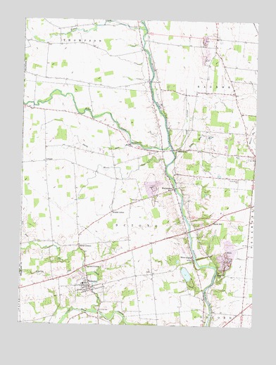
Ostrander, OH USGS Topographic Map
Click on map above to begin viewing in our Map Viewer.

This topographic map contains these locations and features:
Feature Name Type Latitude Longitude GNIS ID View Map
Bellefontaine bridgeBridgeN40.3217°W83.1696°1050824View Map
Blues CreekStreamN40.2559°W83.2096°1065927View Map
Bokes CreekStreamN40.3239°W83.1713°1065930View Map
Bokes Creek CemeteryCemeteryN40.3242°W83.1914°1038178View Map
Bowman FieldAirportN40.3347°W83.1334°2442543View Map
Brindle CornerPopulated PlaceN40.2964°W83.2013°1062664View Map
Buckeye Valley West Elementary SchoolSchoolN40.2667°W83.2160°1050822View Map
Dry RunStreamN40.2826°W83.2446°1039834View Map
Dun RunStreamN40.2562°W83.2221°1039863View Map
Eagon RunStreamN40.3223°W83.1669°1039928View Map
Edinburg CemeteryCemeteryN40.2767°W83.2145°1806213View Map
Fairview CornersPopulated PlaceN40.2739°W83.2152°1064635View Map
Fulton CreekStreamN40.3717°W83.1860°1066012View Map
Gabriel CornersLocaleN40.2823°W83.2191°1040740View Map
KlondikePopulated PlaceN40.2720°W83.1441°1062841View Map
Larkspur FarmLocaleN40.2689°W83.2439°2652015View Map
LybrandPopulated PlaceN40.3167°W83.2371°1062867View Map
Lybrand Post Office (historical)Post OfficeN40.3167°W83.2374°1984022View Map
Mill Creek Airport (historical)AirportN40.2671°W83.2217°1082926View Map
Mill Creek CemeteryCemeteryN40.2567°W83.2079°1806223View Map
Millcreek Golf CourseLocaleN40.2639°W83.1977°1050823View Map
Minton CemeteryCemeteryN40.3652°W83.2383°1806224View Map
Moors RunStreamN40.3153°W83.1727°1043477View Map
Newhouse CemeteryCemeteryN40.3002°W83.1861°1043858View Map
Old Stone ChurchChurchN40.3214°W83.1666°1061530View Map
OstranderPopulated PlaceN40.2662°W83.2127°1044206View Map
Ostrander Post OfficePost OfficeN40.2667°W83.2124°1984016View Map
Prairie RunStreamN40.3214°W83.1691°1044749View Map
Ronolds RunStreamN40.2726°W83.2163°1045168View Map
Sandy HillPopulated PlaceN40.2920°W83.1471°1045955View Map
SciotoPopulated PlaceN40.2803°W83.1407°1063003View Map
Scioto Township Fire Department Station 370BuildingN40.2723°W83.2138°2549713View Map
Smith RunStreamN40.3248°W83.1921°1066208View Map
South Radnor CemeteryCemeteryN40.3102°W83.1341°1046490View Map
Township of SciotoCivilN40.2945°W83.1996°1086056View Map
Village of OstranderCivilN40.2649°W83.2156°2399592View Map
WarrensburgPopulated PlaceN40.3059°W83.1685°1058105View Map
Warrensburg Post Office (historical)Post OfficeN40.3056°W83.1680°1984046View Map
White SulphurPopulated PlaceN40.2767°W83.1574°1061774View Map
White Sulphur Post Office (historical)Post OfficeN40.2764°W83.1569°1983793View Map

Note: Coordinates in the location and feature list above are referenced to NAD83 datum.


Copyright (C) 2008-2025 Ryan Niemi / Sunset Dynamics ... All Rights Reserved