TopoQuest Logo
Do you find TopoQuest useful?
Help keep TopoQuest running and adding new maps/features by donating!
Bitcoin:  19c7KJd3qBynnjoSw5npx9KScwjBe4ifkT
Litecoin:  LXs6TkuXGGXo1vDsWCkWVdjQX94eUKd6ui
Home View Maps Find Maps Find Places Resources & Links


Magnetic Springs, Ohio Topographic Map

USGS Map Title: Magnetic Springs, OH
USGS Map MRC: 40083C3
DRG (GeoTIFF) Download: o40083c3.tif


Neighboring USGS Topographic Map Quads:


  York Center, OH  
40083D4
 

  Richwood, OH  
40083D3
 

  Prospect, OH  
40083D2
 

  Peoria, OH  
40083C4
 

  Magnetic Springs, OH  
40083C3
 

  Ostrander, OH  
40083C2
 

  Milford Center, OH  
40083B4
 

  Marysville, OH  
40083B3
 

  Shawnee Hills, OH  
40083B2


Map MRC Location:

N41°
W84°
N41°
W83°
H8 H7 H6 H5 H4 H3 H2 H1
G8 G7 G6 G5 G4 G3 G2 G1
F8 F7 F6 F5 F4 F3 F2 F1
E8 E7 E6 E5 E4 E3 E2 E1
D8 D7 D6 D5 D4 D3 D2 D1
C8 C7 C6 C5 C4 C3 C2 C1
B8 B7 B6 B5 B4 B3 B2 B1
A8 A7 A6 A5 A4 A3 A2 A1
N40°
W84°
N40°
W83°

Magnetic Springs, OH USGS 1:24K Topographic Map Preview:
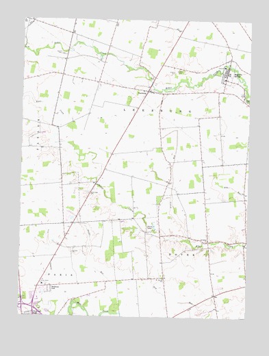
Magnetic Springs, OH USGS Topographic Map
Click on map above to begin viewing in our Map Viewer.

This topographic map contains these locations and features:
Feature Name Type Latitude Longitude GNIS ID View Map
Ashton MeadowsPopulated PlaceN40.2525°W83.3702°2771073View Map
Bayes Airport (historical)AirportN40.3428°W83.2831°1082820View Map
Blackhawk School (historical)SchoolN40.3159°W83.2508°1055584View Map
Blues Creek CemeteryCemeteryN40.3017°W83.3360°1038153View Map
Blues Creek Golf CourseLocaleN40.3037°W83.3305°1955489View Map
Blues Creek School (historical)SchoolN40.3076°W83.3319°1055586View Map
Bonnette School (historical)SchoolN40.3153°W83.2946°1055589View Map
Cotton Slash (historical)LocaleN40.3506°W83.3666°1067255View Map
Elliot School (historical)SchoolN40.3598°W83.3110°1055601View Map
Fleetwood ParkPopulated PlaceN40.2509°W83.3655°1056291View Map
Grassy RunStreamN40.2828°W83.2813°1066023View Map
Hildreth School (historical)SchoolN40.3448°W83.3349°1055611View Map
Hopewell CemeteryCemeteryN40.3544°W83.2887°1041772View Map
Hull School (historical)SchoolN40.3742°W83.3727°1055613View Map
Infirmary DitchCanalN40.2748°W83.3549°1041979View Map
Lee School (historical)SchoolN40.2787°W83.3435°1055615View Map
Leesburg Township Fire and Emergency Medical ServicesBuildingN40.3549°W83.2632°2550260View Map
Leesburg Township HallBuildingN40.3551°W83.2633°1955490View Map
Leesburg-Magnetic Elementary SchoolSchoolN40.3506°W83.2638°1055616View Map
Magnetic SpringsPopulated PlaceN40.3528°W83.2613°1042895View Map
Magnetic Springs Post OfficePost OfficeN40.3542°W83.2625°1955492View Map
Magnetic Springs United Methodist ChurchChurchN40.3531°W83.2613°1955551View Map
Magnetic Springs Village HallBuildingN40.3551°W83.2630°1955493View Map
Maple Dell CemeteryCemeteryN40.3415°W83.2528°1042935View Map
Maskill CemeteryCemeteryN40.3606°W83.3535°1802803View Map
McFadden School (historical)SchoolN40.2667°W83.3744°1055625View Map
Miller School (historical)SchoolN40.3523°W83.3555°1055632View Map
Mount Herman CemeteryCemeteryN40.2662°W83.2959°1043564View Map
Mount Hermon School (historical)SchoolN40.2670°W83.2960°1055634View Map
Parrott VillagePopulated PlaceN40.2918°W83.3496°2771054View Map
Perkins School (historical)SchoolN40.2839°W83.2985°1055637View Map
PharisburgPopulated PlaceN40.3453°W83.3035°1061536View Map
Pharisburg Post Office (historical)Post OfficeN40.3453°W83.3033°2074315View Map
Phelps RunStreamN40.2520°W83.3627°1065848View Map
Phelps School (historical)SchoolN40.3006°W83.3524°1055638View Map
Scott CemeteryCemeteryN40.3503°W83.3004°1046058View Map
Springdale ChurchChurchN40.2823°W83.2708°1046587View Map
Springdale School (historical)SchoolN40.2884°W83.2719°1055651View Map
Tanner Crossing School (historical)SchoolN40.2514°W83.2649°1055658View Map
Thompson School (historical)SchoolN40.2937°W83.2513°1055662View Map
Township of DoverCivilN40.2609°W83.2828°1087076View Map
Township of LeesburgCivilN40.3407°W83.3034°1087079View Map
Twin LakesReservoirN40.2874°W83.3008°1047246View Map
Union CountyCivilN40.2994°W83.3716°1074091View Map
Union County HomeBuildingN40.2634°W83.3621°1055666View Map
Union County Sports ComplexParkN40.2645°W83.3483°1955500View Map
Village of Magnetic SpringsCivilN40.3534°W83.2627°2399223View Map
West Blues Creek School (historical)SchoolN40.3295°W83.3583°1055668View Map
WNRJ-FM (Marysville)TowerN40.3064°W83.3288°1083863View Map
Woodview ParkPopulated PlaceN40.2623°W83.3571°1048124View Map

Note: Coordinates in the location and feature list above are referenced to NAD83 datum.


Copyright (C) 2008-2025 Ryan Niemi / Sunset Dynamics ... All Rights Reserved