TopoQuest Logo
Do you find TopoQuest useful?
Help keep TopoQuest running and adding new maps/features by donating!
Bitcoin:  19c7KJd3qBynnjoSw5npx9KScwjBe4ifkT
Litecoin:  LXs6TkuXGGXo1vDsWCkWVdjQX94eUKd6ui
Home View Maps Find Maps Find Places Resources & Links


Richwood, Ohio Topographic Map

USGS Map Title: Richwood, OH
USGS Map MRC: 40083D3
DRG (GeoTIFF) Download: o40083d3.tif


Neighboring USGS Topographic Map Quads:


  La Rue, OH  
40083E4
 

  New Bloomington, OH  
40083E3
 

  Marion West, OH  
40083E2
 

  York Center, OH  
40083D4
 

  Richwood, OH  
40083D3
 

  Prospect, OH  
40083D2
 

  Peoria, OH  
40083C4
 

  Magnetic Springs, OH  
40083C3
 

  Ostrander, OH  
40083C2


Map MRC Location:

N41°
W84°
N41°
W83°
H8 H7 H6 H5 H4 H3 H2 H1
G8 G7 G6 G5 G4 G3 G2 G1
F8 F7 F6 F5 F4 F3 F2 F1
E8 E7 E6 E5 E4 E3 E2 E1
D8 D7 D6 D5 D4 D3 D2 D1
C8 C7 C6 C5 C4 C3 C2 C1
B8 B7 B6 B5 B4 B3 B2 B1
A8 A7 A6 A5 A4 A3 A2 A1
N40°
W84°
N40°
W83°

Richwood, OH USGS 1:24K Topographic Map Preview:
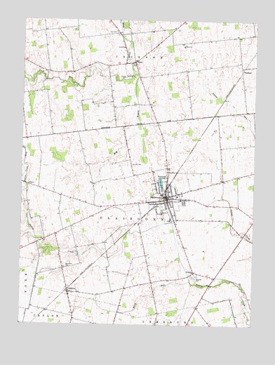
Richwood, OH USGS Topographic Map
Click on map above to begin viewing in our Map Viewer.

This topographic map contains these locations and features:
Feature Name Type Latitude Longitude GNIS ID View Map
Adams School (historical)SchoolN40.4423°W83.2680°1055571View Map
Baldwin School (historical)SchoolN40.4970°W83.2927°1055575View Map
Benedict School (historical)SchoolN40.4784°W83.3480°1055579View Map
Bethlehem ChurchChurchN40.3962°W83.2816°1037968View Map
Big RunStreamN40.4398°W83.3730°1038029View Map
Big SwaleValleyN40.4756°W83.3144°1038040View Map
Big Swale CreekStreamN40.4801°W83.3163°1055592View Map
Big Swale School (historical)SchoolN40.4414°W83.3160°1055582View Map
Bigelow School (historical)SchoolN40.3951°W83.2705°1055583View Map
Boundary School (historical)SchoolN40.4598°W83.2838°1055590View Map
Cahill School (historical)SchoolN40.4317°W83.3708°1055594View Map
Carter School (historical)SchoolN40.4956°W83.3633°1055596View Map
Central United Methodist ChurchChurchN40.4273°W83.2960°1955547View Map
Chaney School (historical)SchoolN40.4656°W83.3102°1055598View Map
Cheney CemeteryCemeteryN40.4765°W83.3199°1039010View Map
ClaibornePopulated PlaceN40.3881°W83.3491°1060971View Map
Claiborne CemeteryCemeteryN40.3942°W83.2808°1039129View Map
Claiborne Post Office (historical)Post OfficeN40.3881°W83.3489°2074276View Map
Claibourne-Richwood Elementary SchoolSchoolN40.4264°W83.2894°1055599View Map
Deadwood School (historical)SchoolN40.3917°W83.3113°1055600View Map
Elliot RunStreamN40.3928°W83.2838°1040139View Map
EssexPopulated PlaceN40.4826°W83.3158°1083981View Map
Essex United Methodist ChurchChurchN40.4820°W83.3144°1955548View Map
First Baptist ChurchChurchN40.4270°W83.2944°1955549View Map
First United Methodist ChurchChurchN40.4253°W83.2980°1955550View Map
Hamilton CemeteryCemeteryN40.4406°W83.3160°1041262View Map
Jackson Elementary SchoolSchoolN40.4834°W83.3144°1055614View Map
North Union High SchoolSchoolN40.4278°W83.2910°1055635View Map
Northern Union County Fire Department and Emergency Medical ServicesBuildingN40.4403°W83.2961°2550267View Map
Peacock RunStreamN40.4173°W83.2938°1067259View Map
Price CemeteryCemeteryN40.4952°W83.3251°1044766View Map
RichwoodPopulated PlaceN40.4264°W83.2969°1061602View Map
Richwood City HallBuildingN40.4253°W83.2960°1955495View Map
Richwood FairgroundsParkN40.4223°W83.3008°1955496View Map
Richwood LakeLakeN40.4333°W83.3000°1044989View Map
Richwood Lake ParkParkN40.4312°W83.3005°1044990View Map
Richwood North Union Public LibraryBuildingN40.4262°W83.2963°1955497View Map
Richwood Post OfficePost OfficeN40.4264°W83.2955°1955498View Map
Stony Point CemeteryCemeteryN40.3985°W83.3497°1046736View Map
Stony Point School (historical)SchoolN40.4153°W83.3480°1055654View Map
Styre School (historical)SchoolN40.3770°W83.3438°1055656View Map
Sunnyside School (historical)SchoolN40.4162°W83.3180°1055657View Map
Tawa EstatesPopulated PlaceN40.4159°W83.2632°2771055View Map
Tawa School (historical)SchoolN40.4181°W83.2674°1055659View Map
Tenery School (historical)SchoolN40.4995°W83.3283°1055661View Map
Township of ClaibourneCivilN40.4211°W83.3114°1087074View Map
Township of JacksonCivilN40.4812°W83.3283°1087077View Map
Village of RichwoodCivilN40.4276°W83.2955°2399070View Map
Village of Richwood Police DepartmentBuildingN40.4292°W83.2975°2732807View Map
Willey School (historical)SchoolN40.4545°W83.3416°1055670View Map
WoodlandPopulated PlaceN40.4789°W83.2574°1063100View Map

Note: Coordinates in the location and feature list above are referenced to NAD83 datum.


Copyright (C) 2008-2025 Ryan Niemi / Sunset Dynamics ... All Rights Reserved