TopoQuest Logo
Do you find TopoQuest useful?
Help keep TopoQuest running and adding new maps/features by donating!
Bitcoin:  19c7KJd3qBynnjoSw5npx9KScwjBe4ifkT
Litecoin:  LXs6TkuXGGXo1vDsWCkWVdjQX94eUKd6ui
Home View Maps Find Maps Find Places Resources & Links


Oswego, South Carolina Topographic Map

USGS Map Title: Oswego, SC
USGS Map MRC: 34080A3
DRG (GeoTIFF) Download: o34080a3.tif


Neighboring USGS Topographic Map Quads:


  Spring Hill, SC  
34080B4
 

  Bishopville West, SC  
34080B3
 

  Bishopville East, SC  
34080B2
 

  Dalzell, SC  
34080A4
 

  Oswego, SC  
34080A3
 

  Elliott, SC  
34080A2
 

  Sumter West, SC  
33080H4
 

  Sumter East, SC  
33080H3
 

  Mayesville, SC  
33080H2


Map MRC Location:

N35°
W81°
N35°
W80°
H8 H7 H6 H5 H4 H3 H2 H1
G8 G7 G6 G5 G4 G3 G2 G1
F8 F7 F6 F5 F4 F3 F2 F1
E8 E7 E6 E5 E4 E3 E2 E1
D8 D7 D6 D5 D4 D3 D2 D1
C8 C7 C6 C5 C4 C3 C2 C1
B8 B7 B6 B5 B4 B3 B2 B1
A8 A7 A6 A5 A4 A3 A2 A1
N34°
W81°
N34°
W80°

Oswego, SC USGS 1:24K Topographic Map Preview:
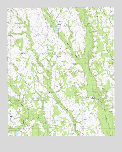
Oswego, SC USGS Topographic Map
Click on map above to begin viewing in our Map Viewer.

This topographic map contains these locations and features:
Feature Name Type Latitude Longitude GNIS ID View Map
Aman (historical)Populated PlaceN34.0871°W80.3331°1236887View Map
Antioch CemeteryCemeteryN34.0238°W80.3331°1220211View Map
Antioch ChurchChurchN34.0393°W80.3279°1244900View Map
AshwoodPopulated PlaceN34.1090°W80.3165°1231018View Map
Ashwood ChurchChurchN34.1213°W80.3434°1244938View Map
Ashwood LakeReservoirN34.1036°W80.3176°1220260View Map
Ashwood School (historical)SchoolN34.1079°W80.3156°1236889View Map
Bethel ChurchChurchN34.0613°W80.3004°1220563View Map
Bethel ChurchChurchN34.0349°W80.2895°1246787View Map
Bethel ChurchChurchN34.0052°W80.3256°1220561View Map
BrentPopulated PlaceN34.0196°W80.3701°1246977View Map
Capers CemeteryCemeteryN34.0224°W80.3326°1221340View Map
Dicks Church (historical)ChurchN34.0596°W80.3573°1244504View Map
Dicks School (historical)SchoolN34.0596°W80.3570°1244505View Map
DuBosePopulated PlaceN34.0535°W80.3459°1247564View Map
DuBose CrossroadsPopulated PlaceN34.0788°W80.3170°1247565View Map
Dubose School (historical)SchoolN34.0499°W80.3501°1244506View Map
Flying O AirportAirportN34.0110°W80.2677°2650804View Map
Georgetown School (historical)SchoolN34.0274°W80.2504°1245663View Map
Good Hope Church (historical)ChurchN34.0152°W80.3248°1244540View Map
Good Hope School (historical)SchoolN34.0152°W80.3248°1244542View Map
Hebron CemeteryCemeteryN34.0771°W80.3170°1244557View Map
Hebron ChurchChurchN34.0788°W80.3179°1245940View Map
Hill PondReservoirN34.0735°W80.3648°1239310View Map
Hill Pond Dam D-1980DamN34.0735°W80.3648°1239309View Map
Lee County Rural Fire Department AshwoodBuildingN34.1094°W80.3120°2578635View Map
Lee SwampStreamN34.0188°W80.3515°1223866View Map
Manning School (historical)SchoolN34.0982°W80.2979°1245654View Map
Marbing School (historical)SchoolN34.1013°W80.3206°1236929View Map
Martin Town School (historical)SchoolN34.0599°W80.2995°1251804View Map
McCabe (historical)Populated PlaceN34.1043°W80.3254°1236931View Map
McGirts CreekStreamN34.1104°W80.3226°1246594View Map
MechanicsvillePopulated PlaceN34.0988°W80.3151°1236934View Map
Mechanicsville ChurchChurchN34.1024°W80.3201°1246616View Map
Mechanicsville SwampSwampN34.0810°W80.2987°1224441View Map
Meredith (historical)LocaleN34.1135°W80.3187°1236935View Map
OswegoPopulated PlaceN34.0074°W80.2876°1231619View Map
Oswego Census Designated PlaceCensusN34.0056°W80.2861°2403383View Map
Oswego School (historical)SchoolN34.0071°W80.2862°1244628View Map
Rembert CemeteryCemeteryN34.0965°W80.3512°1706227View Map
Rembert ChurchChurchN34.0974°W80.3529°1250346View Map
Saint James School Number 2 (historical)SchoolN34.1218°W80.2704°1236953View Map
South Carolina Noname 31012 D-2414 DamDamN34.1015°W80.3159°1238253View Map
Sumter County Rural Fire Department DuBoseBuildingN34.0308°W80.3247°2578265View Map
Sumter Fire Department Oswego Station 14BuildingN34.0073°W80.2852°2578182View Map
Woodrow School (historical)SchoolN34.0988°W80.3729°1236978View Map

Note: Coordinates in the location and feature list above are referenced to NAD83 datum.


Copyright (C) 2008-2025 Ryan Niemi / Sunset Dynamics ... All Rights Reserved