TopoQuest Logo
Do you find TopoQuest useful?
Help keep TopoQuest running and adding new maps/features by donating!
Bitcoin:  19c7KJd3qBynnjoSw5npx9KScwjBe4ifkT
Litecoin:  LXs6TkuXGGXo1vDsWCkWVdjQX94eUKd6ui
Home View Maps Find Maps Find Places Resources & Links


Otselic, New York Topographic Map

USGS Map Title: Otselic, NY
USGS Map MRC: 42075F6
DRG (GeoTIFF) Download: o42075f6.tif


Neighboring USGS Topographic Map Quads:


  Erieville, NY  
42075G7
 

  West Eaton, NY  
42075G6
 

  Hamilton, NY  
42075G5
 

  South Otselic, NY  
42075F7
 

  Otselic, NY  
42075F6
 

  Earlville, NY  
42075F5
 

  Pitcher, NY  
42075E7
 

  East Pharsalia, NY  
42075E6
 

  Norwich, NY  
42075E5


Map MRC Location:

N43°
W76°
N43°
W75°
H8 H7 H6 H5 H4 H3 H2 H1
G8 G7 G6 G5 G4 G3 G2 G1
F8 F7 F6 F5 F4 F3 F2 F1
E8 E7 E6 E5 E4 E3 E2 E1
D8 D7 D6 D5 D4 D3 D2 D1
C8 C7 C6 C5 C4 C3 C2 C1
B8 B7 B6 B5 B4 B3 B2 B1
A8 A7 A6 A5 A4 A3 A2 A1
N42°
W76°
N42°
W75°

Otselic, NY USGS 1:24K Topographic Map Preview:
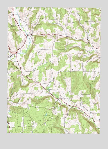
Otselic, NY USGS Topographic Map
Click on map above to begin viewing in our Map Viewer.

This topographic map contains these locations and features:
Feature Name Type Latitude Longitude GNIS ID View Map
Alder Meadow BrookStreamN42.6812°W75.7249°942289View Map
Beaver MeadowPopulated PlaceN42.6595°W75.6802°943399View Map
BonneyPopulated PlaceN42.7215°W75.6710°972246View Map
Bonney CemeteryCemeteryN42.7217°W75.6703°2559146View Map
Coit BrookStreamN42.6573°W75.7466°970020View Map
Cole HillSummitN42.6601°W75.6919°947104View Map
Cole Hill CemeteryCemeteryN42.6499°W75.6867°947106View Map
Mann BrookStreamN42.6992°W75.7466°956362View Map
Maple Grove CemeteryCemeteryN42.7106°W75.7307°956411View Map
Middletown BrookStreamN42.7031°W75.7413°957155View Map
Muller BrookStreamN42.7456°W75.7377°958145View Map
OtselicPopulated PlaceN42.7226°W75.7199°959552View Map
Otselic CenterPopulated PlaceN42.7012°W75.7457°959553View Map
Perkins PondReservoirN42.6333°W75.7494°960198View Map
Pharsalia Game RefugeParkN42.6353°W75.7071°960274View Map
Pigeon HillSummitN42.6390°W75.6582°960375View Map
School Number 1 (historical)SchoolN42.6690°W75.6996°974893View Map
School Number 14 (historical)SchoolN42.7223°W75.6710°975085View Map
School Number 2 (historical)SchoolN42.7234°W75.7180°975187View Map
School Number 6 (historical)SchoolN42.7142°W75.6369°975483View Map
StanbroPopulated PlaceN42.6681°W75.6932°973112View Map
Town of OtselicCivilN42.6861°W75.7403°979330View Map
West Smyrna Baptist ChurchChurchN42.7220°W75.6732°2617194View Map

Note: Coordinates in the location and feature list above are referenced to NAD83 datum.


Copyright (C) 2008-2025 Ryan Niemi / Sunset Dynamics ... All Rights Reserved