TopoQuest Logo
Do you find TopoQuest useful?
Help keep TopoQuest running and adding new maps/features by donating!
Bitcoin:  19c7KJd3qBynnjoSw5npx9KScwjBe4ifkT
Litecoin:  LXs6TkuXGGXo1vDsWCkWVdjQX94eUKd6ui
Home View Maps Find Maps Find Places Resources & Links


Earlville, New York Topographic Map

USGS Map Title: Earlville, NY
USGS Map MRC: 42075F5
DRG (GeoTIFF) Download: o42075f5.tif


Neighboring USGS Topographic Map Quads:


  West Eaton, NY  
42075G6
 

  Hamilton, NY  
42075G5
 

  Hubbardsville, NY  
42075G4
 

  Otselic, NY  
42075F6
 

  Earlville, NY  
42075F5
 

  Sherburne, NY  
42075F4
 

  East Pharsalia, NY  
42075E6
 

  Norwich, NY  
42075E5
 

  Holmesville, NY  
42075E4


Map MRC Location:

N43°
W76°
N43°
W75°
H8 H7 H6 H5 H4 H3 H2 H1
G8 G7 G6 G5 G4 G3 G2 G1
F8 F7 F6 F5 F4 F3 F2 F1
E8 E7 E6 E5 E4 E3 E2 E1
D8 D7 D6 D5 D4 D3 D2 D1
C8 C7 C6 C5 C4 C3 C2 C1
B8 B7 B6 B5 B4 B3 B2 B1
A8 A7 A6 A5 A4 A3 A2 A1
N42°
W76°
N42°
W75°

Earlville, NY USGS 1:24K Topographic Map Preview:
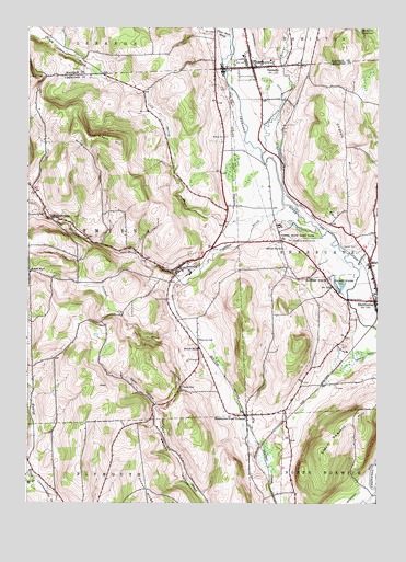
Earlville, NY USGS Topographic Map
Click on map above to begin viewing in our Map Viewer.

This topographic map contains these locations and features:
Feature Name Type Latitude Longitude GNIS ID View Map
Church HillSummitN42.7278°W75.5146°946678View Map
Cold Spring BrookStreamN42.7006°W75.5413°947062View Map
Crooked BrookStreamN42.6837°W75.5707°947774View Map
Crossroads Community ChurchChurchN42.6995°W75.5211°2615831View Map
Dark HollowValleyN42.6509°W75.5791°948036View Map
EarlvillePopulated PlaceN42.7398°W75.5452°948958View Map
Earlville and Poolville United Methodist ChurchChurchN42.7409°W75.5450°2597850View Map
Earlville CemeteryCemeteryN42.7421°W75.5446°2542912View Map
Earlville Fire DepartmentBuildingN42.7403°W75.5450°2718463View Map
Earlville Free LibraryBuildingN42.7402°W75.5449°2599214View Map
First Baptist ChurchChurchN42.7394°W75.5467°2597855View Map
Handsome BrookStreamN42.6867°W75.5066°952152View Map
Hawley BrookStreamN42.6315°W75.6221°952416View Map
Morin AirportAirportN42.7051°W75.5323°2443694View Map
Negro HillSummitN42.7203°W75.5932°958337View Map
Pleasant BrookStreamN42.7034°W75.5335°960702View Map
Reynolds CemeteryCemeteryN42.6680°W75.5638°962426View Map
Rogers State Game FarmLocaleN42.6853°W75.5185°974846View Map
Sangerfield RiverStreamN42.7173°W75.5413°964458View Map
School Number 1 (historical)SchoolN42.7000°W75.6178°2105810View Map
School Number 3 (historical)SchoolN42.6656°W75.5638°975257View Map
School Number 5 (historical)SchoolN42.6856°W75.6238°975410View Map
School Number 6 (historical)SchoolN42.6920°W75.5346°975481View Map
Sherburne Four CornersPopulated PlaceN42.6481°W75.5466°965063View Map
Sherburne Municipal BuildingBuildingN42.6784°W75.5002°2617553View Map
Sherburne Quarter CemeteryCemeteryN42.6928°W75.5069°962072View Map
Sherburne Town Fire DepartmentBuildingN42.6785°W75.5006°2718530View Map
Sherburne West Hill CemeteryCemeteryN42.6943°W75.5314°965064View Map
SmyrnaPopulated PlaceN42.6873°W75.5707°965545View Map
Smyrna Baptist ChurchChurchN42.6885°W75.5669°2616268View Map
Smyrna East CemeteryCemeteryN42.6880°W75.5651°2559147View Map
Smyrna Post OfficePost OfficeN42.6868°W75.5710°2618129View Map
Smyrna Public LibraryBuildingN42.6876°W75.5703°2617431View Map
Smyrna United Methodist ChurchChurchN42.6875°W75.5706°2616269View Map
Smyrna Volunteer Fire DepartmentBuildingN42.6874°W75.5708°2734745View Map
South Lebanon BrookStreamN42.7370°W75.5988°965805View Map
Steam Sawmill HillSummitN42.6370°W75.5188°966310View Map
Stone Mill BrookStreamN42.7478°W75.5524°966508View Map
Stover CemeteryCemeteryN42.6558°W75.5697°966607View Map
Town of SmyrnaCivilN42.6914°W75.6152°979500View Map
UppervillePopulated PlaceN42.7003°W75.6152°968313View Map
Village of EarlvilleCivilN42.7401°W75.5436°2391648View Map
Village of SmyrnaCivilN42.6869°W75.5687°2391141View Map
West End CemeteryCemeteryN42.6865°W75.5750°2559148View Map
Willcox CemeteryCemeteryN42.7215°W75.5546°971237View Map

Note: Coordinates in the location and feature list above are referenced to NAD83 datum.


Copyright (C) 2008-2025 Ryan Niemi / Sunset Dynamics ... All Rights Reserved