TopoQuest Logo
Do you find TopoQuest useful?
Help keep TopoQuest running and adding new maps/features by donating!
Bitcoin:  19c7KJd3qBynnjoSw5npx9KScwjBe4ifkT
Litecoin:  LXs6TkuXGGXo1vDsWCkWVdjQX94eUKd6ui
Home View Maps Find Maps Find Places Resources & Links


Greycliff, Montana Topographic Map

USGS Map Title: Greycliff, MT
USGS Map MRC: 45109G7
DRG (GeoTIFF) Download: o45109g7.tif


Neighboring USGS Topographic Map Quads:


  Otter Creek School, MT  
45109H8
 

  Ryan Creek, MT  
45109H7
 

  Sourdough School, MT  
45109H6
 

  Big Timber, MT  
45109G8
 

  Greycliff, MT  
45109G7
 

  Lone Indian Butte, MT  
45109G6
 

  Ross Canyon, MT  
45109F8
 

  Packsaddle Butte, MT  
45109F7
 

  Work Creek, MT  
45109F6


Map MRC Location:

N46°
W110°
N46°
W109°
H8 H7 H6 H5 H4 H3 H2 H1
G8 G7 G6 G5 G4 G3 G2 G1
F8 F7 F6 F5 F4 F3 F2 F1
E8 E7 E6 E5 E4 E3 E2 E1
D8 D7 D6 D5 D4 D3 D2 D1
C8 C7 C6 C5 C4 C3 C2 C1
B8 B7 B6 B5 B4 B3 B2 B1
A8 A7 A6 A5 A4 A3 A2 A1
N45°
W110°
N45°
W109°

Greycliff, MT USGS 1:24K Topographic Map Preview:
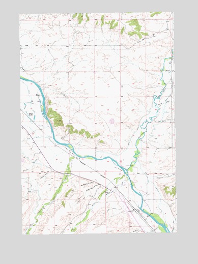
Greycliff, MT USGS Topographic Map
Click on map above to begin viewing in our Map Viewer.

This topographic map contains these locations and features:
Feature Name Type Latitude Longitude GNIS ID View Map
01N15E10DBBD01 WellWellN45.8486°W109.8544°812734View Map
01N15E12C___01 WellWellN45.8461°W109.8096°812710View Map
01N15E21ADAC01 WellWellN45.8238°W109.8585°812479View Map
01N15E21BADA01 WellWellN45.8263°W109.8669°812512View Map
01N15E21DBBC01 WellWellN45.8205°W109.8669°812436View Map
01N15E33ABBC01 WellWellN45.7985°W109.8666°812146View Map
01N15E33ABBC02 WellWellN45.7983°W109.8663°812144View Map
01N16E08____01 WellWellN45.8494°W109.7627°812735View Map
01N16E08ADAA01 WellWellN45.8524°W109.7527°812763View Map
01N16E17____01 WellWellN45.8347°W109.7627°812590View Map
01N16E31____01 WellWellN45.7910°W109.7832°812069View Map
01S15E01DAAC01 WellWellN45.7752°W109.8094°811906View Map
01S15E02ABBA01 WellWellN45.7852°W109.8360°812008View Map
01S15E14BBBC01 SpringSpringN45.7538°W109.8480°811685View Map
01S16E05____01 WellWellN45.7763°W109.7763°811916View Map
01S16E08____01 WellWellN45.7619°W109.7763°811762View Map
01S16E08BCBB01 WellWellN45.7644°W109.7877°811790View Map
01S16E08BDDB01 WellWellN45.7622°W109.7805°811763View Map
Barney GulchValleyN45.8138°W109.7682°768522View Map
Big Timber KOA CampgroundLocaleN45.7694°W109.7935°1743463View Map
Boe RanchLocaleN45.8288°W109.8599°769072View Map
Boggs DitchCanalN45.8388°W109.7535°769081View Map
Cox CreekStreamN45.8397°W109.8674°770241View Map
Dillon GulchValleyN45.7641°W109.7941°770655View Map
Dry CreekStreamN45.8052°W109.8496°782569View Map
Eatons InnLocaleN45.7733°W109.8027°771126View Map
Esp DitchCanalN45.7502°W109.8730°783226View Map
Fletcher CreekStreamN45.8419°W109.7591°771466View Map
GreycliffPopulated PlaceN45.7633°W109.7846°771991View Map
GreycliffLocaleN45.7633°W109.7846°1743397View Map
Greycliff BridgeBridgeN45.7599°W109.7721°1743454View Map
Greycliff Census Designated PlaceCensusN45.7586°W109.7797°2408338View Map
Greycliff Post OfficePost OfficeN45.7625°W109.7862°1743424View Map
Greycliff Prairie Dog TownLocaleN45.7616°W109.7896°1743472View Map
Greycliff Prairie Dog Town State ParkParkN45.7616°W109.7896°1743471View Map
Greycliff SchoolSchoolN45.7622°W109.7852°1743405View Map
Hangmans CreekStreamN45.7794°W109.7732°772119View Map
Harrison (historical)LocaleN45.7763°W109.8024°1743396View Map
Harrison DitchCanalN45.7788°W109.7707°772177View Map
Hawks DitchCanalN45.8033°W109.7869°772213View Map
Howie Post Office (historical)Post OfficeN45.8152°W109.7674°1743429View Map
Howie School (historical)SchoolN45.8491°W109.7519°772591View Map
Interchange 377CrossingN45.7694°W109.7935°1743464View Map
Lower Deer CreekStreamN45.7830°W109.7916°786667View Map
Milligan CreekStreamN45.7935°W109.8605°778819View Map
Milliken SloughsSwampN45.8161°W109.8677°774253View Map
New Schoolhouse GulchValleyN45.7794°W109.8171°774598View Map
Norman GulchValleyN45.8213°W109.7646°774667View Map
Old Schoolhouse GulchValleyN45.7774°W109.8121°774938View Map
Overfelt GulchValleyN45.7530°W109.7649°788531View Map
Pelican Fishing Access SiteLocaleN45.7527°W109.7674°1744482View Map
Peterson GulchValleyN45.7860°W109.8507°775175View Map
Pine Tree GulchValleyN45.7708°W109.8132°775249View Map
Pioneer DamDamN45.8116°W109.8607°797799View Map
Reynolds (historical)LocaleN45.7952°W109.8363°1743393View Map
Spring CreekStreamN45.7802°W109.7902°776999View Map
Sweet Grass CreekStreamN45.7860°W109.7896°791815View Map
Upper Deer CreekStreamN45.7949°W109.8316°792625View Map

Note: Coordinates in the location and feature list above are referenced to NAD83 datum.


Copyright (C) 2008-2025 Ryan Niemi / Sunset Dynamics ... All Rights Reserved