TopoQuest Logo
Do you find TopoQuest useful?
Help keep TopoQuest running and adding new maps/features by donating!
Bitcoin:  19c7KJd3qBynnjoSw5npx9KScwjBe4ifkT
Litecoin:  LXs6TkuXGGXo1vDsWCkWVdjQX94eUKd6ui
Home View Maps Find Maps Find Places Resources & Links


Ottertail, Minnesota Topographic Map

USGS Map Title: Ottertail, MN
USGS Map MRC: 46095D5
DRG (GeoTIFF) Download: o46095d5.tif


Neighboring USGS Topographic Map Quads:


  Dent, MN  
46095E6
 

  Perham, MN  
46095E5
 

  New York Mills West, MN  
46095E4
 

  Walker Lake, MN  
46095D6
 

  Ottertail, MN  
46095D5
 

  Heinola, MN  
46095D4
 

  Battle Lake, MN  
46095C6
 

  Vining, MN  
46095C5
 

  Henning, MN  
46095C4


Map MRC Location:

N47°
W96°
N47°
W95°
H8 H7 H6 H5 H4 H3 H2 H1
G8 G7 G6 G5 G4 G3 G2 G1
F8 F7 F6 F5 F4 F3 F2 F1
E8 E7 E6 E5 E4 E3 E2 E1
D8 D7 D6 D5 D4 D3 D2 D1
C8 C7 C6 C5 C4 C3 C2 C1
B8 B7 B6 B5 B4 B3 B2 B1
A8 A7 A6 A5 A4 A3 A2 A1
N46°
W96°
N46°
W95°

Ottertail, MN USGS 1:24K Topographic Map Preview:
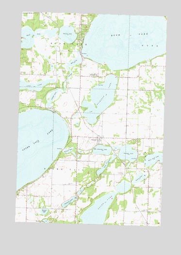
Ottertail, MN USGS Topographic Map
Click on map above to begin viewing in our Map Viewer.

This topographic map contains these locations and features:
Feature Name Type Latitude Longitude GNIS ID View Map
Buchanan LakeLakeN46.4496°W95.5554°640576View Map
City of OttertailCivilN46.4266°W95.5593°2396107View Map
Donalds LakeLakeN46.4192°W95.5525°642882View Map
Gourd LakeLakeN46.3825°W95.5524°644287View Map
Grass LakeLakeN46.4034°W95.5198°644376View Map
Head LakeLakeN46.4863°W95.6109°656560View Map
Leaf Lake CemeteryCemeteryN46.3838°W95.5167°646559View Map
Long LakeLakeN46.4102°W95.5493°647084View Map
Mud LakeLakeN46.4710°W95.5790°648301View Map
Otter Tail CemeteryCemeteryN46.3983°W95.5817°649058View Map
Otter Tail City Historical MarkerParkN46.4269°W95.5792°2073143View Map
Otter Tail County Sheriff's Office SubstationBuildingN46.4256°W95.5731°2758744View Map
Otter Tail Lake Rest AreaLocaleN46.4025°W95.6036°2073149View Map
OttertailPopulated PlaceN46.4255°W95.5573°649060View Map
Ottertail Fire and RescueBuildingN46.4258°W95.5576°2666707View Map
Pelican BayBayN46.4186°W95.5812°649230View Map
Pickerel LakeLakeN46.3879°W95.5793°649365View Map
Portage LakeLakeN46.4176°W95.5304°649666View Map
Round LakeLakeN46.3817°W95.6005°650339View Map
Round LakeLakeN46.4873°W95.5854°650343View Map
Rush LakeLakeN46.4872°W95.5288°650409View Map
Rush Lake DamDamN46.4750°W95.5703°1776260View Map
Rush Lake Post Office (historical)Post OfficeN46.4917°W95.5750°2072981View Map
Saint John SchoolSchoolN46.4261°W95.5228°650651View Map
Saint John's Lutheran ChurchChurchN46.4264°W95.5225°2072849View Map
Saint John's Lutheran Church CemeteryCemeteryN46.4250°W95.5222°2072682View Map
Salem Evangelical United Brethren CemeteryCemeteryN46.4705°W95.5117°2072666View Map
School Number 117 (historical)SchoolN46.3839°W95.5017°2125206View Map
School Number 163 (historical)SchoolN46.3983°W95.5733°2125205View Map
School Number 199 (historical)SchoolN46.4647°W95.5483°2125200View Map
Sherman LakeLakeN46.3756°W95.5984°651967View Map
Thumper Pond Golf CourseLocaleN46.4306°W95.5733°2073166View Map
Township of Otter TailCivilN46.4097°W95.6005°665239View Map
Township of Rush LakeCivilN46.4986°W95.5941°665489View Map
United Methodist ChurchChurchN46.4258°W95.5547°2072846View Map
Zion CemeteryCemeteryN46.3902°W95.6103°654456View Map

Note: Coordinates in the location and feature list above are referenced to NAD83 datum.


Copyright (C) 2008-2025 Ryan Niemi / Sunset Dynamics ... All Rights Reserved