TopoQuest Logo
Do you find TopoQuest useful?
Help keep TopoQuest running and adding new maps/features by donating!
Bitcoin:  19c7KJd3qBynnjoSw5npx9KScwjBe4ifkT
Litecoin:  LXs6TkuXGGXo1vDsWCkWVdjQX94eUKd6ui
Home View Maps Find Maps Find Places Resources & Links


Dent, Minnesota Topographic Map

USGS Map Title: Dent, MN
USGS Map MRC: 46095E6
DRG (GeoTIFF) Download: o46095e6.tif


Neighboring USGS Topographic Map Quads:


  Vergas, MN  
46095F7
 

  Frazee, MN  
46095F6
 

  Little Pine Lake, MN  
46095F5
 

  Star Lake, MN  
46095E7
 

  Dent, MN  
46095E6
 

  Perham, MN  
46095E5
 

  Phelps, MN  
46095D7
 

  Walker Lake, MN  
46095D6
 

  Ottertail, MN  
46095D5


Map MRC Location:

N47°
W96°
N47°
W95°
H8 H7 H6 H5 H4 H3 H2 H1
G8 G7 G6 G5 G4 G3 G2 G1
F8 F7 F6 F5 F4 F3 F2 F1
E8 E7 E6 E5 E4 E3 E2 E1
D8 D7 D6 D5 D4 D3 D2 D1
C8 C7 C6 C5 C4 C3 C2 C1
B8 B7 B6 B5 B4 B3 B2 B1
A8 A7 A6 A5 A4 A3 A2 A1
N46°
W96°
N46°
W95°

Dent, MN USGS 1:24K Topographic Map Preview:
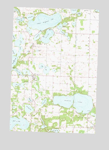
Dent, MN USGS Topographic Map
Click on map above to begin viewing in our Map Viewer.

This topographic map contains these locations and features:
Feature Name Type Latitude Longitude GNIS ID View Map
Aerovilla AirportAirportN46.6247°W95.6494°660350View Map
Berger LakeLakeN46.5871°W95.7398°639961View Map
Bolton LakeLakeN46.5321°W95.7219°640355View Map
Boos LakeLakeN46.5804°W95.7278°640372View Map
Ceynowa LakeLakeN46.5988°W95.6719°641087View Map
City of DentCivilN46.5525°W95.7184°2394517View Map
City of RichvilleCivilN46.5058°W95.6261°2396371View Map
DentPopulated PlaceN46.5536°W95.7164°642771View Map
DentLocaleN46.5575°W95.7178°2073092View Map
Dent Elementary SchoolSchoolN46.5556°W95.7194°2073094View Map
Dent Fire DepartmentBuildingN46.5533°W95.7172°2073091View Map
Dent Post Office (historical)Post OfficeN46.5536°W95.7161°2073090View Map
Frank's CampgroundLocaleN46.5536°W95.7161°2073089View Map
Grunard LakeLakeN46.6124°W95.7410°644515View Map
Immanuel CemeteryCemeteryN46.5575°W95.7142°645356View Map
Kerbs LakeLakeN46.6152°W95.7255°646116View Map
Kurtz Family CampgroundLocaleN46.5067°W95.6253°2072778View Map
Lily LakeLakeN46.5303°W95.7010°646650View Map
Little Devils LakeLakeN46.6203°W95.6543°646793View Map
Little McDonald LakeLakeN46.6110°W95.7038°646855View Map
Lone Pine LakeLakeN46.5015°W95.6830°657175View Map
Marion LakeLakeN46.5308°W95.6551°647539View Map
Memorial CemeteryCemeteryN46.6208°W95.6372°2071833View Map
Mink LakeLakeN46.6221°W95.7485°647916View Map
Moenkedick LakeLakeN46.6068°W95.6816°648014View Map
Mud LakeLakeN46.5792°W95.7490°648347View Map
Paul LakeLakeN46.5965°W95.6994°649185View Map
Pelewski LakeLakeN46.5816°W95.7135°649229View Map
Pleasant Hill CemeteryCemeteryN46.5583°W95.7083°2072699View Map
Pleasant Hill CemeteryCemeteryN46.5569°W95.7292°649552View Map
Rice LakeLakeN46.5467°W95.7396°650007View Map
RichvillePopulated PlaceN46.5066°W95.6256°650069View Map
RichvilleLocaleN46.5083°W95.6253°2072776View Map
Richville CemeteryCemeteryN46.5063°W95.6478°650070View Map
Richville Post Office (historical)Post OfficeN46.5067°W95.6253°2072779View Map
Richville Trailer ParkPopulated PlaceN46.5067°W95.6253°2072777View Map
Rusch LakeLakeN46.5959°W95.7143°650389View Map
Sabbin Dairy FarmLocaleN46.5353°W95.7314°2635901View Map
Sacred Heart CemeteryCemeteryN46.5572°W95.7136°650459View Map
Sacred Heart ChurchChurchN46.5558°W95.7200°2073095View Map
Schuster LakeLakeN46.6245°W95.6272°651792View Map
Star Hills Mobile Home ParkPopulated PlaceN46.5536°W95.7161°2073088View Map
Stony LakeLakeN46.6096°W95.6744°652686View Map
Tamarack LakeLakeN46.5228°W95.7235°653009View Map
Tee LakeLakeN46.5110°W95.7025°653065View Map
Tenter LakeLakeN46.5599°W95.7405°653088View Map
Township of EdnaCivilN46.5858°W95.7197°664050View Map
United Methodist ChurchChurchN46.5528°W95.7144°2073093View Map
Wolf LakeLakeN46.5624°W95.6992°654315View Map

Note: Coordinates in the location and feature list above are referenced to NAD83 datum.


Copyright (C) 2008-2024 Ryan Niemi / Sunset Dynamics ... All Rights Reserved