TopoQuest Logo
Do you find TopoQuest useful?
Help keep TopoQuest running and adding new maps/features by donating!
Bitcoin:  19c7KJd3qBynnjoSw5npx9KScwjBe4ifkT
Litecoin:  LXs6TkuXGGXo1vDsWCkWVdjQX94eUKd6ui
Home View Maps Find Maps Find Places Resources & Links


Owaneco, Illinois Topographic Map

USGS Map Title: Owaneco, IL
USGS Map MRC: 39089D2
DRG (GeoTIFF) Download: o39089d2.tif


Neighboring USGS Topographic Map Quads:


  Taylorville, IL  
39089E3
 

  Willeys, IL  
39089E2
 

  Assumption, IL  
39089E1
 

  Clarksdale, IL  
39089D3
 

  Owaneco, IL  
39089D2
 

  Pana, IL  
39089D1
 

  Nokomis, IL  
39089C3
 

  Ohlman, IL  
39089C2
 

  Oconee, IL  
39089C1


Map MRC Location:

N40°
W90°
N40°
W89°
H8 H7 H6 H5 H4 H3 H2 H1
G8 G7 G6 G5 G4 G3 G2 G1
F8 F7 F6 F5 F4 F3 F2 F1
E8 E7 E6 E5 E4 E3 E2 E1
D8 D7 D6 D5 D4 D3 D2 D1
C8 C7 C6 C5 C4 C3 C2 C1
B8 B7 B6 B5 B4 B3 B2 B1
A8 A7 A6 A5 A4 A3 A2 A1
N39°
W90°
N39°
W89°

Owaneco, IL USGS 1:24K Topographic Map Preview:
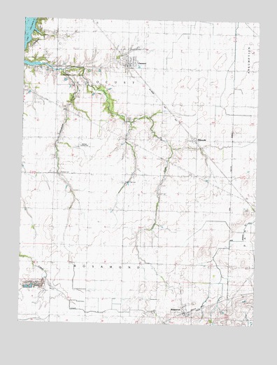
Owaneco, IL USGS Topographic Map
Click on map above to begin viewing in our Map Viewer.

This topographic map contains these locations and features:
Feature Name Type Latitude Longitude GNIS ID View Map
Buckeye CemeteryCemeteryN39.4364°W89.2298°1747877View Map
Buckeye ChurchChurchN39.4506°W89.2334°405113View Map
Buckeye School (historical)SchoolN39.4506°W89.2334°405117View Map
Cottonwood CreekStreamN39.4789°W89.2293°406631View Map
Donner CemeteryCemeteryN39.4792°W89.2373°1953215View Map
Durbin CemeteryCemeteryN39.4589°W89.1942°407519View Map
Durbin College School (historical)SchoolN39.4509°W89.1948°407521View Map
Grant School (historical)SchoolN39.3995°W89.2243°409299View Map
Johnson School (historical)SchoolN39.4809°W89.2331°411173View Map
Metsker Landing Strip (historical)AirportN39.4473°W89.2168°1747913View Map
MillersvillePopulated PlaceN39.4512°W89.1581°422981View Map
Millersville CemeteryCemeteryN39.4366°W89.1602°413609View Map
OwanecoPopulated PlaceN39.4823°W89.1937°415269View Map
Owaneco Fire Protection DistrictBuildingN39.4825°W89.1909°2640144View Map
Pana QuarryMineN39.3906°W89.2418°1976707View Map
Pike School (historical)SchoolN39.4220°W89.1765°415669View Map
Potters Field CemeteryCemeteryN39.4334°W89.1948°416082View Map
Resler School (historical)SchoolN39.4798°W89.1568°416545View Map
RosamondPopulated PlaceN39.3798°W89.1604°416931View Map
Rosamond Post OfficePost OfficeN39.3803°W89.1623°1811254View Map
Sherman School (historical)SchoolN39.4217°W89.2284°418369View Map
Township of LocustCivilN39.4801°W89.1939°429272View Map
Township of RosamondCivilN39.3926°W89.1949°429669View Map
Village of OwanecoCivilN39.4814°W89.1949°2399602View Map

Note: Coordinates in the location and feature list above are referenced to NAD83 datum.


Copyright (C) 2008-2024 Ryan Niemi / Sunset Dynamics ... All Rights Reserved