TopoQuest Logo
Do you find TopoQuest useful?
Help keep TopoQuest running and adding new maps/features by donating!
Bitcoin:  19c7KJd3qBynnjoSw5npx9KScwjBe4ifkT
Litecoin:  LXs6TkuXGGXo1vDsWCkWVdjQX94eUKd6ui
Home View Maps Find Maps Find Places Resources & Links


Nokomis, Illinois Topographic Map

USGS Map Title: Nokomis, IL
USGS Map MRC: 39089C3
DRG (GeoTIFF) Download: o39089c3.tif


Neighboring USGS Topographic Map Quads:


  Morrisonville, IL  
39089D4
 

  Clarksdale, IL  
39089D3
 

  Owaneco, IL  
39089D2
 

  Nokomis SW, IL  
39089C4
 

  Nokomis, IL  
39089C3
 

  Ohlman, IL  
39089C2
 

  Hillsboro, IL  
39089B4
 

  Bald Knob, IL  
39089B3
 

  Ramsey Lake, IL  
39089B2


Map MRC Location:

N40°
W90°
N40°
W89°
H8 H7 H6 H5 H4 H3 H2 H1
G8 G7 G6 G5 G4 G3 G2 G1
F8 F7 F6 F5 F4 F3 F2 F1
E8 E7 E6 E5 E4 E3 E2 E1
D8 D7 D6 D5 D4 D3 D2 D1
C8 C7 C6 C5 C4 C3 C2 C1
B8 B7 B6 B5 B4 B3 B2 B1
A8 A7 A6 A5 A4 A3 A2 A1
N39°
W90°
N39°
W89°

Nokomis, IL USGS 1:24K Topographic Map Preview:
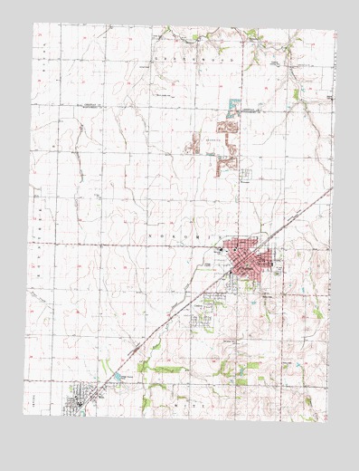
Nokomis, IL USGS Topographic Map
Click on map above to begin viewing in our Map Viewer.

This topographic map contains these locations and features:
Feature Name Type Latitude Longitude GNIS ID View Map
Antioch Methodist CemeteryCemeteryN39.3618°W89.3266°403545View Map
Avoca School (historical)SchoolN39.3339°W89.2706°403762View Map
Bowser School (historical)SchoolN39.2753°W89.2506°404751View Map
Calvary CemeteryCemeteryN39.2980°W89.2716°1772144View Map
Center Grove Methodist CemeteryCemeteryN39.3712°W89.3212°405790View Map
Christian Church of WittChurchN39.2589°W89.3501°1821721View Map
City of NokomisCivilN39.3001°W89.2852°2395243View Map
City of WittCivilN39.2545°W89.3492°2397356View Map
CoaltonPopulated PlaceN39.2828°W89.3012°406308View Map
Compton School (historical)SchoolN39.3639°W89.3359°406431View Map
Dahler AirportAirportN39.3529°W89.3242°427616View Map
Dooley Field (historical)AirportN39.3606°W89.2756°427617View Map
Fair Prairie School (historical)SchoolN39.2903°W89.3459°408155View Map
First Baptist ChurchChurchN39.3000°W89.2818°1821731View Map
First Methodist ChurchChurchN39.2981°W89.2859°1962814View Map
German Methodist Episcopal Church (historical)ChurchN39.3048°W89.2856°1962815View Map
Gopher Hills School (historical)SchoolN39.3706°W89.2795°409194View Map
Hillside Baptist ChurchChurchN39.3020°W89.2709°1821748View Map
J and J Farms Airport (historical)AirportN39.3423°W89.3601°427615View Map
Kettlecamp Methodist CemeteryCemeteryN39.3712°W89.2869°411435View Map
Kottwitz Landing Strip (historical)AirportN39.3634°W89.2756°1747906View Map
Lynnvue FarmsLocaleN39.3294°W89.2531°2680992View Map
Memorial ParkParkN39.3034°W89.2965°1772111View Map
NokomisPopulated PlaceN39.3012°W89.2851°414545View Map
Nokomis Ambulance ServiceBuildingN39.2954°W89.2943°2673908View Map
Nokomis Fire Protection DistrictBuildingN39.2996°W89.2882°2640352View Map
Nokomis High SchoolSchoolN39.3045°W89.2954°1772121View Map
Nokomis Police DepartmentBuildingN39.2997°W89.2880°2758980View Map
Nokomis Post OfficePost OfficeN39.3000°W89.2854°1962816View Map
Nokomis Public LibraryBuildingN39.3003°W89.2873°1821765View Map
Nokomis QuarryMineN39.3437°W89.2937°1983735View Map
Nokomis South Middle SchoolSchoolN39.3000°W89.2795°1821766View Map
North Elementary SchoolSchoolN39.3045°W89.2898°1821767View Map
Oak Grove CemeteryCemeteryN39.2750°W89.2884°1772125View Map
Oak Grove School (historical)SchoolN39.2748°W89.2881°414798View Map
Reliance Mine Number 9MineN39.2850°W89.3029°1962817View Map
Saint Louis Catholic ChurchChurchN39.3012°W89.2795°1821776View Map
Saint Louis SchoolSchoolN39.3017°W89.2787°1772145View Map
Saint Marks Lutheran ChurchChurchN39.3009°W89.2820°1821777View Map
Saint Paul SchoolSchoolN39.3200°W89.3456°417706View Map
South Fork United Methodist ChurchChurchN39.3639°W89.2651°418755View Map
Township of NokomisCivilN39.3050°W89.3074°429451View Map
Trinity Evangelical Lutheran ChurchChurchN39.3023°W89.2881°1962818View Map
Village of CoaltonCivilN39.2848°W89.3030°2398590View Map
Village of WenonahCivilN39.3200°W89.2879°2400124View Map
Walker School (historical)SchoolN39.3195°W89.3348°420408View Map
WenonahPopulated PlaceN39.3270°W89.2890°420751View Map
WittPopulated PlaceN39.2564°W89.3481°421359View Map
Witt High SchoolSchoolN39.2564°W89.3537°1821791View Map
Witt Memorial Public LibraryBuildingN39.2548°W89.3523°1821792View Map
Witt Post OfficePost OfficeN39.2541°W89.3527°2788464View Map
Witt Volunteer Fire DepartmentBuildingN39.2557°W89.3485°2640534View Map

Note: Coordinates in the location and feature list above are referenced to NAD83 datum.


Copyright (C) 2008-2025 Ryan Niemi / Sunset Dynamics ... All Rights Reserved