TopoQuest Logo
Do you find TopoQuest useful?
Help keep TopoQuest running and adding new maps/features by donating!
Bitcoin:  19c7KJd3qBynnjoSw5npx9KScwjBe4ifkT
Litecoin:  LXs6TkuXGGXo1vDsWCkWVdjQX94eUKd6ui
Home View Maps Find Maps Find Places Resources & Links


Ohlman, Illinois Topographic Map

USGS Map Title: Ohlman, IL
USGS Map MRC: 39089C2
DRG (GeoTIFF) Download: o39089c2.tif


Neighboring USGS Topographic Map Quads:


  Clarksdale, IL  
39089D3
 

  Owaneco, IL  
39089D2
 

  Pana, IL  
39089D1
 

  Nokomis, IL  
39089C3
 

  Ohlman, IL  
39089C2
 

  Oconee, IL  
39089C1
 

  Bald Knob, IL  
39089B3
 

  Ramsey Lake, IL  
39089B2
 

  Ramsey, IL  
39089B1


Map MRC Location:

N40°
W90°
N40°
W89°
H8 H7 H6 H5 H4 H3 H2 H1
G8 G7 G6 G5 G4 G3 G2 G1
F8 F7 F6 F5 F4 F3 F2 F1
E8 E7 E6 E5 E4 E3 E2 E1
D8 D7 D6 D5 D4 D3 D2 D1
C8 C7 C6 C5 C4 C3 C2 C1
B8 B7 B6 B5 B4 B3 B2 B1
A8 A7 A6 A5 A4 A3 A2 A1
N39°
W90°
N39°
W89°

Ohlman, IL USGS 1:24K Topographic Map Preview:
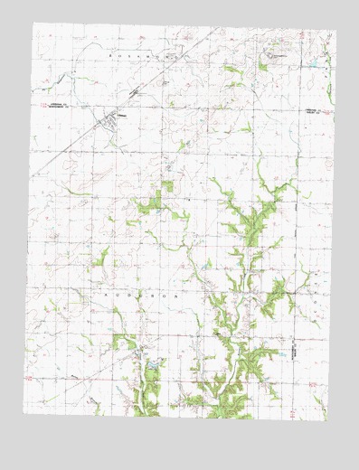
Ohlman, IL USGS Topographic Map
Click on map above to begin viewing in our Map Viewer.

This topographic map contains these locations and features:
Feature Name Type Latitude Longitude GNIS ID View Map
Audubon School (historical)SchoolN39.2837°W89.1767°403722View Map
Cards Grove School (historical)SchoolN39.3275°W89.1962°405582View Map
Fairview School (historical)SchoolN39.3192°W89.2323°408210View Map
Fikan FarmsLocaleN39.3640°W89.1780°2629392View Map
Greeley School (historical)SchoolN39.3634°W89.2245°409367View Map
Green Acre FarmLocaleN39.3572°W89.1569°2629365View Map
Merkle School (historical)SchoolN39.2503°W89.1848°413430View Map
Nokomis Sportsman Club LakeReservoirN39.2668°W89.1972°1692357View Map
Nokomis Sportsman Club Lake DamDamN39.2667°W89.2001°1692356View Map
OhlmanPopulated PlaceN39.3450°W89.2187°414976View Map
Ohlman CemeteryCemeteryN39.3567°W89.1965°414977View Map
Ohlman Post OfficePost OfficeN39.3460°W89.2169°2788444View Map
Prairie College School (historical)SchoolN39.3267°W89.1584°416111View Map
Rosemond Grove CemeteryCemeteryN39.3662°W89.1523°412123View Map
Shiloh ChurchChurchN39.2764°W89.1712°418414View Map
Smoky Row School (historical)SchoolN39.2617°W89.2251°418657View Map
Star Point School (historical)SchoolN39.2909°W89.1534°419046View Map
Tennessee School (historical)SchoolN39.2514°W89.1529°419596View Map
Township of AudubonCivilN39.2833°W89.1953°427933View Map
Village of OhlmanCivilN39.3434°W89.2191°2399565View Map
White Settlement School (historical)SchoolN39.2906°W89.2240°421081View Map
Zion CemeteryCemeteryN39.2725°W89.2024°421633View Map

Note: Coordinates in the location and feature list above are referenced to NAD83 datum.


Copyright (C) 2008-2025 Ryan Niemi / Sunset Dynamics ... All Rights Reserved