TopoQuest Logo
Do you find TopoQuest useful?
Help keep TopoQuest running and adding new maps/features by donating!
Bitcoin:  19c7KJd3qBynnjoSw5npx9KScwjBe4ifkT
Litecoin:  LXs6TkuXGGXo1vDsWCkWVdjQX94eUKd6ui
Home View Maps Find Maps Find Places Resources & Links


Oxford, Arkansas Topographic Map

USGS Map Title: Oxford, AR
USGS Map MRC: 36091B8
DRG (GeoTIFF) Download: o36091b8.tif


Neighboring USGS Topographic Map Quads:


  Elizabeth, AR  
36092C1
 

  Byron, AR  
36091C8
 

  Salem, AR  
36091C7
 

  Pineville, AR  
36092B1
 

  Oxford, AR  
36091B8
 

  Franklin, AR  
36091B7
 

  Boswell, AR  
36092A1
 

  Melbourne, AR  
36091A8
 

  Zion, AR  
36091A7


Map MRC Location:

N37°
W92°
N37°
W91°
H8 H7 H6 H5 H4 H3 H2 H1
G8 G7 G6 G5 G4 G3 G2 G1
F8 F7 F6 F5 F4 F3 F2 F1
E8 E7 E6 E5 E4 E3 E2 E1
D8 D7 D6 D5 D4 D3 D2 D1
C8 C7 C6 C5 C4 C3 C2 C1
B8 B7 B6 B5 B4 B3 B2 B1
A8 A7 A6 A5 A4 A3 A2 A1
N36°
W92°
N36°
W91°

Oxford, AR USGS 1:24K Topographic Map Preview:
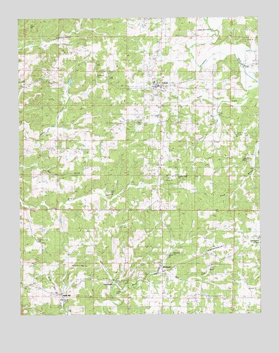
Oxford, AR USGS Topographic Map
Click on map above to begin viewing in our Map Viewer.

This topographic map contains these locations and features:
Feature Name Type Latitude Longitude GNIS ID View Map
Band MillPopulated PlaceN36.1337°W91.9790°57322View Map
Blankenship CemeteryCemeteryN36.1501°W91.9207°65857View Map
BrockwellPopulated PlaceN36.1428°W91.9265°57444View Map
Brockwell Post OfficePost OfficeN36.1431°W91.9247°84345View Map
Campground CemeteryCemeteryN36.2253°W91.9549°65866View Map
Chapel Hill ChurchChurchN36.1276°W91.9224°47699View Map
Christian ChapelChurchN36.1945°W91.9690°47767View Map
City of OxfordCivilN36.2091°W91.9194°2404452View Map
Goodrich CemeteryCemeteryN36.1498°W91.9235°65872View Map
Izard County Consolidated Elementary SchoolSchoolN36.1546°W91.9246°65876View Map
Izard County Consolidated High SchoolSchoolN36.1550°W91.9235°65877View Map
Izard County Consolidated Middle SchoolSchoolN36.1555°W91.9244°2121461View Map
Jett (historical)Populated PlaceN36.1501°W91.8863°65878View Map
Liberty Hill ChurchChurchN36.2370°W91.9682°51118View Map
Owens CemeteryCemeteryN36.1342°W91.9401°65896View Map
OxfordPopulated PlaceN36.2212°W91.9293°53117View Map
Oxford Baptist ChurchChurchN36.2206°W91.9282°65897View Map
Oxford Lookout TowerTowerN36.1812°W91.9174°82537View Map
Oxford Post OfficePost OfficeN36.2249°W91.9294°2781942View Map
Oxford United Methodist ChurchChurchN36.2212°W91.9282°65898View Map
Oxford Volunteer Fire DepartmentBuildingN36.2252°W91.9282°2116919View Map
Pleasant Grove CemeteryCemeteryN36.1565°W91.9910°65903View Map
Pleasant Grove ChurchChurchN36.1576°W91.9915°53551View Map
Pleasant Ridge CemeteryCemeteryN36.1831°W91.9182°65904View Map
Pleasant Ridge ChurchChurchN36.1834°W91.9193°53599View Map
Powell CreekStreamN36.2148°W91.8946°53743View Map
Spring Hill CemeteryCemeteryN36.1995°W91.8829°65915View Map
Spring Hill ChurchChurchN36.1998°W91.8821°55113View Map
Thorn HillSummitN36.2467°W91.9940°58742View Map
Township of New HopeCivilN36.2145°W91.9199°66710View Map
Township of NewburgCivilN36.1315°W91.9629°66709View Map
Twin BridgesPopulated PlaceN36.1384°W91.9507°65918View Map
Wyatt CemeteryCemeteryN36.1765°W91.9529°65922View Map

Note: Coordinates in the location and feature list above are referenced to NAD83 datum.


Copyright (C) 2008-2024 Ryan Niemi / Sunset Dynamics ... All Rights Reserved