TopoQuest Logo
Do you find TopoQuest useful?
Help keep TopoQuest running and adding new maps/features by donating!
Bitcoin:  19c7KJd3qBynnjoSw5npx9KScwjBe4ifkT
Litecoin:  LXs6TkuXGGXo1vDsWCkWVdjQX94eUKd6ui
Home View Maps Find Maps Find Places Resources & Links


Byron, Arkansas Topographic Map

USGS Map Title: Byron, AR
USGS Map MRC: 36091C8
DRG (GeoTIFF) Download: o36091c8.tif


Neighboring USGS Topographic Map Quads:


  Gepp, AR  
36092D1
 

  Viola, AR  
36091D8
 

  Salem Knob, AR  
36091D7
 

  Elizabeth, AR  
36092C1
 

  Byron, AR  
36091C8
 

  Salem, AR  
36091C7
 

  Pineville, AR  
36092B1
 

  Oxford, AR  
36091B8
 

  Franklin, AR  
36091B7


Map MRC Location:

N37°
W92°
N37°
W91°
H8 H7 H6 H5 H4 H3 H2 H1
G8 G7 G6 G5 G4 G3 G2 G1
F8 F7 F6 F5 F4 F3 F2 F1
E8 E7 E6 E5 E4 E3 E2 E1
D8 D7 D6 D5 D4 D3 D2 D1
C8 C7 C6 C5 C4 C3 C2 C1
B8 B7 B6 B5 B4 B3 B2 B1
A8 A7 A6 A5 A4 A3 A2 A1
N36°
W92°
N36°
W91°

Byron, AR USGS 1:24K Topographic Map Preview:
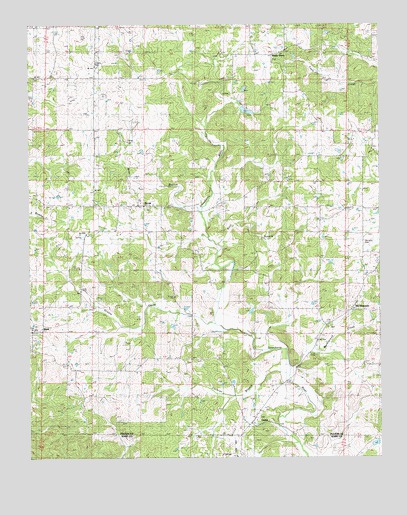
Byron, AR USGS Topographic Map
Click on map above to begin viewing in our Map Viewer.

This topographic map contains these locations and features:
Feature Name Type Latitude Longitude GNIS ID View Map
BexarPopulated PlaceN36.2867°W91.9957°57371View Map
Bray BranchStreamN36.3203°W91.9388°46922View Map
Bulls Eye LakeReservoirN36.3517°W91.9252°79731View Map
Bulls Eye Lake DamDamN36.3517°W91.9252°79730View Map
ByronPopulated PlaceN36.3226°W91.9577°47257View Map
Byron Volunteer Fire DepartmentBuildingN36.3234°W91.9593°2116211View Map
Cochran BranchStreamN36.2734°W91.9079°47877View Map
Greasy CreekStreamN36.2887°W91.9343°49618View Map
Harmony CemeteryCemeteryN36.3120°W91.8807°49867View Map
Liberty CemeteryCemeteryN36.3634°W91.9765°51095View Map
Markleroad CreekStreamN36.2756°W91.9071°63056View Map
Mount PleasantPopulated PlaceN36.2926°W91.8857°58227View Map
Rose BranchStreamN36.3112°W91.9321°54190View Map
Shady GrovePopulated PlaceN36.3667°W91.9129°58597View Map
Spiritual Development LakeReservoirN36.2539°W91.8770°80942View Map
Spiritual Development Lake DamDamN36.2534°W91.8785°80941View Map
Talley CemeteryCemeteryN36.3414°W91.9651°63064View Map
Township of UnionCivilN36.2904°W91.8821°66583View Map
UnionPopulated PlaceN36.2598°W91.9213°58786View Map
Wesley ChapelChurchN36.2773°W91.9446°56156View Map

Note: Coordinates in the location and feature list above are referenced to NAD83 datum.


Copyright (C) 2008-2025 Ryan Niemi / Sunset Dynamics ... All Rights Reserved