TopoQuest Logo
Do you find TopoQuest useful?
Help keep TopoQuest running and adding new maps/features by donating!
Bitcoin:  19c7KJd3qBynnjoSw5npx9KScwjBe4ifkT
Litecoin:  LXs6TkuXGGXo1vDsWCkWVdjQX94eUKd6ui
Home View Maps Find Maps Find Places Resources & Links


Pineville, Arkansas Topographic Map

USGS Map Title: Pineville, AR
USGS Map MRC: 36092B1
DRG (GeoTIFF) Download: o36092b1.tif


Neighboring USGS Topographic Map Quads:


  Norfork Dam North, AR  
36092C2
 

  Elizabeth, AR  
36092C1
 

  Byron, AR  
36091C8
 

  Norfork Dam South, AR  
36092B2
 

  Pineville, AR  
36092B1
 

  Oxford, AR  
36091B8
 

  Calico Rock, AR  
36092A2
 

  Boswell, AR  
36092A1
 

  Melbourne, AR  
36091A8


Map MRC Location:

N37°
W93°
N37°
W92°
H8 H7 H6 H5 H4 H3 H2 H1
G8 G7 G6 G5 G4 G3 G2 G1
F8 F7 F6 F5 F4 F3 F2 F1
E8 E7 E6 E5 E4 E3 E2 E1
D8 D7 D6 D5 D4 D3 D2 D1
C8 C7 C6 C5 C4 C3 C2 C1
B8 B7 B6 B5 B4 B3 B2 B1
A8 A7 A6 A5 A4 A3 A2 A1
N36°
W93°
N36°
W92°

Pineville, AR USGS 1:24K Topographic Map Preview:
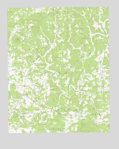
Pineville, AR USGS Topographic Map
Click on map above to begin viewing in our Map Viewer.

This topographic map contains these locations and features:
Feature Name Type Latitude Longitude GNIS ID View Map
Bear CreekStreamN36.1898°W92.0107°46213View Map
Brushy CreekStreamN36.1634°W92.0590°47080View Map
Campgrounds ChurchChurchN36.2209°W92.1035°47361View Map
City of Calico RockCivilN36.1347°W92.1219°2403968View Map
Corinth ChurchChurchN36.2117°W92.0302°48054View Map
Cresswell CemeteryCemeteryN36.1748°W92.0749°48157View Map
CrossroadsPopulated PlaceN36.1937°W92.0943°76717View Map
DolphPopulated PlaceN36.2284°W92.1127°57671View Map
Dolph Post OfficePost OfficeN36.2277°W92.1124°84346View Map
Dry HollowValleyN36.1845°W92.0154°48665View Map
Flat Rock ChurchChurchN36.1456°W92.0379°49113View Map
Flat Rock CreekStreamN36.1476°W92.0665°49116View Map
Forty FourPopulated PlaceN36.1437°W92.0610°57019View Map
Hively MountainSummitN36.2184°W92.1132°50155View Map
Huron (historical)Populated PlaceN36.2290°W92.0627°65875View Map
Indian CreekStreamN36.1803°W92.0324°50500View Map
Little Brushy CreekStreamN36.1484°W92.0707°51208View Map
Little CreekStreamN36.1965°W92.0343°51239View Map
Nasty CreekStreamN36.1667°W92.0399°52577View Map
PinevillePopulated PlaceN36.1628°W92.1071°78015View Map
Pineville Cumberland Presbyterian ChurchChurchN36.1648°W92.1057°65902View Map
Pineville Volunteer Fire DepartmentBuildingN36.1614°W92.1090°2116974View Map
Potts CemeteryCemeteryN36.2034°W92.0174°53731View Map
Spring CreekStreamN36.1334°W92.0807°55091View Map
Spring Creek CemeteryCemeteryN36.1415°W92.1129°55101View Map
Spring Creek Methodist ChurchChurchN36.1417°W92.1093°78431View Map
Town of PinevilleCivilN36.1611°W92.1064°2407124View Map
Township of BryanCivilN36.2285°W92.1061°66696View Map
Township of GuthrieCivilN36.2139°W92.0067°66702View Map
WidemanPopulated PlaceN36.1865°W92.0088°58880View Map
Wideman Post OfficePost OfficeN36.1867°W92.0085°84351View Map

Note: Coordinates in the location and feature list above are referenced to NAD83 datum.


Copyright (C) 2008-2024 Ryan Niemi / Sunset Dynamics ... All Rights Reserved