TopoQuest Logo
Do you find TopoQuest useful?
Help keep TopoQuest running and adding new maps/features by donating!
Bitcoin:  19c7KJd3qBynnjoSw5npx9KScwjBe4ifkT
Litecoin:  LXs6TkuXGGXo1vDsWCkWVdjQX94eUKd6ui
Home View Maps Find Maps Find Places Resources & Links


Packsaddle Canyon, New Mexico Topographic Map

USGS Map Title: Packsaddle Canyon, NM
USGS Map MRC: 32104D8
DRG (GeoTIFF) Download: o32104d8.tif


Neighboring USGS Topographic Map Quads:


  Bullis Spring Ranch, NM  
32105E1
 

  South Taylor Tank, NM  
32104E8
 

  Strychnine Draw, NM  
32104E7
 

  Panama Ranch, NM  
32105D1
 

  Packsaddle Canyon, NM  
32104D8
 

  Texas Hill, NM  
32104D7
 

  Gowdy Ranch, NM  
32105C1
 

  Algerita Canyon, NM  
32104C8
 

  Ares Peak, NM  
32104C7


Map MRC Location:

N33°
W105°
N33°
W104°
H8 H7 H6 H5 H4 H3 H2 H1
G8 G7 G6 G5 G4 G3 G2 G1
F8 F7 F6 F5 F4 F3 F2 F1
E8 E7 E6 E5 E4 E3 E2 E1
D8 D7 D6 D5 D4 D3 D2 D1
C8 C7 C6 C5 C4 C3 C2 C1
B8 B7 B6 B5 B4 B3 B2 B1
A8 A7 A6 A5 A4 A3 A2 A1
N32°
W105°
N32°
W104°

Packsaddle Canyon, NM USGS 1:24K Topographic Map Preview:
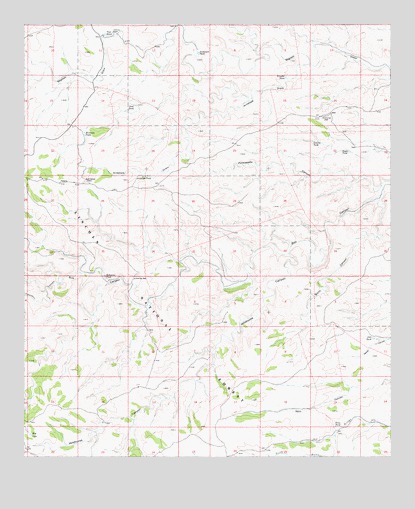
Packsaddle Canyon, NM USGS Topographic Map
Click on map above to begin viewing in our Map Viewer.

This topographic map contains these locations and features:
Feature Name Type Latitude Longitude GNIS ID View Map
Acrey TankReservoirN32.4105°W104.8832°899102View Map
Anderson RanchLocaleN32.4979°W104.9700°903160View Map
Anderson TankReservoirN32.4917°W104.9412°903162View Map
Antelope DrawValleyN32.4887°W104.9030°903185View Map
Antelope WellLocaleN32.4551°W104.9791°903195View Map
Bowman TankReservoirN32.4684°W104.9798°904031View Map
Bowman Water Storage TankReservoirN32.4715°W104.9991°899104View Map
Burro CanyonValleyN32.4493°W104.8794°904232View Map
Chimney Reservoir Number OneReservoirN32.4269°W104.9491°936756View Map
Chimney Reservoir Number TwoReservoirN32.4261°W104.9277°936755View Map
Chimney Storage TankReservoirN32.4265°W104.9627°900867View Map
Chimney TankReservoirN32.4254°W104.9475°900866View Map
Chimney WellWellN32.4265°W104.9627°1993974View Map
Corona HillSummitN32.4734°W104.8994°905357View Map
Corona TankReservoirN32.4662°W104.9021°905358View Map
Deer Water TankReservoirN32.4187°W104.9602°1985754View Map
Dirt TankReservoirN32.4093°W104.8817°905774View Map
Dogie TankReservoirN32.4633°W104.8897°905805View Map
East Wildhorse Water Storage TankReservoirN32.3873°W104.9405°899109View Map
Freeman WaterholeSpringN32.4943°W104.9016°900954View Map
Freezeout CanyonValleyN32.4248°W104.9880°906395View Map
Hardin WellWellN32.4954°W104.9658°900932View Map
Hog LakeLakeN32.3816°W104.9982°907008View Map
Maguay Water Storage TankReservoirN32.4054°W104.8980°899112View Map
Neal TankReservoirN32.4767°W104.9628°909032View Map
North Sheep Water Storage TankReservoirN32.4618°W104.9358°899106View Map
Packsaddle CanyonValleyN32.4529°W104.8789°909426View Map
Penn TankReservoirN32.3838°W104.8945°909558View Map
Post TankReservoirN32.4971°W104.9729°909806View Map
Redwater TankReservoirN32.4274°W104.9734°910103View Map
South Sheep Water Storage TankReservoirN32.4404°W104.9394°899103View Map
South Wildhorse Water Storage TankReservoirN32.3795°W104.9602°1983849View Map
Steel Water Storage TankReservoirN32.4540°W104.9544°899105View Map
Transmission Water Storage TankReservoirN32.3965°W104.9191°899111View Map
Trimble TankReservoirN32.4848°W104.9113°911815View Map
Wildhorse CanyonValleyN32.4334°W104.9097°912385View Map
Wildhorse Mesa Water Storage TankReservoirN32.3993°W104.9264°899110View Map
Wildhorse Number 2 Tank (historical)ReservoirN32.4065°W104.9358°901142View Map
Wildhorse Number TankReservoirN32.3845°W104.9732°900790View Map
Wildhorse Water Storage TankReservoirN32.3951°W104.9597°899108View Map
Wildhorse WellWellN32.3951°W104.9616°899107View Map

Note: Coordinates in the location and feature list above are referenced to NAD83 datum.


Copyright (C) 2008-2025 Ryan Niemi / Sunset Dynamics ... All Rights Reserved