TopoQuest Logo
Do you find TopoQuest useful?
Help keep TopoQuest running and adding new maps/features by donating!
Bitcoin:  19c7KJd3qBynnjoSw5npx9KScwjBe4ifkT
Litecoin:  LXs6TkuXGGXo1vDsWCkWVdjQX94eUKd6ui
Home View Maps Find Maps Find Places Resources & Links


Texas Hill, New Mexico Topographic Map

USGS Map Title: Texas Hill, NM
USGS Map MRC: 32104D7
DRG (GeoTIFF) Download: o32104d7.tif


Neighboring USGS Topographic Map Quads:


  South Taylor Tank, NM  
32104E8
 

  Strychnine Draw, NM  
32104E7
 

  Box Canyon Ranch, NM  
32104E6
 

  Packsaddle Canyon, NM  
32104D8
 

  Texas Hill, NM  
32104D7
 

  Cawley Draw, NM  
32104D6
 

  Algerita Canyon, NM  
32104C8
 

  Ares Peak, NM  
32104C7
 

  Red Bluff Draw, NM  
32104C6


Map MRC Location:

N33°
W105°
N33°
W104°
H8 H7 H6 H5 H4 H3 H2 H1
G8 G7 G6 G5 G4 G3 G2 G1
F8 F7 F6 F5 F4 F3 F2 F1
E8 E7 E6 E5 E4 E3 E2 E1
D8 D7 D6 D5 D4 D3 D2 D1
C8 C7 C6 C5 C4 C3 C2 C1
B8 B7 B6 B5 B4 B3 B2 B1
A8 A7 A6 A5 A4 A3 A2 A1
N32°
W105°
N32°
W104°

Texas Hill, NM USGS 1:24K Topographic Map Preview:
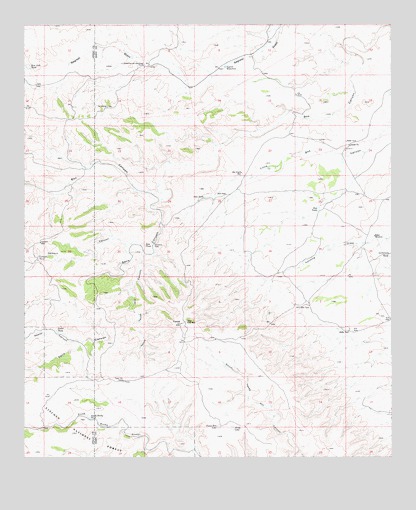
Texas Hill, NM USGS Topographic Map
Click on map above to begin viewing in our Map Viewer.

This topographic map contains these locations and features:
Feature Name Type Latitude Longitude GNIS ID View Map
Acrey LakeLakeN32.3833°W104.8046°902983View Map
Armstrong and Armstrong RanchLocaleN32.4887°W104.8341°903277View Map
Bates WindmillLocaleN32.4387°W104.7564°903608View Map
Boulder TankReservoirN32.4504°W104.8291°901055View Map
Boulder Waterhole (historical)SpringN32.4548°W104.8291°901054View Map
Box Shack WellLocaleN32.4576°W104.8011°904041View Map
Cement CanyonValleyN32.4370°W104.8405°904890View Map
Cement TankReservoirN32.4331°W104.8705°904891View Map
Cement WellLocaleN32.4373°W104.8700°904894View Map
Fanning Tank (historical)ReservoirN32.4332°W104.7752°901165View Map
Gail TankReservoirN32.4502°W104.8139°906436View Map
Howell Tank (historical)ReservoirN32.4143°W104.7886°900929View Map
Larrimore TankReservoirN32.4333°W104.7511°907858View Map
McGonigle TanksReservoirN32.4826°W104.8697°900694View Map
Nester CanyonValleyN32.4084°W104.8564°909052View Map
Nester TankReservoirN32.4113°W104.8643°909054View Map
New Dirt TankReservoirN32.4880°W104.8740°909057View Map
North Rocky TankReservoirN32.3864°W104.8532°909182View Map
North Texas Hill CanyonValleyN32.4332°W104.8344°909202View Map
Red TankReservoirN32.4468°W104.7753°910083View Map
Seco CanyonValleyN32.4495°W104.8280°910901View Map
Seco TankReservoirN32.4363°W104.8345°910905View Map
Segrest WaterholeReservoirN32.4878°W104.8070°910935View Map
Sunshine TankReservoirN32.4362°W104.8311°911499View Map
Texas Deep WellLocaleN32.4140°W104.8200°911618View Map
Texas HillSummitN32.4137°W104.8216°911619View Map
Texas Hill CampLocaleN32.3971°W104.8414°933096View Map
Texas Hill LakeLakeN32.3840°W104.8094°911620View Map
Tin TankReservoirN32.4182°W104.7811°911720View Map

Note: Coordinates in the location and feature list above are referenced to NAD83 datum.


Copyright (C) 2008-2025 Ryan Niemi / Sunset Dynamics ... All Rights Reserved