TopoQuest Logo
Do you find TopoQuest useful?
Help keep TopoQuest running and adding new maps/features by donating!
Bitcoin:  19c7KJd3qBynnjoSw5npx9KScwjBe4ifkT
Litecoin:  LXs6TkuXGGXo1vDsWCkWVdjQX94eUKd6ui
Home View Maps Find Maps Find Places Resources & Links


Ares Peak, New Mexico Topographic Map

USGS Map Title: Ares Peak, NM
USGS Map MRC: 32104C7
DRG (GeoTIFF) Download: o32104c7.tif


Neighboring USGS Topographic Map Quads:


  Packsaddle Canyon, NM  
32104D8
 

  Texas Hill, NM  
32104D7
 

  Cawley Draw, NM  
32104D6
 

  Algerita Canyon, NM  
32104C8
 

  Ares Peak, NM  
32104C7
 

  Red Bluff Draw, NM  
32104C6
 

  La Paloma Canyon, NM  
32104B8
 

  Pickett Hill, NM  
32104B7
 

  Queen, NM  
32104B6


Map MRC Location:

N33°
W105°
N33°
W104°
H8 H7 H6 H5 H4 H3 H2 H1
G8 G7 G6 G5 G4 G3 G2 G1
F8 F7 F6 F5 F4 F3 F2 F1
E8 E7 E6 E5 E4 E3 E2 E1
D8 D7 D6 D5 D4 D3 D2 D1
C8 C7 C6 C5 C4 C3 C2 C1
B8 B7 B6 B5 B4 B3 B2 B1
A8 A7 A6 A5 A4 A3 A2 A1
N32°
W105°
N32°
W104°

Ares Peak, NM USGS 1:24K Topographic Map Preview:
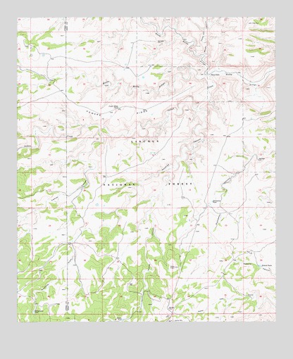
Ares Peak, NM USGS Topographic Map
Click on map above to begin viewing in our Map Viewer.

This topographic map contains these locations and features:
Feature Name Type Latitude Longitude GNIS ID View Map
Acrey Water Storage TankReservoirN32.3359°W104.8311°913228View Map
Ares PeakSummitN32.2726°W104.7988°903270View Map
B-Storage TankReservoirN32.3262°W104.7741°913233View Map
Black Water Storage TankReservoirN32.2898°W104.7888°913236View Map
Clark WellWellN32.3165°W104.7588°905187View Map
Dunnaway TankReservoirN32.2994°W104.7812°905905View Map
Foster Water Storage TankReservoirN32.2657°W104.8216°913235View Map
Guadalupe Mountains Historical MarkerParkN32.3334°W104.8339°932329View Map
Heard Storage TankReservoirN32.3554°W104.8105°900184View Map
HearnReservoirN32.3504°W104.8145°913227View Map
Indian CreekStreamN32.3521°W104.7741°907199View Map
Joyce Water Storage TankReservoirN32.2543°W104.8055°913238View Map
Lawyer CanyonValleyN32.3301°W104.8330°907905View Map
Lawyer Dirt TankReservoirN32.3128°W104.8397°913232View Map
Middle Rocky ArroyoStreamN32.3521°W104.7833°908710View Map
Montgomery TankReservoirN32.2547°W104.8675°908851View Map
Montgomery Water Storage TankReservoirN32.2568°W104.8608°913237View Map
National RanchLocaleN32.2607°W104.8000°1983846View Map
North Rocky ArroyoStreamN32.3523°W104.7741°909181View Map
North Rocky CanyonValleyN32.3521°W104.7836°897525View Map
Pierce CanyonValleyN32.3134°W104.8000°909634View Map
Powers RidgeRidgeN32.3340°W104.8286°909833View Map
Powers Ridge TankReservoirN32.3382°W104.8263°909834View Map
Rawhide CanyonValleyN32.3371°W104.7875°910029View Map
Rawhide DrawValleyN32.2832°W104.8486°910030View Map
Rawhide Water Storage TankReservoirN32.2823°W104.8491°913234View Map
Roberts TanksReservoirN32.2730°W104.7580°910350View Map
SandiaReservoirN32.3098°W104.8325°924226View Map
South Texas Hill CanyonValleyN32.3590°W104.7841°911281View Map
Three ForksPopulated PlaceN32.3515°W104.7822°911677View Map
Wilson TankReservoirN32.2512°W104.8246°912440View Map

Note: Coordinates in the location and feature list above are referenced to NAD83 datum.


Copyright (C) 2008-2025 Ryan Niemi / Sunset Dynamics ... All Rights Reserved