TopoQuest Logo
Do you find TopoQuest useful?
Help keep TopoQuest running and adding new maps/features by donating!
Bitcoin:  19c7KJd3qBynnjoSw5npx9KScwjBe4ifkT
Litecoin:  LXs6TkuXGGXo1vDsWCkWVdjQX94eUKd6ui
Home View Maps Find Maps Find Places Resources & Links


Pactola Dam, South Dakota Topographic Map

USGS Map Title: Pactola Dam, SD
USGS Map MRC: 44103A4
DRG (GeoTIFF) Download: o44103a4.tif


Neighboring USGS Topographic Map Quads:


  Nemo, SD  
44103B5
 

  Piedmont, SD  
44103B4
 

  Blackhawk, SD  
44103B3
 

  Silver City, SD  
44103A5
 

  Pactola Dam, SD  
44103A4
 

  Rapid City West, SD  
44103A3
 

  Hill City, SD  
43103H5
 

  Mount Rushmore, SD  
43103H4
 

  Rockerville, SD  
43103H3


Map MRC Location:

N45°
W104°
N45°
W103°
H8 H7 H6 H5 H4 H3 H2 H1
G8 G7 G6 G5 G4 G3 G2 G1
F8 F7 F6 F5 F4 F3 F2 F1
E8 E7 E6 E5 E4 E3 E2 E1
D8 D7 D6 D5 D4 D3 D2 D1
C8 C7 C6 C5 C4 C3 C2 C1
B8 B7 B6 B5 B4 B3 B2 B1
A8 A7 A6 A5 A4 A3 A2 A1
N44°
W104°
N44°
W103°

Pactola Dam, SD USGS 1:24K Topographic Map Preview:
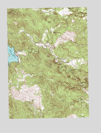
Pactola Dam, SD USGS Topographic Map
Click on map above to begin viewing in our Map Viewer.

This topographic map contains these locations and features:
Feature Name Type Latitude Longitude GNIS ID View Map
Bald HillsRangeN44.0253°W103.4691°1261210View Map
Big BendPopulated PlaceN44.0655°W103.4146°1261262View Map
Bogus Jim CreekStreamN44.1250°W103.4177°1261314View Map
Boone DrawValleyN44.0120°W103.4284°1261323View Map
Brush CreekStreamN44.0461°W103.4446°1261353View Map
Buzzards RoostSummitN44.0523°W103.3881°1261384View Map
Commissary PointCapeN44.0336°W103.3782°1261475View Map
Custer GulchValleyN44.0647°W103.4974°1261519View Map
Deer CreekStreamN44.0825°W103.4457°1261547View Map
Gold Standard GulchValleyN44.0520°W103.4486°1261726View Map
Hat MountainSummitN44.1085°W103.4348°1261783View Map
HisegaPopulated PlaceN44.0533°W103.4019°1261819View Map
Hisega Post Office (historical)Post OfficeN44.0533°W103.4019°1926746View Map
Johnson SidingPopulated PlaceN44.0847°W103.4380°1265605View Map
Johnson Siding Census Designated PlaceCensusN44.0846°W103.4380°2628846View Map
Johnson Siding Volunteer Fire Department Station 1BuildingN44.0840°W103.4380°2580726View Map
Loveland CanyonValleyN44.1184°W103.3935°1262000View Map
McCurdy GulchValleyN44.0733°W103.4863°1262039View Map
McGeePopulated PlaceN44.0380°W103.3841°1265291View Map
Melcore Acres SubdivisionPopulated PlaceN44.0830°W103.4399°1265085View Map
Moose Camp (historical)LocaleN44.0294°W103.3769°1264586View Map
Mount WheatonSummitN44.0582°W103.4097°1765042View Map
Norris PeakSummitN44.0968°W103.4266°1262135View Map
Pactola (historical)Populated PlaceN44.0736°W103.4838°1267038View Map
Pactola DamDamN44.0722°W103.4885°1262173View Map
Pactola Forest Service FacilityLocaleN44.1017°W103.4746°1263010View Map
Pactola Point Picnic AreaLocaleN44.0642°W103.4935°1263011View Map
Pactola Visitor CenterLocaleN44.0686°W103.4838°1263012View Map
Perrin MountainSummitN44.0853°W103.4759°1267031View Map
Placerville CampLocaleN44.0775°W103.4627°1267032View Map
Power House (historical)LocaleN44.0728°W103.4282°1264579View Map
Powerhouse GulchValleyN44.0620°W103.4189°1262235View Map
Prairie CreekStreamN44.0375°W103.3896°1262236View Map
Presbyterian Church CampParkN44.0625°W103.4121°1264578View Map
Rimrock Community CenterBuildingN44.0839°W103.4384°2728283View Map
Shanks GulchValleyN44.0621°W103.3773°1262390View Map
South Bogus Jim CreekStreamN44.1250°W103.4816°1262451View Map
South Branch Prairie CreekStreamN44.0408°W103.4849°1262454View Map
South Victoria CreekStreamN44.0150°W103.4113°1262473View Map
Tamarack GulchValleyN44.0758°W103.4678°1262552View Map
Thrall MountainSummitN44.0699°W103.4378°1262583View Map
Thunderbird Homes AdditionPopulated PlaceN44.1222°W103.4707°1265088View Map
Thunderhead FallsFallsN44.0583°W103.4135°1267043View Map
Thunderhead Falls TunnelTunnelN44.0583°W103.4135°1262584View Map
Tomaha CampLocaleN44.0539°W103.4082°1262599View Map
Tomaha PointCapeN44.0464°W103.4069°1262600View Map
Township of PactolaCivilN44.0603°W103.4421°1268748View Map
Twin SistersSummitN44.0205°W103.4627°1262617View Map
Victoria DamDamN44.0200°W103.3888°1262639View Map
Wheaton College Summer CampParkN44.0625°W103.4085°1262687View Map

Note: Coordinates in the location and feature list above are referenced to NAD83 datum.


Copyright (C) 2008-2024 Ryan Niemi / Sunset Dynamics ... All Rights Reserved