TopoQuest Logo
Do you find TopoQuest useful?
Help keep TopoQuest running and adding new maps/features by donating!
Bitcoin:  19c7KJd3qBynnjoSw5npx9KScwjBe4ifkT
Litecoin:  LXs6TkuXGGXo1vDsWCkWVdjQX94eUKd6ui
Home View Maps Find Maps Find Places Resources & Links


Silver City, South Dakota Topographic Map

USGS Map Title: Silver City, SD
USGS Map MRC: 44103A5
DRG (GeoTIFF) Download: o44103a5.tif


Neighboring USGS Topographic Map Quads:


  Minnesota Ridge, SD  
44103B6
 

  Nemo, SD  
44103B5
 

  Piedmont, SD  
44103B4
 

  Rochford, SD  
44103A6
 

  Silver City, SD  
44103A5
 

  Pactola Dam, SD  
44103A4
 

  Medicine Mountain, SD  
43103H6
 

  Hill City, SD  
43103H5
 

  Mount Rushmore, SD  
43103H4


Map MRC Location:

N45°
W104°
N45°
W103°
H8 H7 H6 H5 H4 H3 H2 H1
G8 G7 G6 G5 G4 G3 G2 G1
F8 F7 F6 F5 F4 F3 F2 F1
E8 E7 E6 E5 E4 E3 E2 E1
D8 D7 D6 D5 D4 D3 D2 D1
C8 C7 C6 C5 C4 C3 C2 C1
B8 B7 B6 B5 B4 B3 B2 B1
A8 A7 A6 A5 A4 A3 A2 A1
N44°
W104°
N44°
W103°

Silver City, SD USGS 1:24K Topographic Map Preview:
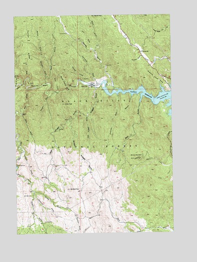
Silver City, SD USGS Topographic Map
Click on map above to begin viewing in our Map Viewer.

This topographic map contains these locations and features:
Feature Name Type Latitude Longitude GNIS ID View Map
Banner GulchValleyN44.0959°W103.5971°1261216View Map
Bear GulchValleyN44.0786°W103.5243°1261229View Map
Bear Gulch CampgroundLocaleN44.0744°W103.5260°1263030View Map
Bear Gulch II (historical)LocaleN44.0800°W103.5241°1265563View Map
Boarding House GulchValleyN44.0807°W103.5068°1261307View Map
Broad GulchValleyN44.1046°W103.5616°1261350View Map
Bullock Lookout TowerTowerN44.0428°W103.5263°1265746View Map
California GulchValleyN44.0232°W103.6108°1261396View Map
Camp Prospect (historical)LocaleN44.0878°W103.6199°1264601View Map
Canyon City (historical)Populated PlaceN44.0850°W103.6057°1261404View Map
Canyon Junction (historical)LocaleN44.0855°W103.6171°1264585View Map
Castle CreekStreamN44.0864°W103.6194°1261416View Map
Clear CreekStreamN44.0378°W103.5038°1262530View Map
Diana MineMineN44.0883°W103.5707°1261555View Map
East Nugget GulchValleyN44.0669°W103.5678°1261617View Map
Elkhorn II (historical)LocaleN44.0772°W103.5241°1264566View Map
Empress GulchValleyN44.0800°W103.5436°1261644View Map
Fall DrawValleyN44.0898°W103.6138°1261661View Map
Flannigan CabinLocaleN44.0689°W103.6205°1261678View Map
Friday GulchValleyN44.0231°W103.6111°1261701View Map
Gold Dirt Mine (historical)MineN44.0378°W103.5319°1264190View Map
Golden Slipper Mine (historical)MineN44.0367°W103.5102°1264595View Map
Goose Pasture DrawValleyN44.0828°W103.5816°1261727View Map
Gorman GulchValleyN44.0874°W103.5702°1261733View Map
Hay DrawValleyN44.1059°W103.5637°1261794View Map
Homelode MineMineN44.1147°W103.5832°1261830View Map
Horton GulchValleyN44.0463°W103.6185°1261846View Map
J and E Trailer CourtPopulated PlaceN44.1028°W103.5260°1265083View Map
Jenney GulchValleyN44.0821°W103.5423°1261885View Map
Jenney Gulch Picnic AreaLocaleN44.0833°W103.5471°1263023View Map
Jenney MineMineN44.0961°W103.5524°1261886View Map
Kelly GulchValleyN44.0901°W103.6004°1261909View Map
Magpie GulchValleyN44.0795°W103.5318°1262012View Map
Merritt PeakSummitN44.1247°W103.5616°1262058View Map
Middle Nugget GulchValleyN44.0651°W103.5817°1262070View Map
Nugget GulchValleyN44.0834°W103.5605°1262156View Map
Old Bald PeakSummitN44.0253°W103.5828°1262164View Map
Omega Mine (historical)MineN44.0458°W103.5402°1264191View Map
Pactola CampgroundLocaleN44.0661°W103.5124°1263027View Map
Pactola CampgroundLocaleN44.0705°W103.5138°1263028View Map
Pactola Point Picnic AreaLocaleN44.0644°W103.5116°1263029View Map
Pactola ReservoirReservoirN44.0751°W103.5068°1262174View Map
Pactola Reservoir Recreation AreaParkN44.0753°W103.5330°1263064View Map
Pactola SchoolSchoolN44.1042°W103.5232°1262175View Map
Post DrawValleyN44.0819°W103.5911°1262230View Map
Queen Bee MineMineN44.0219°W103.6141°1262248View Map
Rapid Creek TrailTrailN44.0850°W103.5980°1263024View Map
Scruton MountainSummitN44.0428°W103.5263°1267036View Map
Silver CityPopulated PlaceN44.0844°W103.5638°1265375View Map
Silver City Post Office (historical)Post OfficeN44.0844°W103.5638°1926743View Map
Silver City Volunteer Fire DepartmentBuildingN44.0848°W103.5636°2580786View Map
Silver PeakSummitN44.0742°W103.5857°1262418View Map
Skull GulchValleyN44.0378°W103.6246°1262424View Map
Slate CreekStreamN44.0830°W103.6144°1262425View Map
Slate Creek DamDamN44.0389°W103.6244°1262426View Map
Smoker GulchValleyN44.1012°W103.5234°1262440View Map
Spaw GulchValleyN44.0690°W103.6201°1262475View Map
Spruce GulchValleyN44.0239°W103.6107°1262494View Map
Spurgeon GulchValleyN44.0863°W103.6002°1262496View Map
Stewart GulchValleyN44.0807°W103.5940°1262511View Map
Sunbeam MineMineN44.0067°W103.6027°1262536View Map
Sunnyside GulchValleyN44.0863°W103.5599°1262538View Map
Tiffel MineMineN44.0319°W103.6010°1262586View Map
Tunnel RidgeRidgeN44.1080°W103.6135°1262611View Map
West Nugget GulchValleyN44.0671°W103.5681°1262675View Map
Whispering Pines Campground and LodgingLocaleN44.1083°W103.5338°1269145View Map

Note: Coordinates in the location and feature list above are referenced to NAD83 datum.


Copyright (C) 2008-2025 Ryan Niemi / Sunset Dynamics ... All Rights Reserved