TopoQuest Logo
Do you find TopoQuest useful?
Help keep TopoQuest running and adding new maps/features by donating!
Bitcoin:  19c7KJd3qBynnjoSw5npx9KScwjBe4ifkT
Litecoin:  LXs6TkuXGGXo1vDsWCkWVdjQX94eUKd6ui
Home View Maps Find Maps Find Places Resources & Links


Panama, New York Topographic Map

USGS Map Title: Panama, NY
USGS Map MRC: 42079A4
DRG (GeoTIFF) Download: o42079a4.tif


Neighboring USGS Topographic Map Quads:


  Sherman, NY  
42079B5
 

  Chautauqua, NY  
42079B4
 

  Ellery Center, NY  
42079B3
 

  North Clymer, NY  
42079A5
 

  Panama, NY  
42079A4
 

  Lakewood, NY  
42079A3
 

  Columbus, PA  
41079H5
 

  Lottsville, PA  
41079H4
 

  Sugar Grove, PA  
41079H3


Map MRC Location:

N43°
W80°
N43°
W79°
H8 H7 H6 H5 H4 H3 H2 H1
G8 G7 G6 G5 G4 G3 G2 G1
F8 F7 F6 F5 F4 F3 F2 F1
E8 E7 E6 E5 E4 E3 E2 E1
D8 D7 D6 D5 D4 D3 D2 D1
C8 C7 C6 C5 C4 C3 C2 C1
B8 B7 B6 B5 B4 B3 B2 B1
A8 A7 A6 A5 A4 A3 A2 A1
N42°
W80°
N42°
W79°

Panama, NY USGS 1:24K Topographic Map Preview:
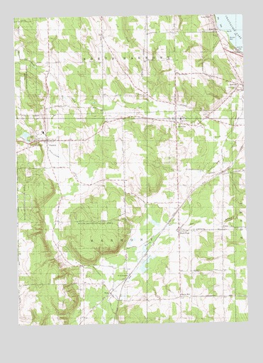
Panama, NY USGS Topographic Map
Click on map above to begin viewing in our Map Viewer.

This topographic map contains these locations and features:
Feature Name Type Latitude Longitude GNIS ID View Map
AshvillePopulated PlaceN42.0964°W79.3756°942643View Map
Ashville BayBayN42.1109°W79.3753°942644View Map
Ashville Free LibraryBuildingN42.0955°W79.3750°2617212View Map
Ashville Methodist ChurchChurchN42.0947°W79.3753°2413878View Map
Ashville Post OfficePost OfficeN42.0948°W79.3754°2617799View Map
Baker School (historical)SchoolN42.1062°W79.4776°2485810View Map
BlockvillePopulated PlaceN42.0817°W79.4123°944268View Map
Blockville Union Burial GroundCemeteryN42.0794°W79.4127°2554251View Map
Bly CemeteryCemeteryN42.1164°W79.3881°950886View Map
Bly PointCapeN42.1176°W79.3842°944365View Map
Cherry HillPopulated PlaceN42.0109°W79.4114°972316View Map
East Branch Little Brokenstraw CreekStreamN42.0131°W79.4470°949005View Map
Goose Creek AirportAirportN42.0804°W79.3958°978090View Map
Grant CemeteryCemeteryN42.0170°W79.4553°951508View Map
Greenwood CemeteryCemeteryN42.0755°W79.4914°951783View Map
Long ViewPopulated PlaceN42.1245°W79.3923°955939View Map
Maple Grove CemeteryCemeteryN42.0946°W79.3783°956397View Map
Niets CrestPopulated PlaceN42.1181°W79.3892°958582View Map
NiobePopulated PlaceN42.0126°W79.4495°958614View Map
Niobe Baptist ChurchChurchN42.0109°W79.4497°2616143View Map
North East JunctionPopulated PlaceN42.0201°W79.4389°972862View Map
Odell FarmsLocaleN42.0225°W79.4633°2704004View Map
Our Lady of the SnowsChurchN42.0747°W79.4785°2616199View Map
PanamaPopulated PlaceN42.0751°W79.4831°959806View Map
Panama Baptist ChurchChurchN42.0760°W79.4836°2616205View Map
Panama Fire Department Station 1BuildingN42.0753°W79.4804°2701008View Map
Panama Fire Department Station 2BuildingN42.0442°W79.4110°2734704View Map
Panama High SchoolSchoolN42.0784°W79.4851°2669236View Map
Panama K - 6 SchoolSchoolN42.0806°W79.4854°2668888View Map
Panama Post OfficePost OfficeN42.0748°W79.4824°2618055View Map
Panama RocksCliffN42.0726°W79.4862°959807View Map
Panama Union CemeteryCemeteryN42.0755°W79.4783°968148View Map
Panama United Methodist ChurchChurchN42.0746°W79.4804°2616206View Map
Tillotson CemeteryCemeteryN42.0143°W79.4646°967523View Map
Town of HarmonyCivilN42.0420°W79.4541°979048View Map
Village of PanamaCivilN42.0747°W79.4850°2391051View Map
Warner BayBayN42.1148°W79.3800°968800View Map
Watts FlatsPopulated PlaceN42.0373°W79.4120°968934View Map
Wesleyan Methodist ChurchChurchN42.0950°W79.3772°2413877View Map

Note: Coordinates in the location and feature list above are referenced to NAD83 datum.


Copyright (C) 2008-2025 Ryan Niemi / Sunset Dynamics ... All Rights Reserved