TopoQuest Logo
Do you find TopoQuest useful?
Help keep TopoQuest running and adding new maps/features by donating!
Bitcoin:  19c7KJd3qBynnjoSw5npx9KScwjBe4ifkT
Litecoin:  LXs6TkuXGGXo1vDsWCkWVdjQX94eUKd6ui
Home View Maps Find Maps Find Places Resources & Links


Sugar Grove, Pennsylvania Topographic Map

USGS Map Title: Sugar Grove, PA
USGS Map MRC: 41079H3
DRG (GeoTIFF) Download: o41079h3.tif


Neighboring USGS Topographic Map Quads:


  Panama, NY  
42079A4
 

  Lakewood, NY  
42079A3
 

  Jamestown, NY  
42079A2
 

  Lottsville, PA  
41079H4
 

  Sugar Grove, PA  
41079H3
 

  Russell, PA  
41079H2
 

  Pittsfield, PA  
41079G4
 

  Youngsville, PA  
41079G3
 

  Warren, PA  
41079G2


Map MRC Location:

N42°
W80°
N42°
W79°
H8 H7 H6 H5 H4 H3 H2 H1
G8 G7 G6 G5 G4 G3 G2 G1
F8 F7 F6 F5 F4 F3 F2 F1
E8 E7 E6 E5 E4 E3 E2 E1
D8 D7 D6 D5 D4 D3 D2 D1
C8 C7 C6 C5 C4 C3 C2 C1
B8 B7 B6 B5 B4 B3 B2 B1
A8 A7 A6 A5 A4 A3 A2 A1
N41°
W80°
N41°
W79°

Sugar Grove, PA USGS 1:24K Topographic Map Preview:
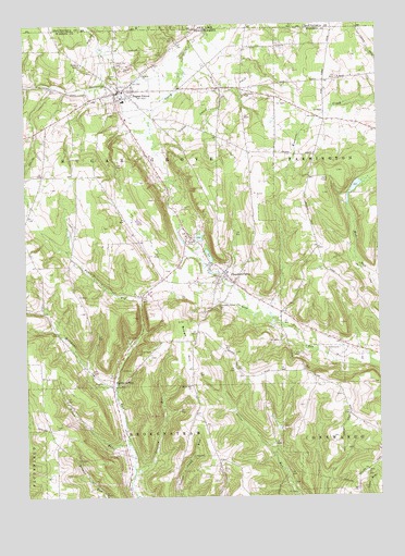
Sugar Grove, PA USGS Topographic Map
Click on map above to begin viewing in our Map Viewer.

This topographic map contains these locations and features:
Feature Name Type Latitude Longitude GNIS ID View Map
Borough of Sugar GroveCivilN41.9837°W79.3396°1215647View Map
Brown HillSummitN41.9173°W79.3187°1170367View Map
Brown Hill ChurchChurchN41.9042°W79.3159°1170368View Map
Brown Hill School (historical)SchoolN41.9173°W79.3150°1201204View Map
Browns PondLakeN41.9569°W79.2575°1212107View Map
Chandlers ValleyPopulated PlaceN41.9342°W79.3037°1171556View Map
Chandlers Valley CemeteryCemeteryN41.9264°W79.3063°1171557View Map
Chandlers Valley Post OfficePost OfficeN41.9331°W79.3019°2768337View Map
Cherry Hill CemeteryCemeteryN41.9889°W79.3401°1171641View Map
Dalrymple Hill SchoolSchoolN41.9601°W79.3681°1201206View Map
Frondelius CornersLocaleN41.9734°W79.3670°1212105View Map
Hamblin Hill SchoolSchoolN41.8937°W79.3173°1201203View Map
Hazeltine School (historical)SchoolN41.9120°W79.3567°1201205View Map
Henning Hill School (historical)SchoolN41.9403°W79.2712°1201201View Map
Jackson Valley Golf CourseLocaleN41.9267°W79.2962°1206135View Map
Kitchen SchoolSchoolN41.9014°W79.2628°1201202View Map
Lansing RunStreamN41.8814°W79.3367°1178881View Map
Matthews RunPopulated PlaceN41.9045°W79.3445°1180559View Map
Patchen RunStreamN41.9037°W79.3431°1199280View Map
Peoples ChurchChurchN41.9867°W79.3317°1183570View Map
Sanders Personal Use AirportAirportN41.9894°W79.3006°1212106View Map
Sugar GrovePopulated PlaceN41.9826°W79.3387°1188932View Map
Sugar Grove Elementary SchoolSchoolN41.9798°W79.3395°1211639View Map
Sugar Grove Oil FieldOilfieldN41.9789°W79.3056°1188936View Map
Sugar Grove Post OfficePost OfficeN41.9816°W79.3403°2773266View Map
Sugar Grove SwampSwampN41.9470°W79.3198°1201208View Map
Sugar Grove Volunteer Fire Department / Sugar Grove Ambulance Service Station 63BuildingN41.9809°W79.3403°2645181View Map
Sugargrove Post Office (historical)Post OfficeN41.9826°W79.3387°1212111View Map
Telick RunStreamN41.8889°W79.3384°1189343View Map
Township of Sugar GroveCivilN41.9494°W79.3379°1217178View Map
Wesleyan CemeteryCemeteryN41.9822°W79.2973°1190866View Map
White SchoolSchoolN41.9839°W79.3039°1201207View Map

Note: Coordinates in the location and feature list above are referenced to NAD83 datum.


Copyright (C) 2008-2025 Ryan Niemi / Sunset Dynamics ... All Rights Reserved