TopoQuest Logo
Do you find TopoQuest useful?
Help keep TopoQuest running and adding new maps/features by donating!
Bitcoin:  19c7KJd3qBynnjoSw5npx9KScwjBe4ifkT
Litecoin:  LXs6TkuXGGXo1vDsWCkWVdjQX94eUKd6ui
Home View Maps Find Maps Find Places Resources & Links


Columbus, Pennsylvania Topographic Map

USGS Map Title: Columbus, PA
USGS Map MRC: 41079H5
DRG (GeoTIFF) Download: o41079h5.tif


Neighboring USGS Topographic Map Quads:


  Clymer, NY  
42079A6
 

  North Clymer, NY  
42079A5
 

  Panama, NY  
42079A4
 

  Corry, PA  
41079H6
 

  Columbus, PA  
41079H5
 

  Lottsville, PA  
41079H4
 

  Spartansburg, PA  
41079G6
 

  Spring Creek, PA  
41079G5
 

  Pittsfield, PA  
41079G4


Map MRC Location:

N42°
W80°
N42°
W79°
H8 H7 H6 H5 H4 H3 H2 H1
G8 G7 G6 G5 G4 G3 G2 G1
F8 F7 F6 F5 F4 F3 F2 F1
E8 E7 E6 E5 E4 E3 E2 E1
D8 D7 D6 D5 D4 D3 D2 D1
C8 C7 C6 C5 C4 C3 C2 C1
B8 B7 B6 B5 B4 B3 B2 B1
A8 A7 A6 A5 A4 A3 A2 A1
N41°
W80°
N41°
W79°

Columbus, PA USGS 1:24K Topographic Map Preview:
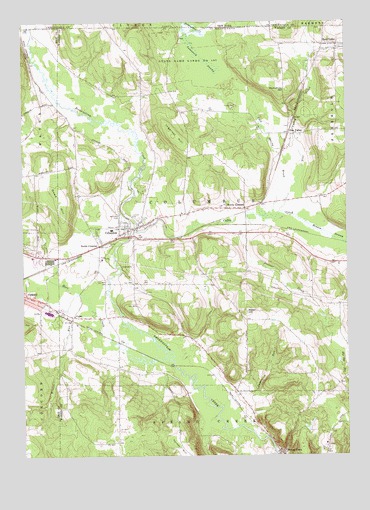
Columbus, PA USGS Topographic Map
Click on map above to begin viewing in our Map Viewer.

This topographic map contains these locations and features:
Feature Name Type Latitude Longitude GNIS ID View Map
Backus CornersLocaleN41.9392°W79.5384°1212698View Map
Baker HillSummitN41.9164°W79.5381°1168597View Map
Barney Carrier CornersLocaleN41.9203°W79.5131°1212700View Map
Bear LakePopulated PlaceN41.9934°W79.5028°1198175View Map
Bear Lake Post OfficePost OfficeN41.9931°W79.5026°2779944View Map
Bear Lake Volunteer Fire DepartmentBuildingN41.9930°W79.5034°2644838View Map
Benson SwampSwampN41.9445°W79.5209°1169274View Map
Blue Eye SchoolSchoolN41.8953°W79.5026°1205994View Map
Borough of Bear LakeCivilN41.9934°W79.5014°1215645View Map
Coffee CreekStreamN41.9398°W79.5809°1172128View Map
Cold Spring BrookStreamN41.9456°W79.5278°1172154View Map
ColumbusPopulated PlaceN41.9409°W79.5817°1198179View Map
Columbus Census Designated PlaceCensusN41.9479°W79.5835°2631256View Map
Columbus Post OfficePost OfficeN41.9406°W79.5809°2772641View Map
Columbus Volunteer Fire DepartmentBuildingN41.9409°W79.5818°2645180View Map
ColzaPopulated PlaceN41.9153°W79.6053°1172257View Map
Corry Country ClubLocaleN41.9401°W79.6198°1208330View Map
Curtis CemeteryCemeteryN41.9438°W79.5792°1172855View Map
Damon RunStreamN41.8892°W79.5481°1172914View Map
Dewey CornersLocaleN41.9462°W79.5384°1173216View Map
Doane SchoolSchoolN41.9934°W79.5081°1205999View Map
Dowd HillSummitN41.9453°W79.6101°1173430View Map
Hare CreekStreamN41.9026°W79.5678°952225View Map
Hudson School (historical)SchoolN41.9789°W79.5784°1205998View Map
Humphrey HillSummitN41.9801°W79.5220°1177589View Map
Humphreys CornersLocaleN41.9764°W79.5228°1212696View Map
Ingersol HillSummitN41.9673°W79.5653°1177809View Map
Jacob Kerinsky CornersLocaleN41.9184°W79.5026°1212701View Map
John Pondell CornersLocaleN41.9326°W79.5139°1212699View Map
Mather ParkParkN41.9417°W79.5892°1180546View Map
Picadilli SchoolSchoolN41.8792°W79.5973°1205995View Map
Pine ValleyPopulated PlaceN41.9676°W79.5187°1204403View Map
Pine Valley CreekStreamN41.9451°W79.5253°1193133View Map
Prosser CreekStreamN41.9448°W79.5373°1184469View Map
Sample CornersLocaleN41.9006°W79.5881°1212702View Map
Sample Flats SchoolSchoolN41.8792°W79.5889°1205997View Map
Scotts CrossingPopulated PlaceN41.9356°W79.5951°1204597View Map
Spring CreekPopulated PlaceN41.8759°W79.5253°1188211View Map
State Game Lands Number 197ParkN41.9895°W79.5542°1188482View Map
State Game Lands Number 263ParkN41.9584°W79.6206°1208331View Map
State Game Lands Number 291ParkN41.8792°W79.6081°1208383View Map
State Game Lands Number 306ParkN41.9417°W79.5081°1208369View Map
Sulfur SpringSpringN41.9826°W79.5398°1201605View Map
Tamarack SwampSwampN41.9958°W79.5595°1189251View Map
Township of ColumbusCivilN41.9442°W79.5553°1217160View Map
Turner HillSummitN41.8778°W79.5645°1189959View Map
Valley Central FarmLocaleN41.9783°W79.6158°2712233View Map
Weber School (historical)SchoolN41.9309°W79.5139°1205996View Map
Westlawn CemeteryCemeteryN41.9437°W79.5862°1191160View Map
Wilbur CrossingLocaleN41.9476°W79.5331°1212697View Map
Winton RunStreamN41.9220°W79.6034°1198142View Map

Note: Coordinates in the location and feature list above are referenced to NAD83 datum.


Copyright (C) 2008-2025 Ryan Niemi / Sunset Dynamics ... All Rights Reserved