TopoQuest Logo
Do you find TopoQuest useful?
Help keep TopoQuest running and adding new maps/features by donating!
Bitcoin:  19c7KJd3qBynnjoSw5npx9KScwjBe4ifkT
Litecoin:  LXs6TkuXGGXo1vDsWCkWVdjQX94eUKd6ui
Home View Maps Find Maps Find Places Resources & Links


Lottsville, Pennsylvania Topographic Map

USGS Map Title: Lottsville, PA
USGS Map MRC: 41079H4
DRG (GeoTIFF) Download: o41079h4.tif


Neighboring USGS Topographic Map Quads:


  North Clymer, NY  
42079A5
 

  Panama, NY  
42079A4
 

  Lakewood, NY  
42079A3
 

  Columbus, PA  
41079H5
 

  Lottsville, PA  
41079H4
 

  Sugar Grove, PA  
41079H3
 

  Spring Creek, PA  
41079G5
 

  Pittsfield, PA  
41079G4
 

  Youngsville, PA  
41079G3


Map MRC Location:

N42°
W80°
N42°
W79°
H8 H7 H6 H5 H4 H3 H2 H1
G8 G7 G6 G5 G4 G3 G2 G1
F8 F7 F6 F5 F4 F3 F2 F1
E8 E7 E6 E5 E4 E3 E2 E1
D8 D7 D6 D5 D4 D3 D2 D1
C8 C7 C6 C5 C4 C3 C2 C1
B8 B7 B6 B5 B4 B3 B2 B1
A8 A7 A6 A5 A4 A3 A2 A1
N41°
W80°
N41°
W79°

Lottsville, PA USGS 1:24K Topographic Map Preview:
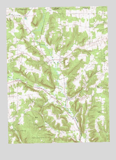
Lottsville, PA USGS Topographic Map
Click on map above to begin viewing in our Map Viewer.

This topographic map contains these locations and features:
Feature Name Type Latitude Longitude GNIS ID View Map
Barneyville School (historical)SchoolN41.9428°W79.4706°1201211View Map
Bear LakeReservoirN41.9900°W79.4758°1168886View Map
Bear Lake CemeteryCemeteryN41.9918°W79.4772°1168887View Map
Berea ChurchChurchN41.9026°W79.4248°1169287View Map
Brooks Hill CemeteryCemeteryN41.8937°W79.4874°1170334View Map
Brooks Hill ChurchChurchN41.9023°W79.4792°1201209View Map
Brooks RocksSummitN41.8989°W79.4670°1170338View Map
Deadmans RunStreamN41.9087°W79.4292°1209296View Map
Deer CreekStreamN41.9570°W79.4451°1173079View Map
DugallLocaleN41.8767°W79.4089°1208904View Map
Forest ChapelPopulated PlaceN41.9812°W79.3976°1201215View Map
Forest Chapel (historical)ChurchN41.9812°W79.3973°1201217View Map
Forest School (historical)SchoolN41.9889°W79.3976°1201216View Map
FreeholdLocaleN41.9017°W79.4256°1212109View Map
Gourleys CornersLocaleN41.9417°W79.3781°1213027View Map
LottsvillePopulated PlaceN41.9517°W79.4334°1179980View Map
Miles RunStreamN41.8751°W79.4114°1181102View Map
Miles SchoolSchoolN41.8923°W79.4498°1201212View Map
Mill CreekStreamN41.9523°W79.4428°1202624View Map
NuttalLocaleN41.9334°W79.3759°1213036View Map
Nuttles RocksPillarN41.9026°W79.3856°1198196View Map
Pikes RocksPillarN41.9264°W79.3900°1183735View Map
Sears Hill SchoolSchoolN41.9189°W79.4876°1201210View Map
Sheldon CornersLocaleN41.9176°W79.3956°1212110View Map
Smith Hill School (historical)SchoolN41.8934°W79.3914°1201213View Map
Stillson Hill School (historical)SchoolN41.9256°W79.3845°1188677View Map
Stony CreekStreamN41.9148°W79.4267°1188764View Map
Swamp RunStreamN41.9245°W79.4764°1202623View Map
Township of FreeholdCivilN41.9532°W79.4465°1217165View Map
Turnpike CemeteryCemeteryN41.9662°W79.3978°1189970View Map
Wells CornersLocaleN41.9570°W79.4864°1212108View Map
WrightsvillePopulated PlaceN41.9145°W79.4253°1191813View Map
Wrightsville CemeteryCemeteryN41.9206°W79.4285°1191814View Map
Wrightsville Volunteer Fire DepartmentBuildingN41.9154°W79.4237°2645112View Map

Note: Coordinates in the location and feature list above are referenced to NAD83 datum.


Copyright (C) 2008-2025 Ryan Niemi / Sunset Dynamics ... All Rights Reserved