TopoQuest Logo
Do you find TopoQuest useful?
Help keep TopoQuest running and adding new maps/features by donating!
Bitcoin:  19c7KJd3qBynnjoSw5npx9KScwjBe4ifkT
Litecoin:  LXs6TkuXGGXo1vDsWCkWVdjQX94eUKd6ui
Home View Maps Find Maps Find Places Resources & Links


Paris, Mississippi Topographic Map

USGS Map Title: Paris, MS
USGS Map MRC: 34089B4
DRG (GeoTIFF) Download: o34089b4.tif


Neighboring USGS Topographic Map Quads:


  Oxford South, MS  
34089C5
 

  Yocona, MS  
34089C4
 

  Denmark, MS  
34089C3
 

  Water Valley East, MS  
34089B5
 

  Paris, MS  
34089B4
 

  Tula, MS  
34089B3
 

  Pine Valley, MS  
34089A5
 

  Banner, MS  
34089A4
 

  Sarepta, MS  
34089A3


Map MRC Location:

N35°
W90°
N35°
W89°
H8 H7 H6 H5 H4 H3 H2 H1
G8 G7 G6 G5 G4 G3 G2 G1
F8 F7 F6 F5 F4 F3 F2 F1
E8 E7 E6 E5 E4 E3 E2 E1
D8 D7 D6 D5 D4 D3 D2 D1
C8 C7 C6 C5 C4 C3 C2 C1
B8 B7 B6 B5 B4 B3 B2 B1
A8 A7 A6 A5 A4 A3 A2 A1
N34°
W90°
N34°
W89°

Paris, MS USGS 1:24K Topographic Map Preview:
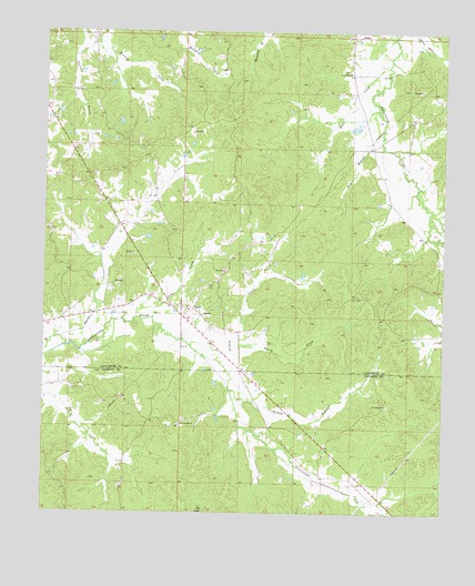
Paris, MS USGS Topographic Map
Click on map above to begin viewing in our Map Viewer.

This topographic map contains these locations and features:
Feature Name Type Latitude Longitude GNIS ID View Map
Cannons Store (historical)LocaleN34.2129°W89.4651°684345View Map
Colemans Mill (historical)LocaleN34.1718°W89.4373°684354View Map
Crains Store (historical)LocaleN34.2384°W89.4681°684358View Map
Crocker CemeteryCemeteryN34.1740°W89.4340°2025087View Map
DelayPopulated PlaceN34.2490°W89.4040°669212View Map
Dickey CreekStreamN34.1676°W89.4409°669263View Map
Drivers Flat CemeteryCemeteryN34.1473°W89.4587°705966View Map
Drivers Flat ChurchChurchN34.1479°W89.4573°669386View Map
Dry BranchStreamN34.2204°W89.3940°669402View Map
Harwell Pond DamDamN34.2284°W89.4051°682522View Map
Lafayette County Volunteer Fire Department Station 14BuildingN34.1785°W89.4544°2665887View Map
Lafayette County Volunteer Fire Department Station 6BuildingN34.2317°W89.3767°2665910View Map
Moore CreekStreamN34.2440°W89.3920°673783View Map
Murray Creek Y-13a-4 DamDamN34.2334°W89.4667°682527View Map
ParisPopulated PlaceN34.1787°W89.4598°675445View Map
Paris Baptist ChurchChurchN34.1776°W89.4548°684417View Map
Paris CemeteryCemeteryN34.1759°W89.4495°706738View Map
Pattons Store (historical)LocaleN34.1854°W89.4823°684419View Map
Providence ChurchChurchN34.1532°W89.3929°676393View Map
Red Hill School (historical)SchoolN34.1912°W89.4970°684428View Map
Rock Hill ChurchChurchN34.2398°W89.4051°676761View Map
Shippy CreekStreamN34.1571°W89.4420°677726View Map
Smith CreekStreamN34.1662°W89.4504°677925View Map
Supervisor District 5CivilN34.2204°W89.4014°711932View Map
Town CreekStreamN34.1751°W89.4756°678835View Map
Union Church (historical)ChurchN34.2368°W89.4842°684462View Map

Note: Coordinates in the location and feature list above are referenced to NAD83 datum.


Copyright (C) 2008-2025 Ryan Niemi / Sunset Dynamics ... All Rights Reserved