TopoQuest Logo
Do you find TopoQuest useful?
Help keep TopoQuest running and adding new maps/features by donating!
Bitcoin:  19c7KJd3qBynnjoSw5npx9KScwjBe4ifkT
Litecoin:  LXs6TkuXGGXo1vDsWCkWVdjQX94eUKd6ui
Home View Maps Find Maps Find Places Resources & Links


Parsons, West Virginia Topographic Map

USGS Map Title: Parsons, WV
USGS Map MRC: 39079A6
DRG (GeoTIFF) Download: o39079a6.tif


Neighboring USGS Topographic Map Quads:


  Colebank, WV  
39079B7
 

  Saint George, WV  
39079B6
 

  Lead Mine, WV  
39079B5
 

  Montrose, WV  
39079A7
 

  Parsons, WV  
39079A6
 

  Mozark Mountain, WV  
39079A5
 

  Elkins, WV  
38079H7
 

  Bowden, WV  
38079H6
 

  Harman, WV  
38079H5


Map MRC Location:

N40°
W80°
N40°
W79°
H8 H7 H6 H5 H4 H3 H2 H1
G8 G7 G6 G5 G4 G3 G2 G1
F8 F7 F6 F5 F4 F3 F2 F1
E8 E7 E6 E5 E4 E3 E2 E1
D8 D7 D6 D5 D4 D3 D2 D1
C8 C7 C6 C5 C4 C3 C2 C1
B8 B7 B6 B5 B4 B3 B2 B1
A8 A7 A6 A5 A4 A3 A2 A1
N39°
W80°
N39°
W79°

Parsons, WV USGS 1:24K Topographic Map Preview:
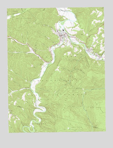
Parsons, WV USGS Topographic Map
Click on map above to begin viewing in our Map Viewer.

This topographic map contains these locations and features:
Feature Name Type Latitude Longitude GNIS ID View Map
Aarons RunStreamN39.0409°W79.7431°1550070View Map
Bear RunStreamN39.1170°W79.7490°1550196View Map
Bear RunStreamN39.0562°W79.6684°1550192View Map
Big Spring RunStreamN39.0496°W79.6709°1550350View Map
Big Springs GapGapN39.0440°W79.6631°1550351View Map
Big Springs Gap TrailTrailN39.0432°W79.6567°1553648View Map
Black ForkStreamN39.1109°W79.6790°1550368View Map
Black Fork DistrictCivilN39.0786°W79.6623°1928168View Map
Blackfork BridgeBridgeN39.0959°W79.6692°2647396View Map
Blackwater RiverStreamN39.0721°W79.6292°1550382View Map
BretzPopulated PlaceN39.0954°W79.6640°1553972View Map
Bretz Church of ChristChurchN39.0943°W79.6620°1689313View Map
Camp HollowValleyN39.0496°W79.6731°1550605View Map
Canoe RunStreamN39.0329°W79.7117°1550630View Map
Cheat District Ranger StationLocaleN39.0923°W79.6628°1553611View Map
City of ParsonsCivilN39.0942°W79.6785°2390633View Map
Clover Run (historical)Populated PlaceN39.0871°W79.6920°1689325View Map
Coberley School (historical)SchoolN39.0965°W79.7487°1743036View Map
Collett CemeteryCemeteryN39.0845°W79.6409°1550770View Map
DavisvillePopulated PlaceN39.0982°W79.6765°1689339View Map
Devils Dump RunStreamN39.1118°W79.6606°1550913View Map
Dry ForkStreamN39.0723°W79.6289°1550963View Map
Elklick RunStreamN39.0796°W79.6484°1551042View Map
Elklick Run SpringSpringN39.0501°W79.6706°1677858View Map
Fansler CemeteryCemeteryN39.0801°W79.6314°1689344View Map
Farmers ChapelChurchN39.0223°W79.7470°1551099View Map
Ferron Experimental ForestParkN39.0543°W79.6701°1553647View Map
First Baptist ChurchChurchN39.0984°W79.6798°1689345View Map
First Methodist ChurchChurchN39.0959°W79.6823°1689346View Map
First United Brethren ChurchChurchN39.1001°W79.6773°1689347View Map
Fishing Trough HollowValleyN39.0762°W79.6501°1551117View Map
Flatbrush RunStreamN39.0065°W79.7303°1551136View Map
Fools RunStreamN39.0887°W79.7290°1551149View Map
Fork MountainSummitN39.0729°W79.6815°1551158View Map
Fork Mountain School (historical)SchoolN39.0854°W79.6637°1743037View Map
Goff CemeteryCemeteryN39.0848°W79.6420°1551249View Map
Goff Memorial Methodist Protestant ChurchChurchN39.0812°W79.6467°1689352View Map
Goodwin RunStreamN39.0890°W79.7262°1551254View Map
Green Mountain TrailTrailN39.0190°W79.6309°1551288View Map
Haddix RunStreamN39.0734°W79.6906°1551318View Map
HambletonPopulated PlaceN39.0821°W79.6453°1551333View Map
Hambleton Church of the BrethrenChurchN39.0826°W79.6451°1689354View Map
Hambleton Post OfficePost OfficeN39.0813°W79.6448°1689355View Map
Hamrick School (historical)SchoolN39.0790°W79.6387°1551345View Map
Harlan Irons SpringSpringN39.0451°W79.7328°1677857View Map
Hawk RunStreamN39.0857°W79.6928°1551394View Map
HendricksPopulated PlaceN39.0751°W79.6309°1554682View Map
Hendricks Post OfficePost OfficeN39.0752°W79.6313°1689363View Map
Hickman Slide HollowValleyN39.0629°W79.6645°1551419View Map
Holly Meadows BridgeBridgeN39.1215°W79.6755°2647398View Map
Holly Meadows School (historical)SchoolN39.1223°W79.6751°1743039View Map
Irons ChapelChurchN39.0448°W79.7276°1551546View Map
Jobs FordCrossingN39.1215°W79.6751°1689372View Map
Jobs RunStreamN39.0668°W79.6992°1551582View Map
John B HollowValleyN39.0718°W79.6598°1551587View Map
Lamberts Ambulance Service ParsonsBuildingN39.0957°W79.6699°2581183View Map
Laurel RunStreamN39.0234°W79.7156°1551729View Map
Laurel RunStreamN39.0507°W79.7201°1551744View Map
McNeely CemeteryCemeteryN39.0787°W79.6376°1552043View Map
Mill RunStreamN39.1220°W79.7284°1552134View Map
MoorePopulated PlaceN39.0843°W79.7178°1552176View Map
Moore Run TrailTrailN39.0007°W79.6603°1552182View Map
Moss BridgeBridgeN39.1215°W79.6751°1689387View Map
Nail RunStreamN39.0126°W79.7187°1552270View Map
Nail Run School (historical)SchoolN39.0132°W79.7151°1727027View Map
Panther ForkStreamN39.0437°W79.7328°1552419View Map
ParsonsPopulated PlaceN39.0965°W79.6809°1555312View Map
Parsons Elementary School (historical)SchoolN39.0971°W79.6823°1689390View Map
Parsons High School (historical)SchoolN39.1015°W79.6853°1689391View Map
Parsons Police DepartmentBuildingN39.0974°W79.6806°2727622View Map
Parsons Post OfficePost OfficeN39.0982°W79.6810°1689392View Map
Parsons Presbyterian ChurchChurchN39.0990°W79.6809°1689393View Map
Parsons Town HallBuildingN39.0979°W79.6790°1689394View Map
Parsons Volunteer Fire DepartmentBuildingN39.0975°W79.6815°2577861View Map
Pettit (historical)Populated PlaceN39.0209°W79.7181°1727032View Map
Pleasant RunPopulated PlaceN39.0443°W79.7234°1552507View Map
Pleasant RunStreamN39.0440°W79.7212°1552508View Map
Pleasant Run School (historical)SchoolN39.0223°W79.7476°1727033View Map
PorterwoodPopulated PlaceN39.0698°W79.6981°1552542View Map
Roaring RunStreamN39.0879°W79.6506°1552690View Map
Rock Camp RunStreamN39.0215°W79.7017°1552699View Map
Saint Johns Methodist ChurchChurchN39.0971°W79.6770°1689409View Map
Shavers ForkStreamN39.1109°W79.6787°1552850View Map
Shingle Tree RunStreamN39.0793°W79.7148°1552869View Map
Shingle Tree Run TrailTrailN39.0954°W79.7090°1552870View Map
Shingle Tree TrailTrailN39.1129°W79.7256°1552650View Map
Slip HollowValleyN39.0765°W79.6531°1552933View Map
Smoky HollowValleyN39.1012°W79.6873°1552948View Map
South Branch Haddix RunStreamN39.0801°W79.7159°1552965View Map
Spring RunStreamN39.0415°W79.6509°1553010View Map
Stonelick RunStreamN39.0437°W79.7203°1553072View Map
Sugarcamp RunStreamN39.0348°W79.7109°1553129View Map
Sugarcamp RunStreamN39.0879°W79.6865°1553130View Map
Town of HambletonCivilN39.0813°W79.6454°2390225View Map
Town of HendricksCivilN39.0754°W79.6299°2390242View Map
Tucker Christian Academy (historical)SchoolN39.0979°W79.6793°2487422View Map
Tucker County CourthouseBuildingN39.0979°W79.6758°1689424View Map
Tucker County Emergency Medical ServicesBuildingN39.0976°W79.6820°2581098View Map
Tucker County Hospital (historical)HospitalN39.0990°W79.6831°1689426View Map
Tucker County JailBuildingN39.0968°W79.6803°1689427View Map
Tucker County Sheriff's OfficeBuildingN39.0970°W79.6803°2727621View Map
Tucker Valley Annex SchoolSchoolN39.1016°W79.6856°2088378View Map
Tucker Valley Elementary and Middle SchoolSchoolN39.1025°W79.6699°2088377View Map
Turkey KnobSummitN39.0976°W79.6565°1555834View Map
Turkey RunStreamN39.0259°W79.6537°1553289View Map
Turkey Run TrailTrailN39.0173°W79.6720°1553290View Map
West Virginia State Police Troop 3 - Parsons DetachmentBuildingN39.0925°W79.6578°2727620View Map
Wilson HollowValleyN39.0609°W79.6695°1553481View Map

Note: Coordinates in the location and feature list above are referenced to NAD83 datum.


Copyright (C) 2008-2025 Ryan Niemi / Sunset Dynamics ... All Rights Reserved