TopoQuest Logo
Do you find TopoQuest useful?
Help keep TopoQuest running and adding new maps/features by donating!
Bitcoin:  19c7KJd3qBynnjoSw5npx9KScwjBe4ifkT
Litecoin:  LXs6TkuXGGXo1vDsWCkWVdjQX94eUKd6ui
Home View Maps Find Maps Find Places Resources & Links


Saint George, West Virginia Topographic Map

USGS Map Title: Saint George, WV
USGS Map MRC: 39079B6
DRG (GeoTIFF) Download: o39079b6.tif


Neighboring USGS Topographic Map Quads:


  Fellowsville, WV  
39079C7
 

  Rowlesburg, WV  
39079C6
 

  Aurora, WV  
39079C5
 

  Colebank, WV  
39079B7
 

  Saint George, WV  
39079B6
 

  Lead Mine, WV  
39079B5
 

  Montrose, WV  
39079A7
 

  Parsons, WV  
39079A6
 

  Mozark Mountain, WV  
39079A5


Map MRC Location:

N40°
W80°
N40°
W79°
H8 H7 H6 H5 H4 H3 H2 H1
G8 G7 G6 G5 G4 G3 G2 G1
F8 F7 F6 F5 F4 F3 F2 F1
E8 E7 E6 E5 E4 E3 E2 E1
D8 D7 D6 D5 D4 D3 D2 D1
C8 C7 C6 C5 C4 C3 C2 C1
B8 B7 B6 B5 B4 B3 B2 B1
A8 A7 A6 A5 A4 A3 A2 A1
N39°
W80°
N39°
W79°

Saint George, WV USGS 1:24K Topographic Map Preview:
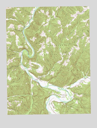
Saint George, WV USGS Topographic Map
Click on map above to begin viewing in our Map Viewer.

This topographic map contains these locations and features:
Feature Name Type Latitude Longitude GNIS ID View Map
Ann Eliza Methodist Episcopal ChurchChurchN39.1679°W79.7023°1689307View Map
AuvilPopulated PlaceN39.1779°W79.7237°1553766View Map
Bearwallow RunStreamN39.2218°W79.7251°1550213View Map
Beckner School (historical)SchoolN39.1365°W79.6631°1743030View Map
Bethel CemeteryCemeteryN39.1365°W79.6839°1550268View Map
Bethel ChurchChurchN39.1340°W79.6809°1550273View Map
Bingham RunStreamN39.1954°W79.6665°1550359View Map
Bonifield CemeteryCemeteryN39.1618°W79.6384°1550418View Map
Brannons RunStreamN39.1329°W79.6923°1550448View Map
Bridge RunStreamN39.1784°W79.6809°1550456View Map
Bull RunStreamN39.1973°W79.7262°1550553View Map
Camp KiddLocaleN39.1468°W79.6667°1550606View Map
Chestnut Grove School (historical)SchoolN39.2182°W79.7490°1743033View Map
Church of GodChurchN39.1679°W79.7012°1689322View Map
Clay Lick RunStreamN39.1793°W79.7203°1550718View Map
Clay Lick School (historical)SchoolN39.1795°W79.7201°1743052View Map
Clover RunStreamN39.1662°W79.7109°1550731View Map
Cloverdale Church (historical)ChurchN39.1468°W79.7434°1743035View Map
Coon HollowValleyN39.1651°W79.6409°1550786View Map
Drift RunStreamN39.1690°W79.6309°1550952View Map
Dry RunStreamN39.1584°W79.6881°1550982View Map
Dry RunStreamN39.1468°W79.6567°1550986View Map
Fairview CemeteryCemeteryN39.2143°W79.6370°1689343View Map
Fairview ChurchChurchN39.2043°W79.6440°1551084View Map
Fairview ChurchChurchN39.2134°W79.6378°1551085View Map
Fairview School (historical)SchoolN39.2137°W79.6373°1551087View Map
HannahsvillePopulated PlaceN39.2415°W79.7115°1554641View Map
Holly MeadowsPopulated PlaceN39.1343°W79.6812°1689366View Map
Holly MeadowsBendN39.1395°W79.6853°1551477View Map
Holly Meadows Golf CourseLocaleN39.1485°W79.6652°2634127View Map
Holly Meadows Presbyterian Church (historical)ChurchN39.1340°W79.6806°1689368View Map
Horseshoe BendBendN39.1446°W79.6623°1551504View Map
Horseshoe Bend School (historical)SchoolN39.1493°W79.6726°1743040View Map
Horseshoe RunStreamN39.1523°W79.6615°1551505View Map
Johnson RunStreamN39.1284°W79.7148°1551601View Map
Jonathan RunStreamN39.1837°W79.7276°1551607View Map
Laurel RunStreamN39.1798°W79.7201°1551734View Map
Left Fork Bull RunStreamN39.1982°W79.7342°1551767View Map
Left Fork Clover RunStreamN39.1473°W79.7142°1551769View Map
Licking CreekStreamN39.2273°W79.7206°1551800View Map
Licking Creek School (historical)SchoolN39.2368°W79.7495°1743041View Map
Licking DistrictCivilN39.2320°W79.7137°1928303View Map
Limestone CemeteryCemeteryN39.2354°W79.6809°1689376View Map
Limestone ChurchChurchN39.2351°W79.6806°1551810View Map
Limestone MountainSummitN39.2223°W79.6987°1551811View Map
Limestone School (historical)SchoolN39.2373°W79.6762°1551813View Map
Little Mill RunStreamN39.2062°W79.6673°1551876View Map
LocationPopulated PlaceN39.2140°W79.6370°1689377View Map
Long RunStreamN39.2490°W79.7037°1551933View Map
Louse Camp RunStreamN39.2404°W79.7090°1551951View Map
Macedonia ChurchChurchN39.2220°W79.7262°1551981View Map
Macedonia School (historical)SchoolN39.2093°W79.7206°1743053View Map
Mike RunStreamN39.1673°W79.6337°1552091View Map
Mill RunStreamN39.1451°W79.6537°1552135View Map
Mill RunStreamN39.2045°W79.6698°1552137View Map
Minear RunStreamN39.1643°W79.7048°1552160View Map
Mount Olive Church (historical)ChurchN39.1912°W79.6598°1743047View Map
Mount Olive School (historical)SchoolN39.1893°W79.6576°1743048View Map
Mount Olivet CemeteryCemeteryN39.2048°W79.6439°1689388View Map
Mount Prospect School (historical)SchoolN39.2065°W79.6940°1743049View Map
Pleasant ValePopulated PlaceN39.1654°W79.6320°1689398View Map
Pleasant Vale School (historical)SchoolN39.1657°W79.6314°1552509View Map
Right Fork Bull RunStreamN39.1984°W79.7340°1552656View Map
Right Fork Clover RunStreamN39.1476°W79.7140°1552658View Map
Roaring RunStreamN39.1848°W79.6748°1552689View Map
Sailor RunStreamN39.1734°W79.6867°1552764View Map
Saint GeorgePopulated PlaceN39.1668°W79.7023°1552767View Map
Saint George AcademySchoolN39.1634°W79.6987°1689406View Map
Saint George BridgeBridgeN39.1651°W79.7073°2647399View Map
Saint George Census Designated PlaceCensusN39.1663°W79.6988°2586886View Map
Saint George DistrictCivilN39.1800°W79.6304°1928371View Map
Stump RunStreamN39.2048°W79.6698°1553104View Map
Tobes RunStreamN39.2023°W79.7103°1553246View Map
Upper Jonathan RunStreamN39.1793°W79.7220°1553325View Map
White RidgeRidgeN39.2401°W79.6451°1553426View Map
White Ridge ChurchChurchN39.2409°W79.6437°1553427View Map
White Ridge ChurchChurchN39.2484°W79.6292°1553428View Map
White Ridge School (historical)SchoolN39.2432°W79.6348°1553429View Map
Wolf RunStreamN39.1376°W79.6640°1553504View Map

Note: Coordinates in the location and feature list above are referenced to NAD83 datum.


Copyright (C) 2008-2025 Ryan Niemi / Sunset Dynamics ... All Rights Reserved