TopoQuest Logo
Do you find TopoQuest useful?
Help keep TopoQuest running and adding new maps/features by donating!
Bitcoin:  19c7KJd3qBynnjoSw5npx9KScwjBe4ifkT
Litecoin:  LXs6TkuXGGXo1vDsWCkWVdjQX94eUKd6ui
Home View Maps Find Maps Find Places Resources & Links


Lead Mine, West Virginia Topographic Map

USGS Map Title: Lead Mine, WV
USGS Map MRC: 39079B5
DRG (GeoTIFF) Download: o39079b5.tif


Neighboring USGS Topographic Map Quads:


  Rowlesburg, WV  
39079C6
 

  Aurora, WV  
39079C5
 

  Table Rock, MD  
39079C4
 

  Saint George, WV  
39079B6
 

  Lead Mine, WV  
39079B5
 

  Davis, WV  
39079B4
 

  Parsons, WV  
39079A6
 

  Mozark Mountain, WV  
39079A5
 

  Blackwater Falls, WV  
39079A4


Map MRC Location:

N40°
W80°
N40°
W79°
H8 H7 H6 H5 H4 H3 H2 H1
G8 G7 G6 G5 G4 G3 G2 G1
F8 F7 F6 F5 F4 F3 F2 F1
E8 E7 E6 E5 E4 E3 E2 E1
D8 D7 D6 D5 D4 D3 D2 D1
C8 C7 C6 C5 C4 C3 C2 C1
B8 B7 B6 B5 B4 B3 B2 B1
A8 A7 A6 A5 A4 A3 A2 A1
N39°
W80°
N39°
W79°

Lead Mine, WV USGS 1:24K Topographic Map Preview:
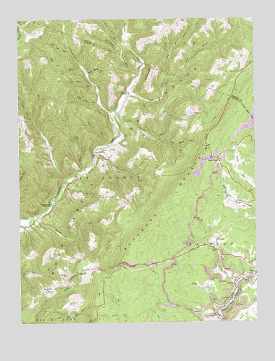
Lead Mine, WV USGS Topographic Map
Click on map above to begin viewing in our Map Viewer.

This topographic map contains these locations and features:
Feature Name Type Latitude Longitude GNIS ID View Map
BenbushPopulated PlaceN39.1587°W79.5209°1553858View Map
Black Lick RunStreamN39.2368°W79.5967°1550370View Map
Blackwater Wildlife Management AreaParkN39.1476°W79.6153°2043509View Map
Bonifield RunStreamN39.2090°W79.6170°1550419View Map
Cannon School (historical)SchoolN39.2123°W79.5339°1743031View Map
Close MountainSummitN39.1812°W79.5823°1550728View Map
Close Mountain School (historical)SchoolN39.1790°W79.5781°1743034View Map
Close Mountain SpringSpringN39.1509°W79.5737°1677841View Map
CoketonPopulated PlaceN39.1401°W79.5120°1554170View Map
DouglasPopulated PlaceN39.1271°W79.5206°1554324View Map
Evans Mill (historical)LocaleN39.2034°W79.5578°1689341View Map
Fairfax DistrictCivilN39.1560°W79.5179°1928267View Map
Fairfax QuarryMineN39.1844°W79.5331°2633144View Map
Forty ThreeLocaleN39.1918°W79.5195°1551169View Map
Hickory Grove School (historical)SchoolN39.2029°W79.6176°1743038View Map
Hile CemeteryCemeteryN39.1948°W79.6092°1551439View Map
Hile RunStreamN39.1821°W79.6012°1551440View Map
HogbackRidgeN39.2290°W79.5545°1551466View Map
Horseshoe YMCA CampLocaleN39.1737°W79.6070°1551506View Map
Horseshore Recreation SiteLocaleN39.1804°W79.6003°1553587View Map
Kight CemeteryCemeteryN39.2215°W79.5228°1551646View Map
Knotts CemeteryCemeteryN39.1757°W79.5720°1551668View Map
Laurel RunStreamN39.1937°W79.5851°1551735View Map
Lead MinePopulated PlaceN39.1946°W79.5848°1557462View Map
Leadmine RunStreamN39.2126°W79.5748°1551757View Map
Left Branch Mill RunStreamN39.1251°W79.6181°1551763View Map
Lick DrainStreamN39.1882°W79.5914°1551787View Map
Lime Hollow RunStreamN39.2004°W79.5489°1551805View Map
Long Hollow RunStreamN39.2223°W79.5845°1551921View Map
Long RunStreamN39.1259°W79.5187°1551929View Map
Lynn RunStreamN39.1982°W79.5776°1551978View Map
Maxwell RunStreamN39.1693°W79.6162°1552012View Map
Middle RunStreamN39.1298°W79.5203°1552089View Map
Mount Grove ChurchChurchN39.2282°W79.5070°1552201View Map
Mount Hope School (historical)SchoolN39.2343°W79.6226°1743046View Map
Mount Olive ChurchChurchN39.1451°W79.5942°1552212View Map
Mud Lick RunStreamN39.2290°W79.5901°1552252View Map
North Branch Wolf RunStreamN39.2259°W79.5453°1552318View Map
PiercePopulated PlaceN39.1737°W79.5103°1555342View Map
Pine Grove School (historical)SchoolN39.1946°W79.5837°1689396View Map
Rams Hollow RunStreamN39.2273°W79.5889°1552583View Map
Rose Hill CemeteryCemeteryN39.1537°W79.5031°1552730View Map
Sell School (historical)SchoolN39.2498°W79.5381°1743028View Map
ShaferPopulated PlaceN39.2193°W79.5678°1552839View Map
Shaffertown School (historical)SchoolN39.2212°W79.5670°1689415View Map
Snyder RunStreamN39.1409°W79.5117°1552959View Map
Stanbaugh School (historical)SchoolN39.2312°W79.5037°1743029View Map
Sugarland ChurchChurchN39.1382°W79.6103°1553136View Map
Sugarland School (historical)SchoolN39.1443°W79.6009°1553137View Map
Tanner RunStreamN39.2365°W79.5698°1553175View Map
Tucker County Ambulance Authority Squad 54734BuildingN39.1500°W79.5037°2581206View Map
Tucker County High SchoolSchoolN39.1376°W79.5831°1689425View Map
Twelvemile RunStreamN39.2262°W79.5603°1553295View Map
Walnut Hollow RunStreamN39.2159°W79.5812°1553364View Map
Wolf RunStreamN39.2193°W79.5681°1553500View Map

Note: Coordinates in the location and feature list above are referenced to NAD83 datum.


Copyright (C) 2008-2025 Ryan Niemi / Sunset Dynamics ... All Rights Reserved