TopoQuest Logo
Do you find TopoQuest useful?
Help keep TopoQuest running and adding new maps/features by donating!
Bitcoin:  19c7KJd3qBynnjoSw5npx9KScwjBe4ifkT
Litecoin:  LXs6TkuXGGXo1vDsWCkWVdjQX94eUKd6ui
Home View Maps Find Maps Find Places Resources & Links


Parsons, Tennessee Topographic Map

USGS Map Title: Parsons, TN
USGS Map MRC: 35088F2
DRG (GeoTIFF) Download: o35088f2.tif


Neighboring USGS Topographic Map Quads:


  Yuma, TN  
35088G3
 

  Holladay, TN  
35088G2
 

  Sugar Tree, TN  
35088G1
 

  Chesterfield, TN  
35088F3
 

  Parsons, TN  
35088F2
 

  Jeannette, TN  
35088F1
 

  Reagan, TN  
35088E3
 

  Scotts Hill, TN  
35088E2
 

  Perryville, TN  
35088E1


Map MRC Location:

N36°
W89°
N36°
W88°
H8 H7 H6 H5 H4 H3 H2 H1
G8 G7 G6 G5 G4 G3 G2 G1
F8 F7 F6 F5 F4 F3 F2 F1
E8 E7 E6 E5 E4 E3 E2 E1
D8 D7 D6 D5 D4 D3 D2 D1
C8 C7 C6 C5 C4 C3 C2 C1
B8 B7 B6 B5 B4 B3 B2 B1
A8 A7 A6 A5 A4 A3 A2 A1
N35°
W89°
N35°
W88°

Parsons, TN USGS 1:24K Topographic Map Preview:
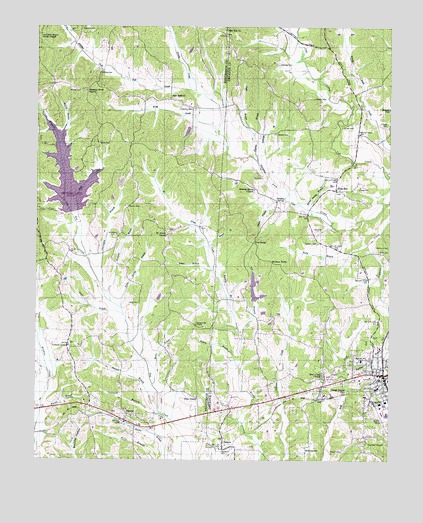
Parsons, TN USGS Topographic Map
Click on map above to begin viewing in our Map Viewer.

This topographic map contains these locations and features:
Feature Name Type Latitude Longitude GNIS ID View Map
Arnold CemeteryCemeteryN35.7212°W88.1417°1275885View Map
BeaconPopulated PlaceN35.6284°W88.1831°1305006View Map
Beacon Baptist ChurchChurchN35.6292°W88.1825°1644647View Map
Beacon Church of ChristChurchN35.6287°W88.1806°1644648View Map
Beacon Cumberland Presbyterian Church (historical)ChurchN35.6292°W88.1825°1644649View Map
Beacon JunctionPopulated PlaceN35.6398°W88.1809°1644650View Map
Beacon School (historical)SchoolN35.6295°W88.1809°1316716View Map
Bear CreekPopulated PlaceN35.6487°W88.1489°1644651View Map
Bear Creek Baptist ChurchChurchN35.6498°W88.1484°1305017View Map
Beech River Regional AirportAirportN35.6574°W88.1973°2675488View Map
Bible HillPopulated PlaceN35.7031°W88.1439°1305195View Map
Bible Hill Baptist ChurchChurchN35.7031°W88.1428°1644652View Map
Bible Hill Church (historical)ChurchN35.7006°W88.1395°1316720View Map
Bible Hill School (historical)SchoolN35.7031°W88.1423°1307241View Map
Big BranchStreamN35.6601°W88.1767°1277239View Map
Blankenship (historical)Populated PlaceN35.6903°W88.2195°1310804View Map
Box CemeteryCemeteryN35.7070°W88.1734°1278087View Map
Bradfield BranchStreamN35.6709°W88.2237°1278158View Map
Brown Spring BranchStreamN35.6976°W88.1542°1278608View Map
Buckner BranchStreamN35.6476°W88.1403°1278877View Map
Cagle BranchStreamN35.7187°W88.1731°1279284View Map
Carrington BranchStreamN35.6751°W88.2270°1279734View Map
Cedar Hill ChurchChurchN35.7492°W88.1842°1280069View Map
Center Hill Church of Christ (historical)ChurchN35.6473°W88.1673°1644656View Map
Central SchoolSchoolN35.7170°W88.2181°1280180View Map
Cheney CemeteryCemeteryN35.7223°W88.1261°1280316View Map
City of Parsons Fire DepartmentBuildingN35.6448°W88.1251°2653821View Map
Colwick BranchStreamN35.6384°W88.2053°1281032View Map
Commissioner District 6CivilN35.6278°W88.1436°2464524View Map
Corinth ChapelChurchN35.6578°W88.2384°1306111View Map
Corinth School (historical)SchoolN35.6581°W88.2392°1317464View Map
Cox CemeteryCemeteryN35.6292°W88.1886°1281484View Map
DardenPopulated PlaceN35.6381°W88.2170°1282038View Map
Darden Baptist ChurchChurchN35.6395°W88.2181°1317466View Map
Darden Census Designated PlaceCensusN35.6384°W88.2261°2586047View Map
Darden Post OfficePost OfficeN35.6359°W88.2181°1650817View Map
Darden School (historical)SchoolN35.6384°W88.2175°1317467View Map
Davis BranchStreamN35.6667°W88.2189°1282119View Map
Derryberry CemeteryCemeteryN35.6898°W88.2217°1282371View Map
Dodd BranchStreamN35.6367°W88.1778°1310575View Map
Dogwood DamDamN35.6961°W88.2390°1302049View Map
Dogwood LakeReservoirN35.7064°W88.2390°1302050View Map
Duke CemeteryCemeteryN35.6437°W88.1928°1646122View Map
Duke ChapelChurchN35.6431°W88.1923°1283111View Map
Duke HollowValleyN35.6448°W88.1991°1313209View Map
Duke School (historical)SchoolN35.6940°W88.2498°1317470View Map
Eubanks CemeteryCemeteryN35.7495°W88.2342°1283876View Map
Evans BranchStreamN35.6878°W88.1892°1283892View Map
Evans CemeteryCemeteryN35.6978°W88.2173°1283898View Map
Five ForksPopulated PlaceN35.6878°W88.1731°1315057View Map
Flowers HollowValleyN35.6465°W88.2038°1310810View Map
Gabbard CemeteryCemeteryN35.6876°W88.1506°1285057View Map
Gilbert BranchStreamN35.6678°W88.1803°1310577View Map
Glenwood SchoolSchoolN35.7387°W88.1745°1285526View Map
Graves CemeteryCemeteryN35.6276°W88.1417°1285956View Map
Greasy CreekStreamN35.7317°W88.1959°1286040View Map
Gulledge BranchStreamN35.7040°W88.1625°1286389View Map
Gulledge CemeteryCemeteryN35.7392°W88.1645°1286390View Map
Hawkes BranchStreamN35.7112°W88.1720°1287170View Map
Hawkes CemeteryCemeteryN35.7192°W88.1656°1287171View Map
Hayes BranchStreamN35.6798°W88.1873°1287210View Map
Hayes BranchStreamN35.6995°W88.1617°1287211View Map
Hayes CemeteryCemeteryN35.6703°W88.2134°1287215View Map
Hendrix CemeteryCemeteryN35.7262°W88.1998°1287402View Map
Hendrix CemeteryCemeteryN35.7295°W88.1520°1287403View Map
Hendrix Chapel (historical)ChurchN35.7217°W88.1542°1307243View Map
Hickory ForksPopulated PlaceN35.6820°W88.1664°1315227View Map
Hill CemeteryCemeteryN35.6914°W88.1503°1287785View Map
Howard BranchStreamN35.6392°W88.2061°1288521View Map
Hydro Volunteer Fire DepartmentBuildingN35.7328°W88.1301°2654283View Map
King CreekStreamN35.7195°W88.1859°1290216View Map
Lexington Management Corporation DamDamN35.7217°W88.1967°1302087View Map
Lexington Management Corporation LakeReservoirN35.7217°W88.1967°1302086View Map
Long CemeteryCemeteryN35.7034°W88.1359°1291917View Map
Mackey BranchStreamN35.6398°W88.2478°1292450View Map
Mays SchoolSchoolN35.7181°W88.1534°1293037View Map
McCoy BranchStreamN35.7162°W88.2423°1293198View Map
McCoy CemeteryCemeteryN35.7314°W88.2348°1293204View Map
McMurry CemeteryCemeteryN35.6862°W88.1292°1293426View Map
Midway SchoolSchoolN35.6795°W88.2428°1293750View Map
Milton BranchStreamN35.7162°W88.2423°1294013View Map
Mincey CemeteryCemeteryN35.7364°W88.2278°1294023View Map
Moore CemeteryCemeteryN35.7159°W88.2278°1294265View Map
Moores Hill School (historical)SchoolN35.6812°W88.2056°1317494View Map
Mount Ararat CemeteryCemeteryN35.6909°W88.2031°1317496View Map
Mount Ararat ChurchChurchN35.6901°W88.2037°1294547View Map
New SaffordPopulated PlaceN35.7290°W88.2042°1295632View Map
Old Safford (historical)Populated PlaceN35.7431°W88.1928°1310822View Map
ParsonsPopulated PlaceN35.6498°W88.1267°1296893View Map
Parsons College (historical)SchoolN35.6465°W88.1292°1644667View Map
Parsons Elementary SchoolSchoolN35.6456°W88.1292°1316765View Map
Parsons First Baptist ChurchChurchN35.6476°W88.1261°1644668View Map
Parsons High School (historical)SchoolN35.6534°W88.1348°1644669View Map
Parsons Junior High SchoolSchoolN35.6537°W88.1348°1316766View Map
Parsons Post OfficePost OfficeN35.6605°W88.1258°1650588View Map
Parsons United Methodist ChurchChurchN35.6481°W88.1253°1644670View Map
Pleasant Grove ChurchChurchN35.7315°W88.2325°1297822View Map
Pleasant Hill ChurchChurchN35.6640°W88.1936°1317508View Map
Pleasant Hill SchoolSchoolN35.6640°W88.1931°1297895View Map
Reeves BranchStreamN35.6467°W88.2084°1299181View Map
Refish Number One DamDamN35.6717°W88.1734°1302028View Map
Refish Number One LakeReservoirN35.6717°W88.1734°1302029View Map
Refish Number Two DamDamN35.6751°W88.1734°1302037View Map
Refish Number Two LakeReservoirN35.6751°W88.1734°1302036View Map
Roberts BranchStreamN35.6520°W88.1778°1299614View Map
Rocky BranchStreamN35.6873°W88.1328°1299857View Map
Rushing BranchStreamN35.6695°W88.1811°1300275View Map
Scott Field (historical)AirportN35.6390°W88.1286°1301355View Map
Shell ForkStreamN35.6831°W88.2317°1270003View Map
Shipman CreekStreamN35.6951°W88.1250°1303593View Map
Spring HollowValleyN35.7452°W88.2379°1310832View Map
Stills CemeteryCemeteryN35.6848°W88.1267°1271433View Map
Sulphur SpringSpringN35.6997°W88.1639°1271794View Map
Sulphur Spring ChurchChurchN35.7034°W88.1731°1271812View Map
Sulphur Springs (historical)Populated PlaceN35.7015°W88.1689°1310591View Map
Tomlins Chapel Baptist ChurchChurchN35.6298°W88.1325°1304132View Map
Tub Store (historical)LocaleN35.7209°W88.1539°1307245View Map
Tubbs Spring BranchStreamN35.6690°W88.2198°1272932View Map
West Fork Cub CreekStreamN35.7434°W88.1631°1310592View Map
WilkinstownPopulated PlaceN35.6287°W88.1539°1274603View Map
Wilson BranchStreamN35.6551°W88.2128°1310836View Map
WTBP-AM (Parsons)TowerN35.6573°W88.1520°1639879View Map

Note: Coordinates in the location and feature list above are referenced to NAD83 datum.


Copyright (C) 2008-2025 Ryan Niemi / Sunset Dynamics ... All Rights Reserved