TopoQuest Logo
Do you find TopoQuest useful?
Help keep TopoQuest running and adding new maps/features by donating!
Bitcoin:  19c7KJd3qBynnjoSw5npx9KScwjBe4ifkT
Litecoin:  LXs6TkuXGGXo1vDsWCkWVdjQX94eUKd6ui
Home View Maps Find Maps Find Places Resources & Links


Perryville, Tennessee Topographic Map

USGS Map Title: Perryville, TN
USGS Map MRC: 35088E1
DRG (GeoTIFF) Download: o35088e1.tif


Neighboring USGS Topographic Map Quads:


  Parsons, TN  
35088F2
 

  Jeannette, TN  
35088F1
 

  Pine View, TN  
35087F8
 

  Scotts Hill, TN  
35088E2
 

  Perryville, TN  
35088E1
 

  Pope, TN  
35087E8
 

  Thurman, TN  
35088D2
 

  Bath Springs, TN  
35088D1
 

  Clifton, TN  
35087D8


Map MRC Location:

N36°
W89°
N36°
W88°
H8 H7 H6 H5 H4 H3 H2 H1
G8 G7 G6 G5 G4 G3 G2 G1
F8 F7 F6 F5 F4 F3 F2 F1
E8 E7 E6 E5 E4 E3 E2 E1
D8 D7 D6 D5 D4 D3 D2 D1
C8 C7 C6 C5 C4 C3 C2 C1
B8 B7 B6 B5 B4 B3 B2 B1
A8 A7 A6 A5 A4 A3 A2 A1
N35°
W89°
N35°
W88°

Perryville, TN USGS 1:24K Topographic Map Preview:
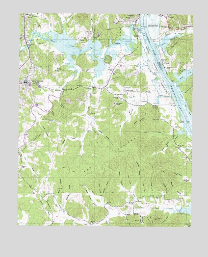
Perryville, TN USGS Topographic Map
Click on map above to begin viewing in our Map Viewer.

This topographic map contains these locations and features:
Feature Name Type Latitude Longitude GNIS ID View Map
Adams BranchStreamN35.6140°W88.1025°1275454View Map
Beasley HollowValleyN35.6170°W88.0086°1647067View Map
Beech BendBendN35.6167°W88.0417°1310570View Map
Beech Bend Recreation AreaParkN35.6123°W88.0406°1316717View Map
Beech RiverStreamN35.6167°W88.0378°1305068View Map
Beech River LandingLocaleN35.6173°W88.0450°1316718View Map
Blue SpringSpringN35.5244°W88.0766°1277781View Map
Blue Spring HollowValleyN35.5092°W88.0582°1277805View Map
Blunts LandingLocaleN35.6087°W88.0295°1314709View Map
Bob SpringSpringN35.5072°W88.0441°1277861View Map
Boyer CemeteryCemeteryN35.5151°W88.0150°1316721View Map
Brown HollowValleyN35.5065°W88.0469°1278591View Map
Brownsport FurnaceLocaleN35.5198°W88.0189°1316722View Map
Buck BranchStreamN35.5017°W88.0667°1278797View Map
Bussell CemeteryCemeteryN35.6167°W88.0067°1279153View Map
Cave HollowValleyN35.5622°W88.1094°1279928View Map
Cedar Grove Church (historical)ChurchN35.5134°W88.0620°1316724View Map
Cole BendBendN35.5992°W88.0678°1280918View Map
Commissioner District 4CivilN35.5433°W88.0820°2464028View Map
Crane HollowValleyN35.5544°W88.0095°1281558View Map
Crowell BranchStreamN35.6073°W88.0745°1281747View Map
Cypress CreekStreamN35.6073°W88.0286°1281929View Map
Cypress Creek Boat DockLocaleN35.6045°W88.0225°1647066View Map
Cypress Creek SchoolSchoolN35.6176°W88.0186°1281941View Map
Dark HollowValleyN35.5239°W88.0425°1282043View Map
Decatur CountyCivilN35.6030°W88.1088°1639739View Map
Decatur County CourthouseBuildingN35.5845°W88.1200°1316732View Map
Decatur County Sheriff's OfficeBuildingN35.5834°W88.1174°2765961View Map
Decatur County Volunteer Fire Department Station 3BuildingN35.5845°W88.1191°2654182View Map
DecaturvillePopulated PlaceN35.5842°W88.1195°1282275View Map
Decaturville First Baptist ChurchChurchN35.5840°W88.1195°1644658View Map
Decaturville High School (historical)SchoolN35.5837°W88.1175°1316737View Map
Decaturville Police DepartmentBuildingN35.5849°W88.1187°2766029View Map
Decaturville Post OfficePost OfficeN35.5835°W88.1235°1650575View Map
Dixon CemeteryCemeteryN35.5817°W88.0481°1282518View Map
Dry BranchStreamN35.5615°W88.0050°1282838View Map
East Perryville LandingLocaleN35.6178°W88.0334°1314998View Map
Elkins BranchStreamN35.5553°W88.0086°1283650View Map
Elkins LandingLocaleN35.5623°W88.0056°1315014View Map
First United Methodist Church of DecaturvilleChurchN35.5856°W88.1200°1644660View Map
Fisher BranchStreamN35.5117°W88.0353°1284311View Map
Fisher CemeteryCemeteryN35.5667°W88.0734°1284313View Map
Fisher CemeteryCemeteryN35.5709°W88.0245°1284314View Map
Fisher CemeteryCemeteryN35.5117°W88.0406°1316740View Map
Fisher SpringSpringN35.5145°W88.0403°1284326View Map
Fishers LandingLocaleN35.5731°W88.0123°1315054View Map
Furnace CemeteryCemeteryN35.5184°W88.0228°1316741View Map
Furnace HollowValleyN35.5133°W88.0202°1285045View Map
Gates CemeteryCemeteryN35.5117°W88.0478°1316743View Map
Grayfield HollowValleyN35.5105°W88.0931°1286012View Map
Greenwood BranchStreamN35.5020°W88.0995°1286192View Map
Hern HollowValleyN35.5733°W88.0436°1287493View Map
Herron CreekStreamN35.6128°W88.0928°1287508View Map
Hoosier HollowValleyN35.5130°W88.0630°1288260View Map
Horseshoe Pond (historical)LakeN35.6109°W88.0473°1310580View Map
Houston CemeteryCemeteryN35.6173°W88.1123°1316748View Map
Howard CemeteryCemeteryN35.6181°W88.0075°1288529View Map
Howard CemeteryCemeteryN35.6228°W88.0181°1288530View Map
Jamison HollowValleyN35.5797°W88.0065°1289291View Map
Jennings BluffCliffN35.5926°W88.0195°1289374View Map
Jennings Bluff LandingLocaleN35.5937°W88.0189°1315295View Map
Jims BranchStreamN35.6076°W88.0339°1289442View Map
LargoPopulated PlaceN35.5501°W88.0964°1290639View Map
Largo School (historical)SchoolN35.5601°W88.0884°1316750View Map
Largo TrailTrailN35.5265°W88.0800°1290640View Map
Lightning HollowValleyN35.5738°W88.0966°1291270View Map
Little SpringSpringN35.5734°W88.0325°1291673View Map
Long HollowValleyN35.5003°W88.0658°1291951View Map
Long PointCapeN35.5931°W88.0089°1291990View Map
Lost CreekStreamN35.5970°W88.0664°1292073View Map
Lost Creek DockLocaleN35.5956°W88.0636°1644664View Map
Luton BranchStreamN35.5045°W88.0889°1292313View Map
Luton CemeteryCemeteryN35.5217°W88.0959°1292314View Map
Mager HollowValleyN35.5028°W88.0612°1292497View Map
Marsh CreekStreamN35.5848°W88.0139°1292751View Map
Marvins Bluff LandingLocaleN35.5826°W88.0120°1315473View Map
McKendre School (historical)SchoolN35.5187°W88.1086°1316755View Map
Mire BranchStreamN35.6178°W88.0945°1294076View Map
Moore HollowValleyN35.5208°W88.0456°1294292View Map
Mount Carmel CemeteryCemeteryN35.5005°W88.0002°1294570View Map
Mount Carmel ChurchChurchN35.5009°W88.0009°1316756View Map
Mount LebanonPopulated PlaceN35.5753°W88.0503°1315551View Map
Mount Lebanon ChurchChurchN35.5728°W88.0548°1294661View Map
Mount Lebanon Church (historical)ChurchN35.5781°W88.0489°1316758View Map
Mount Lebanon School (historical)SchoolN35.5776°W88.0545°1316759View Map
Mount TaborPopulated PlaceN35.6231°W88.1164°1315557View Map
Mount Tabor Pentecostal ChurchChurchN35.6231°W88.1167°1644666View Map
Mount Tabor School (historical)SchoolN35.6237°W88.1161°1316761View Map
Mount Zion CemeteryCemeteryN35.5440°W88.0531°1294860View Map
Mount Zion TrailTrailN35.5409°W88.0375°1294927View Map
Mozier HollowValleyN35.5504°W88.0795°1294976View Map
Murphy CemeteryCemeteryN35.5140°W88.0342°1316762View Map
Murphy HollowValleyN35.5128°W88.0025°1295125View Map
Old Mill (historical)LocaleN35.5045°W88.0895°1316764View Map
PerryvillePopulated PlaceN35.6206°W88.0417°1297223View Map
Perryville Dewatering AreaBasinN35.5970°W88.0286°1297224View Map
Perryville Ferry (historical)CrossingN35.6209°W88.0359°1308605View Map
Perryville First Baptist ChurchChurchN35.6206°W88.0420°1644672View Map
Perryville Post Office (historical)Post OfficeN35.6215°W88.0406°1650590View Map
Perryville School (historical)SchoolN35.6240°W88.0417°1316768View Map
Pikes Peak BranchStreamN35.6242°W88.0373°1297461View Map
Pitts HollowValleyN35.5132°W88.0312°1297765View Map
Plunket HollowValleyN35.5144°W88.0234°1297986View Map
Poor HollowValleyN35.5133°W88.0647°1298137View Map
Rameys DockLocaleN35.5970°W88.0228°1308607View Map
Riverside High SchoolSchoolN35.6106°W88.1225°1316772View Map
Rocky HollowValleyN35.5086°W88.0139°1299907View Map
Round Pond (historical)LakeN35.6009°W88.0300°1310588View Map
Rushing CreekStreamN35.6009°W88.0889°1300283View Map
Scott HollowValleyN35.5153°W88.0975°1300956View Map
Scott HollowValleyN35.5612°W88.1107°1300957View Map
Shook HollowValleyN35.5087°W88.0320°1270154View Map
Simms BridgeBridgeN35.5090°W88.0084°1270323View Map
Slabtown HollowValleyN35.5195°W88.0427°1270461View Map
Spout SpringSpringN35.5635°W88.0239°1271030View Map
Spout Spring HillSummitN35.5626°W88.0359°1271037View Map
Spurgeon HollowValleyN35.5088°W88.0358°1271170View Map
Stillhouse HollowValleyN35.5679°W88.1018°1271414View Map
Sulphur SpringSpringN35.5798°W88.0475°1271793View Map
Sulphur Spring BranchStreamN35.5753°W88.0328°1271801View Map
Tanyard ParkParkN35.6209°W88.0503°1272115View Map
The CoalingsSummitN35.5179°W88.0531°1304055View Map
Thwattles LandingLocaleN35.5853°W88.0189°1644677View Map
Tolley CemeteryCemeteryN35.6090°W88.0781°1272736View Map
Town of DecaturvilleCivilN35.5819°W88.1194°2406367View Map
Town of Decaturville City Fire DepartmentBuildingN35.5844°W88.1193°2653910View Map
UtahPopulated PlaceN35.5903°W88.0584°1314447View Map
Utah School (historical)SchoolN35.5909°W88.0528°1316782View Map
Vise SpringSpringN35.5725°W88.0245°1273484View Map
Wallace CemeteryCemeteryN35.5540°W88.0692°1273667View Map
Wallace CemeteryCemeteryN35.5817°W88.0831°1273668View Map
Ward BendBendN35.5770°W88.0067°1273769View Map
Wards Ferry (historical)CrossingN35.5778°W88.0125°1642913View Map
Webbs LandingLocaleN35.5965°W88.0223°1314484View Map
White CemeteryCemeteryN35.6070°W88.1111°1274344View Map
Wright BranchStreamN35.5442°W88.1220°1275154View Map

Note: Coordinates in the location and feature list above are referenced to NAD83 datum.


Copyright (C) 2008-2025 Ryan Niemi / Sunset Dynamics ... All Rights Reserved