TopoQuest Logo
Do you find TopoQuest useful?
Help keep TopoQuest running and adding new maps/features by donating!
Bitcoin:  19c7KJd3qBynnjoSw5npx9KScwjBe4ifkT
Litecoin:  LXs6TkuXGGXo1vDsWCkWVdjQX94eUKd6ui
Home View Maps Find Maps Find Places Resources & Links


Paskenta, California Topographic Map

USGS Map Title: Paskenta, CA
USGS Map MRC: 39122H5
DRG (GeoTIFF) Download: o39122h5.tif


Neighboring USGS Topographic Map Quads:


  Raglin Ridge, CA  
40122A6
 

  Lowrey, CA  
40122A5
 

  Red Bank, CA  
40122A4
 

  Riley Ridge, CA  
39122H6
 

  Paskenta, CA  
39122H5
 

  Flournoy, CA  
39122H4
 

  Hall Ridge, CA  
39122G6
 

  Newville, CA  
39122G5
 

  Sehorn Creek, CA  
39122G4


Map MRC Location:

N40°
W123°
N40°
W122°
H8 H7 H6 H5 H4 H3 H2 H1
G8 G7 G6 G5 G4 G3 G2 G1
F8 F7 F6 F5 F4 F3 F2 F1
E8 E7 E6 E5 E4 E3 E2 E1
D8 D7 D6 D5 D4 D3 D2 D1
C8 C7 C6 C5 C4 C3 C2 C1
B8 B7 B6 B5 B4 B3 B2 B1
A8 A7 A6 A5 A4 A3 A2 A1
N39°
W123°
N39°
W122°

Paskenta, CA USGS 1:24K Topographic Map Preview:
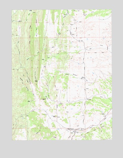
Paskenta, CA USGS Topographic Map
Click on map above to begin viewing in our Map Viewer.

This topographic map contains these locations and features:
Feature Name Type Latitude Longitude GNIS ID View Map
Blue CanyonValleyN39.9954°W122.5936°219483View Map
Cat RidgeRidgeN39.9332°W122.6078°220718View Map
Digger CreekStreamN39.8835°W122.5458°259361View Map
Digger Pine HillSummitN39.8827°W122.5944°1658419View Map
Duncan CanyonValleyN39.9321°W122.5931°222712View Map
Elkins Elementary SchoolSchoolN39.8857°W122.5536°1692743View Map
Gordon CanyonValleyN39.9210°W122.6006°224339View Map
High Flat RidgeRidgeN39.9768°W122.6025°225265View Map
Hull CanyonValleyN39.9288°W122.6028°225744View Map
Lowrey SchoolSchoolN39.9954°W122.5564°227806View Map
Maupin FlatFlatN39.9521°W122.5844°228243View Map
Nevada BottomBasinN39.9357°W122.5411°229473View Map
Nevada CreekStreamN39.9174°W122.5125°229474View Map
Owens ButteSummitN39.8977°W122.5714°230169View Map
PaskentaPopulated PlaceN39.8846°W122.5458°230388View Map
Paskenta CemeteryCemeteryN39.8997°W122.5100°230389View Map
Paskenta Census Designated PlaceCensusN39.8833°W122.5458°2628772View Map
Paskenta Post OfficePost OfficeN39.8848°W122.5468°2760076View Map
Pony SpringSpringN39.9123°W122.6038°230924View Map
Rouse GardensFlatN39.9996°W122.6022°231984View Map
Salt CreekStreamN39.9979°W122.6014°256095View Map
Sulphur SpringsSpringN39.9316°W122.5940°235733View Map
Tehama County Fire Department PaskentaBuildingN39.8852°W122.5548°2622010View Map
Uhl SpringSpringN39.9446°W122.5845°236760View Map
Whitlock ButteSummitN39.9143°W122.5875°237702View Map

Note: Coordinates in the location and feature list above are referenced to NAD83 datum.


Copyright (C) 2008-2024 Ryan Niemi / Sunset Dynamics ... All Rights Reserved