TopoQuest Logo
Do you find TopoQuest useful?
Help keep TopoQuest running and adding new maps/features by donating!
Bitcoin:  19c7KJd3qBynnjoSw5npx9KScwjBe4ifkT
Litecoin:  LXs6TkuXGGXo1vDsWCkWVdjQX94eUKd6ui
Home View Maps Find Maps Find Places Resources & Links


Riley Ridge, California Topographic Map

USGS Map Title: Riley Ridge, CA
USGS Map MRC: 39122H6
DRG (GeoTIFF) Download: o39122h6.tif


Neighboring USGS Topographic Map Quads:


  South Yolla Bolly, CA  
40122A7
 

  Raglin Ridge, CA  
40122A6
 

  Lowrey, CA  
40122A5
 

  Ball Mountain, CA  
39122H7
 

  Riley Ridge, CA  
39122H6
 

  Paskenta, CA  
39122H5
 

  Log Spring, CA  
39122G7
 

  Hall Ridge, CA  
39122G6
 

  Newville, CA  
39122G5


Map MRC Location:

N40°
W123°
N40°
W122°
H8 H7 H6 H5 H4 H3 H2 H1
G8 G7 G6 G5 G4 G3 G2 G1
F8 F7 F6 F5 F4 F3 F2 F1
E8 E7 E6 E5 E4 E3 E2 E1
D8 D7 D6 D5 D4 D3 D2 D1
C8 C7 C6 C5 C4 C3 C2 C1
B8 B7 B6 B5 B4 B3 B2 B1
A8 A7 A6 A5 A4 A3 A2 A1
N39°
W123°
N39°
W122°

Riley Ridge, CA USGS 1:24K Topographic Map Preview:
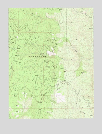
Riley Ridge, CA USGS Topographic Map
Click on map above to begin viewing in our Map Viewer.

This topographic map contains these locations and features:
Feature Name Type Latitude Longitude GNIS ID View Map
All TopSummitN39.8821°W122.7108°256185View Map
Ball RockSummitN39.9668°W122.7378°1657991View Map
Beehive FlatFlatN39.8890°W122.6347°256794View Map
Brush MountainSummitN39.9832°W122.6597°257533View Map
Cold SpringSpringN39.9540°W122.7436°258542View Map
Crowfoot PointCapeN39.8782°W122.6278°258945View Map
Dawson PlacePopulated PlaceN39.9238°W122.7075°1658379View Map
Eagle PeakSummitN39.9271°W122.6417°259669View Map
Eagle RockCliffN39.9277°W122.6697°259675View Map
Eagle Rock CampLocaleN39.9313°W122.6706°259678View Map
Government SpringSpringN39.9132°W122.6828°260728View Map
Henderson GladeFlatN39.8835°W122.7367°261265View Map
Horse Camp Recreation SiteLocaleN39.9171°W122.6836°1654911View Map
KALF-FM (Red Bluff)TowerN39.9174°W122.6711°1663017View Map
KCEZ-FM (Corning)TowerN39.8879°W122.6283°1662843View Map
Kleinsorge MineMineN39.9952°W122.6403°262211View Map
Mitchell PlacePopulated PlaceN39.9590°W122.7181°1659149View Map
Patton MillLocaleN39.9082°W122.6792°264567View Map
Pellow PlacePopulated PlaceN39.9765°W122.6297°1659364View Map
Postpile CampLocaleN39.9402°W122.7414°264990View Map
Raglin RidgeRidgeN39.9979°W122.6822°265132View Map
Red MountainSummitN39.9643°W122.6522°265298View Map
Riley CabinLocaleN39.9652°W122.6856°265424View Map
Riley RidgeRidgeN39.9646°W122.6975°265425View Map
Rocky Cabin Recreation SiteLocaleN39.9524°W122.7372°275903View Map
Rocky Cabin SpringSpringN39.9543°W122.7397°265528View Map
Round MountainSummitN39.9174°W122.6706°265608View Map
South Elder MineMineN39.9832°W122.6744°267417View Map
Steuben PlacePopulated PlaceN39.9643°W122.7447°1659869View Map
Stony PointCliffN39.9627°W122.6953°267791View Map
Tatham RidgeRidgeN39.9113°W122.7106°268094View Map
Trough RidgeRidgeN39.9065°W122.7422°268425View Map
Whiskey SaddleGapN39.8932°W122.7056°268966View Map
Whitlock CampgroundLocaleN39.9202°W122.6864°269040View Map
Williams CampLocaleN39.9382°W122.7356°269114View Map

Note: Coordinates in the location and feature list above are referenced to NAD83 datum.


Copyright (C) 2008-2024 Ryan Niemi / Sunset Dynamics ... All Rights Reserved