TopoQuest Logo
Do you find TopoQuest useful?
Help keep TopoQuest running and adding new maps/features by donating!
Bitcoin:  19c7KJd3qBynnjoSw5npx9KScwjBe4ifkT
Litecoin:  LXs6TkuXGGXo1vDsWCkWVdjQX94eUKd6ui
Home View Maps Find Maps Find Places Resources & Links


Raglin Ridge, California Topographic Map

USGS Map Title: Raglin Ridge, CA
USGS Map MRC: 40122A6
DRG (GeoTIFF) Download: o40122a6.tif


Neighboring USGS Topographic Map Quads:


  North Yolla Bolly, CA  
40122B7
 

  Cold Fork, CA  
40122B6
 

  Oxbow Bridge, CA  
40122B5
 

  South Yolla Bolly, CA  
40122A7
 

  Raglin Ridge, CA  
40122A6
 

  Lowrey, CA  
40122A5
 

  Ball Mountain, CA  
39122H7
 

  Riley Ridge, CA  
39122H6
 

  Paskenta, CA  
39122H5


Map MRC Location:

N41°
W123°
N41°
W122°
H8 H7 H6 H5 H4 H3 H2 H1
G8 G7 G6 G5 G4 G3 G2 G1
F8 F7 F6 F5 F4 F3 F2 F1
E8 E7 E6 E5 E4 E3 E2 E1
D8 D7 D6 D5 D4 D3 D2 D1
C8 C7 C6 C5 C4 C3 C2 C1
B8 B7 B6 B5 B4 B3 B2 B1
A8 A7 A6 A5 A4 A3 A2 A1
N40°
W123°
N40°
W122°

Raglin Ridge, CA USGS 1:24K Topographic Map Preview:
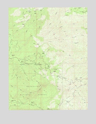
Raglin Ridge, CA USGS Topographic Map
Click on map above to begin viewing in our Map Viewer.

This topographic map contains these locations and features:
Feature Name Type Latitude Longitude GNIS ID View Map
Alder CreekStreamN40.0757°W122.6806°256157View Map
Basin CreekStreamN40.0318°W122.6878°256574View Map
Bear WallowBasinN40.0102°W122.7158°1666608View Map
Bear WallowBasinN40.0810°W122.7053°256731View Map
Bear Wallow SpringSpringN40.0096°W122.7156°256738View Map
Biscuit FlatFlatN40.1210°W122.6995°257087View Map
Brush CreekStreamN40.1207°W122.7042°257527View Map
Buck CreekStreamN40.1215°W122.6972°257562View Map
Copple PlacePopulated PlaceN40.0085°W122.6297°1658317View Map
Dry LakeLakeN40.0552°W122.7288°259577View Map
Elkhorn CreekStreamN40.1235°W122.7258°259863View Map
Elkhorn RidgeRidgeN40.0727°W122.7489°266688View Map
Franklin PointSummitN40.0460°W122.6803°260342View Map
Grau MineMineN40.0279°W122.6728°260812View Map
Hammer PlacePopulated PlaceN40.1196°W122.7172°1658703View Map
Hensley CreekStreamN40.1210°W122.7172°261275View Map
Hensley SpringsSpringN40.1043°W122.7267°261277View Map
Last Feed FlatFlatN40.1143°W122.6614°262338View Map
Little Basin CreekStreamN40.0282°W122.7000°262522View Map
Love Cabin SpringSpringN40.0663°W122.7457°262977View Map
Mary Ellen PlacePopulated PlaceN40.1199°W122.6322°1659071View Map
North Fork Dry CreekStreamN40.0957°W122.6475°264158View Map
North Fork Hensley CreekStreamN40.1077°W122.7225°264170View Map
Pepperwood SpringSpringN40.0099°W122.6597°264648View Map
Pine SpringSpringN40.0493°W122.6747°264780View Map
Quail GulchValleyN40.1204°W122.7214°265084View Map
Raspberry Camp (historical)LocaleN40.0115°W122.7472°1666629View Map
Raspberry Camp SpringSpringN40.0110°W122.7469°265189View Map
Salt Lick SpringSpringN40.0390°W122.6386°265783View Map
Secret FlatFlatN40.1202°W122.7100°265973View Map
South Fork Dry CreekStreamN40.0957°W122.6472°267451View Map
South Fork Hensley CreekStreamN40.1077°W122.7225°267462View Map
Sulphur SpringSpringN40.1176°W122.7104°267903View Map
Sunflower FlatFlatN40.0802°W122.6439°267957View Map
Sunflower TrailTrailN40.0843°W122.6620°267962View Map
Twin SpringsSpringN40.0007°W122.6875°268547View Map
Wakefield FlatFlatN40.1238°W122.6408°268743View Map
WatsonPopulated PlaceN40.0538°W122.6878°1666636View Map
West Tehama DivisionCivilN40.0624°W122.6345°1935375View Map
Whisky RidgeRidgeN40.0421°W122.7247°268980View Map

Note: Coordinates in the location and feature list above are referenced to NAD83 datum.


Copyright (C) 2008-2025 Ryan Niemi / Sunset Dynamics ... All Rights Reserved