TopoQuest Logo
Do you find TopoQuest useful?
Help keep TopoQuest running and adding new maps/features by donating!
Bitcoin:  19c7KJd3qBynnjoSw5npx9KScwjBe4ifkT
Litecoin:  LXs6TkuXGGXo1vDsWCkWVdjQX94eUKd6ui
Home View Maps Find Maps Find Places Resources & Links


Lowrey, California Topographic Map

USGS Map Title: Lowrey, CA
USGS Map MRC: 40122A5
DRG (GeoTIFF) Download: o40122a5.tif


Neighboring USGS Topographic Map Quads:


  Cold Fork, CA  
40122B6
 

  Oxbow Bridge, CA  
40122B5
 

  Blossom, CA  
40122B4
 

  Raglin Ridge, CA  
40122A6
 

  Lowrey, CA  
40122A5
 

  Red Bank, CA  
40122A4
 

  Riley Ridge, CA  
39122H6
 

  Paskenta, CA  
39122H5
 

  Flournoy, CA  
39122H4


Map MRC Location:

N41°
W123°
N41°
W122°
H8 H7 H6 H5 H4 H3 H2 H1
G8 G7 G6 G5 G4 G3 G2 G1
F8 F7 F6 F5 F4 F3 F2 F1
E8 E7 E6 E5 E4 E3 E2 E1
D8 D7 D6 D5 D4 D3 D2 D1
C8 C7 C6 C5 C4 C3 C2 C1
B8 B7 B6 B5 B4 B3 B2 B1
A8 A7 A6 A5 A4 A3 A2 A1
N40°
W123°
N40°
W122°

Lowrey, CA USGS 1:24K Topographic Map Preview:
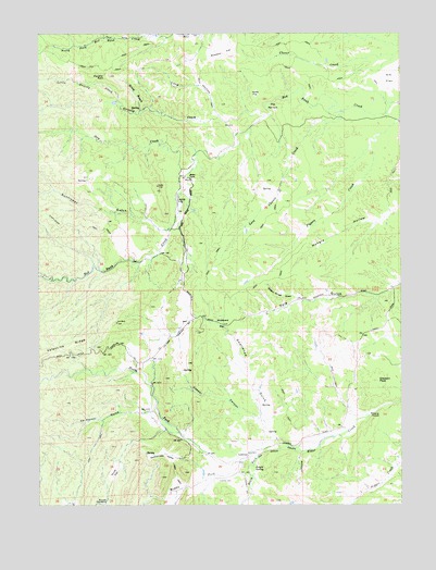
Lowrey, CA USGS Topographic Map
Click on map above to begin viewing in our Map Viewer.

This topographic map contains these locations and features:
Feature Name Type Latitude Longitude GNIS ID View Map
Banfield PlacePopulated PlaceN40.0865°W122.6086°1666607View Map
Big Bluff Ranch Airport (historical)AirportN40.0802°W122.5781°1653860View Map
Bluedoor FlatFlatN40.1199°W122.5633°219533View Map
Brown PlacePopulated PlaceN40.0252°W122.5897°1666610View Map
Cooper CanyonValleyN40.0238°W122.5522°221520View Map
De Haven GulchValleyN40.0218°W122.5858°222080View Map
Dry CreekStreamN40.0938°W122.5714°259554View Map
Elk FlatFlatN40.1121°W122.5006°233843View Map
Gleason PeakSummitN40.0327°W122.5094°224210View Map
Grizzly CreekStreamN40.1032°W122.5475°260917View Map
Jungle SpringSpringN40.0099°W122.5522°226386View Map
Last Chance CreekStreamN40.1046°W122.5200°226912View Map
Leonard Place (historical)Populated PlaceN40.0754°W122.5058°1666621View Map
Lewis FlatFlatN40.1088°W122.5508°227043View Map
Little Grizzly CreekStreamN40.1071°W122.5992°262622View Map
Long HollowValleyN40.1040°W122.5658°227573View Map
LowreyPopulated PlaceN40.0138°W122.5533°252729View Map
Lowrey CemeteryCemeteryN40.0065°W122.5647°227803View Map
Middle Fork Elder CreekStreamN40.0115°W122.5561°263527View Map
Miller RanchLocaleN40.0463°W122.5778°1666625View Map
Montgomery PlacePopulated PlaceN40.0865°W122.5761°1666626View Map
North Fork Elder CreekStreamN40.0132°W122.5500°264161View Map
Panther RockPillarN40.1135°W122.6020°230312View Map
Rattlesnake ValleyValleyN40.0124°W122.5783°231278View Map
Rouse FlatAreaN40.0096°W122.5997°231983View Map
Saunders PlacePopulated PlaceN40.0504°W122.5475°1666630View Map
Smallwood GulchValleyN40.0240°W122.5497°233308View Map
South Fork Elder CreekStreamN40.0132°W122.5500°267456View Map
Spring BranchStreamN40.1046°W122.5917°235225View Map
Sunflower 1261 DamDamN40.0732°W122.5861°1664429View Map
Sunflower GulchValleyN40.0732°W122.5853°267960View Map
The NarrowsGapN40.1065°W122.5458°236203View Map
Wagon Wheel DrawValleyN40.0546°W122.5372°237152View Map
Westend Galatin Place (historical)Populated PlaceN40.0243°W122.5192°1666637View Map
Woodyard FlatFlatN40.0479°W122.5639°238178View Map

Note: Coordinates in the location and feature list above are referenced to NAD83 datum.


Copyright (C) 2008-2024 Ryan Niemi / Sunset Dynamics ... All Rights Reserved