TopoQuest Logo
Do you find TopoQuest useful?
Help keep TopoQuest running and adding new maps/features by donating!
Bitcoin:  19c7KJd3qBynnjoSw5npx9KScwjBe4ifkT
Litecoin:  LXs6TkuXGGXo1vDsWCkWVdjQX94eUKd6ui
Home View Maps Find Maps Find Places Resources & Links


Peculiar, Missouri Topographic Map

USGS Map Title: Peculiar, MO
USGS Map MRC: 38094F4
DRG (GeoTIFF) Download: o38094f4.tif


Neighboring USGS Topographic Map Quads:


  Belton, MO  
38094G5
 

  Raymore, MO  
38094G4
 

  Pleasant Hill, MO  
38094G3
 

  West Line, MO  
38094F5
 

  Peculiar, MO  
38094F4
 

  Harrisonville, MO  
38094F3
 

  Freeman, MO  
38094E5
 

  Everett, MO  
38094E4
 

  Austin, MO  
38094E3


Map MRC Location:

N39°
W95°
N39°
W94°
H8 H7 H6 H5 H4 H3 H2 H1
G8 G7 G6 G5 G4 G3 G2 G1
F8 F7 F6 F5 F4 F3 F2 F1
E8 E7 E6 E5 E4 E3 E2 E1
D8 D7 D6 D5 D4 D3 D2 D1
C8 C7 C6 C5 C4 C3 C2 C1
B8 B7 B6 B5 B4 B3 B2 B1
A8 A7 A6 A5 A4 A3 A2 A1
N38°
W95°
N38°
W94°

Peculiar, MO USGS 1:24K Topographic Map Preview:
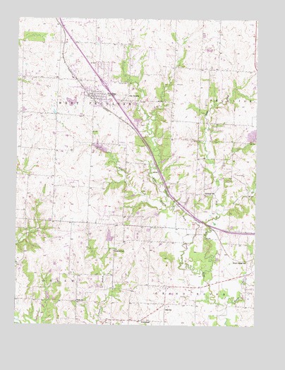
Peculiar, MO USGS Topographic Map
Click on map above to begin viewing in our Map Viewer.

This topographic map contains these locations and features:
Feature Name Type Latitude Longitude GNIS ID View Map
Baiers Den LakeReservoirN38.6611°W94.4513°763142View Map
Baiers Den Lake DamDamN38.6600°W94.4519°763141View Map
BartonLocaleN38.6875°W94.4261°745561View Map
Bills School (historical)SchoolN38.6314°W94.4213°714241View Map
Brown CemeteryCemeteryN38.6869°W94.3855°714766View Map
Brush College School (historical)SchoolN38.6514°W94.3794°714819View Map
Cass Regional Medical CenterHospitalN38.6649°W94.3770°2655091View Map
City of PeculiarCivilN38.7306°W94.4736°2396171View Map
East Fork East Branch South Grand RiverStreamN38.6453°W94.4013°717282View Map
Harper LakeReservoirN38.7160°W94.4719°762902View Map
Harper Lake DamDamN38.7150°W94.4702°762901View Map
Muddy CreekStreamN38.6345°W94.3883°723033View Map
Old PeculiarPopulated PlaceN38.7192°W94.4416°723771View Map
PeculiarPopulated PlaceN38.7192°W94.4586°724169View Map
Peculiar CemeteryCemeteryN38.7238°W94.4435°724170View Map
Peculiar City ReservoirReservoirN38.6972°W94.4566°763215View Map
Peculiar City Reservoir DamDamN38.6950°W94.4536°763214View Map
Peculiar Elementary SchoolSchoolN38.7182°W94.4553°2545197View Map
Peculiar Police DepartmentBuildingN38.7188°W94.4600°2752192View Map
Peculiar Post OfficePost OfficeN38.7230°W94.4595°2782812View Map
Pleasant Ridge School (historical)SchoolN38.6752°W94.4947°745919View Map
Polecat CreekStreamN38.6725°W94.3916°724706View Map
PrettymanPopulated PlaceN38.6267°W94.4316°741171View Map
Raymore - Peculiar Freshman CenterSchoolN38.7419°W94.4582°2545200View Map
Raymore - Peculiar High SchoolSchoolN38.7454°W94.4578°2477506View Map
Raymore - Peculiar Middle SchoolSchoolN38.7488°W94.4573°2477505View Map
Ridgeview Ranch AirportAirportN38.7216°W94.3791°2679339View Map
Rockford School (historical)SchoolN38.6553°W94.4488°725479View Map
Rodman School (historical)SchoolN38.6792°W94.4016°725529View Map
Shull Elementary SchoolSchoolN38.7406°W94.4569°2545347View Map
South Harper Peaking FacilityLocaleN38.6802°W94.4821°2477738View Map
Township of West PeculiarCivilN38.7099°W94.4610°766448View Map
West Aero Ranch AirportAirportN38.6997°W94.4733°758854View Map
West Peculiar Fire Protection District Station 1BuildingN38.7170°W94.4620°2621093View Map
Wills CemeteryCemeteryN38.7234°W94.4177°728912View Map
Wolf CreekStreamN38.6761°W94.4252°729040View Map
Wolfe School (historical)SchoolN38.6347°W94.4688°729076View Map

Note: Coordinates in the location and feature list above are referenced to NAD83 datum.


Copyright (C) 2008-2025 Ryan Niemi / Sunset Dynamics ... All Rights Reserved