TopoQuest Logo
Do you find TopoQuest useful?
Help keep TopoQuest running and adding new maps/features by donating!
Bitcoin:  19c7KJd3qBynnjoSw5npx9KScwjBe4ifkT
Litecoin:  LXs6TkuXGGXo1vDsWCkWVdjQX94eUKd6ui
Home View Maps Find Maps Find Places Resources & Links


Pemberton, New Jersey Topographic Map

USGS Map Title: Pemberton, NJ
USGS Map MRC: 39074H6
DRG (GeoTIFF) Download: o39074h6.tif


Neighboring USGS Topographic Map Quads:


  Bristol, PA  
40074A7
 

  Columbus, NJ  
40074A6
 

  New Egypt, NJ  
40074A5
 

  Mount Holly, NJ  
39074H7
 

  Pemberton, NJ  
39074H6
 

  Browns Mills, NJ  
39074H5
 

  Medford Lakes, NJ  
39074G7
 

  Indian Mills, NJ  
39074G6
 

  Chatsworth, NJ  
39074G5


Map MRC Location:

N40°
W75°
N40°
W74°
H8 H7 H6 H5 H4 H3 H2 H1
G8 G7 G6 G5 G4 G3 G2 G1
F8 F7 F6 F5 F4 F3 F2 F1
E8 E7 E6 E5 E4 E3 E2 E1
D8 D7 D6 D5 D4 D3 D2 D1
C8 C7 C6 C5 C4 C3 C2 C1
B8 B7 B6 B5 B4 B3 B2 B1
A8 A7 A6 A5 A4 A3 A2 A1
N39°
W75°
N39°
W74°

Pemberton, NJ USGS 1:24K Topographic Map Preview:
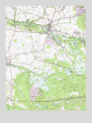
Pemberton, NJ USGS Topographic Map
Click on map above to begin viewing in our Map Viewer.

This topographic map contains these locations and features:
Feature Name Type Latitude Longitude GNIS ID View Map
Beaverdam CreekStreamN39.9307°W74.7490°874626View Map
BeavervillePopulated PlaceN39.9018°W74.7418°874628View Map
Big HillSummitN39.8976°W74.6954°874755View Map
BirminghamPopulated PlaceN39.9759°W74.7102°874772View Map
Birmingham Post OfficePost OfficeN39.9768°W74.7101°2781410View Map
Borough of PembertonCivilN39.9714°W74.6859°885346View Map
Budd RunStreamN39.9751°W74.6922°883171View Map
BuddtownPopulated PlaceN39.9393°W74.7029°875017View Map
Burlington CountyCivilN39.8777°W74.6681°882272View Map
Burlington County Alternative High SchoolSchoolN39.9643°W74.6452°2372492View Map
Burlington County CollegeSchoolN39.9644°W74.6455°2372750View Map
Burlington County Juvenile Detention CenterBuildingN39.9672°W74.6333°2733245View Map
Burrs MillPopulated PlaceN39.8884°W74.6499°875051View Map
Burrs Mill BrookStreamN39.8796°W74.6915°875052View Map
Burrs Mill Brook ReservoirReservoirN39.8854°W74.6365°884193View Map
Buttonwood Hospital of Burlington CountyBuildingN39.9680°W74.6370°878776View Map
Cedar RunStreamN39.9140°W74.6860°875313View Map
Cold Water RunStreamN39.8803°W74.7465°875548View Map
Comical CornersPopulated PlaceN39.9834°W74.6832°875595View Map
Crescent HeightsPopulated PlaceN39.9687°W74.7165°875717View Map
Eastampton Township Fire Company Station 341BuildingN39.9853°W74.7485°2401763View Map
EwansvillePopulated PlaceN39.9784°W74.7352°876246View Map
Fort Dix Elementary SchoolSchoolN39.9932°W74.6277°2373473View Map
Friendship CreekStreamN39.9230°W74.7165°876531View Map
Friendship Creek BranchStreamN39.8810°W74.6981°876532View Map
Good Will Fire CompanyBuildingN39.9695°W74.6840°2401934View Map
Gravelly Run DamDamN39.8768°W74.7013°884071View Map
Gravelly Run PondReservoirN39.8795°W74.6966°884072View Map
Greenwood BranchStreamN39.9606°W74.6359°876810View Map
Hampton LakesPopulated PlaceN39.8918°W74.7118°883366View Map
Hampton Lakes Emergency SquadBuildingN39.8869°W74.7105°2659906View Map
Hampton Lakes Fire CompanyBuildingN39.8964°W74.7135°2401555View Map
Helen A Fort Newcomb Middle SchoolSchoolN39.9982°W74.6592°2372456View Map
Howard L Emmons Elementary SchoolSchoolN39.9621°W74.6821°2373413View Map
Huntington Drive DamDamN39.9068°W74.7113°884190View Map
Lake ThreeReservoirN39.9068°W74.7113°884189View Map
LeisuretownePopulated PlaceN39.8923°W74.7021°883367View Map
Leisuretowne Census Designated PlaceCensusN39.8987°W74.7052°2390054View Map
Lisbon DamDamN39.9604°W74.6296°884192View Map
MagnoliaPopulated PlaceN39.9498°W74.6607°878026View Map
Magnolia Road Volunteer Fire CompanyBuildingN39.9474°W74.6593°2401935View Map
Marcus W Newcomb Elementary SchoolSchoolN39.9968°W74.6581°2372399View Map
Marl PitMineN39.9829°W74.7157°878127View Map
New Jersey State Police Troop C Red Lion StationBuildingN39.8821°W74.7383°2730829View Map
New LisbonPopulated PlaceN39.9582°W74.6279°878745View Map
New Lisbon Mill DamDamN39.9604°W74.6296°884191View Map
Oak Grove ChurchChurchN39.9187°W74.7154°878904View Map
Old Forge LakeReservoirN39.8896°W74.7079°878955View Map
PembertonPopulated PlaceN39.9721°W74.6829°879198View Map
Pemberton AirportAirportN39.9813°W74.6956°884882View Map
Pemberton Borough Elementary SchoolSchoolN39.9729°W74.6794°2372109View Map
Pemberton Borough Police DepartmentBuildingN39.9735°W74.6797°2730899View Map
Pemberton First Aid and Rescue SquadBuildingN39.9889°W74.6869°2659900View Map
Pemberton HeightsPopulated PlaceN39.9626°W74.6788°879199View Map
Pemberton Heights Census Designated PlaceCensusN39.9564°W74.6766°2389655View Map
Pemberton Township High SchoolSchoolN39.9922°W74.6857°2372498View Map
Pemberton Township Police DepartmentBuildingN39.9672°W74.6335°2730750View Map
Powells RunStreamN39.9827°W74.7388°879471View Map
Red LionPopulated PlaceN39.8896°W74.7446°879636View Map
Red Lion AirportAirportN39.9042°W74.7495°884962View Map
Red Lion CircleLocaleN39.8871°W74.7413°879638View Map
RetreatPopulated PlaceN39.9165°W74.7127°879666View Map
Saint James ChurchChurchN39.9001°W74.6588°879992View Map
Samuel T Busansky Elementary SchoolSchoolN39.9597°W74.6817°2372277View Map
ScrapetownPopulated PlaceN39.9479°W74.6921°883365View Map
Scratch RidgePopulated PlaceN39.9693°W74.7329°883073View Map
SmithvillePopulated PlaceN39.9859°W74.7485°880667View Map
South PembertonPopulated PlaceN39.9676°W74.6849°880742View Map
Southampton Township School Number 1SchoolN39.9353°W74.7478°2372192View Map
Southampton Township School Number 2SchoolN39.9359°W74.7459°2372490View Map
Southampton Township School Number 3SchoolN39.9350°W74.7460°2373581View Map
Township of SouthamptonCivilN39.9137°W74.7171°882090View Map
VincentownPopulated PlaceN39.9340°W74.7485°881465View Map
Vincentown MillpondReservoirN39.9309°W74.7488°884110View Map
WWJZ-AM (Mount Holly)TowerN39.9971°W74.7193°884582View Map

Note: Coordinates in the location and feature list above are referenced to NAD83 datum.


Copyright (C) 2008-2024 Ryan Niemi / Sunset Dynamics ... All Rights Reserved