TopoQuest Logo
Do you find TopoQuest useful?
Help keep TopoQuest running and adding new maps/features by donating!
Bitcoin:  19c7KJd3qBynnjoSw5npx9KScwjBe4ifkT
Litecoin:  LXs6TkuXGGXo1vDsWCkWVdjQX94eUKd6ui
Home View Maps Find Maps Find Places Resources & Links


Perry, Michigan Topographic Map

USGS Map Title: Perry, MI
USGS Map MRC: 42084G2
DRG (GeoTIFF) Download: o42084g2.tif


Neighboring USGS Topographic Map Quads:


  Laingsburg, MI  
42084H3
 

  Owosso South, MI  
42084H2
 

  Corunna, MI  
42084H1
 

  Shaftsburg, MI  
42084G3
 

  Perry, MI  
42084G2
 

  Corunna SE, MI  
42084G1
 

  Williamston, MI  
42084F3
 

  Webberville, MI  
42084F2
 

  Fowlerville, MI  
42084F1


Map MRC Location:

N43°
W85°
N43°
W84°
H8 H7 H6 H5 H4 H3 H2 H1
G8 G7 G6 G5 G4 G3 G2 G1
F8 F7 F6 F5 F4 F3 F2 F1
E8 E7 E6 E5 E4 E3 E2 E1
D8 D7 D6 D5 D4 D3 D2 D1
C8 C7 C6 C5 C4 C3 C2 C1
B8 B7 B6 B5 B4 B3 B2 B1
A8 A7 A6 A5 A4 A3 A2 A1
N42°
W85°
N42°
W84°

Perry, MI USGS 1:24K Topographic Map Preview:
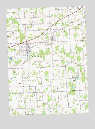
Perry, MI USGS Topographic Map
Click on map above to begin viewing in our Map Viewer.

This topographic map contains these locations and features:
Feature Name Type Latitude Longitude GNIS ID View Map
Alling DrainCanalN42.8581°W84.1622°619996View Map
Atherton DrainCanalN42.8631°W84.1416°620299View Map
Bacon LakeLakeN42.7914°W84.2439°620419View Map
Beard CemeteryCemeteryN42.8106°W84.1491°620882View Map
Bennington and Perry DrainCanalN42.8639°W84.2072°621122View Map
Bethany Bible ChurchChurchN42.8403°W84.1308°2576020View Map
Bethemy CemeteryCemeteryN42.8317°W84.1811°621228View Map
Buck BranchStreamN42.7839°W84.2469°622167View Map
Church of NazareneChurchN42.8125°W84.2183°2576026View Map
City of PerryCivilN42.8261°W84.2208°1626895View Map
Dysinger AirportAirportN42.8124°W84.1893°1624101View Map
Family Christian ChurchChurchN42.8339°W84.2178°2576024View Map
Glenbrier Golf CourseLocaleN42.7853°W84.2489°2576051View Map
Grub DrainCanalN42.8270°W84.1855°627482View Map
Hemingway LakeLakeN42.7920°W84.1405°628076View Map
Hog IslandSummitN42.8673°W84.1261°628387View Map
Howard CemeteryCemeteryN42.8721°W84.1729°628687View Map
Howard DrainCanalN42.8739°W84.1711°628691View Map
Interchange 105CrossingN42.8361°W84.2194°2576161View Map
Kellogg DrainCanalN42.8698°W84.2314°629525View Map
McCrea DrainCanalN42.7764°W84.2122°631857View Map
MorricePopulated PlaceN42.8386°W84.1783°632707View Map
Morrice Area Elementary SchoolSchoolN42.8414°W84.1783°2575952View Map
Morrice LibraryBuildingN42.8381°W84.1778°2575949View Map
Morrice Police DepartmentBuildingN42.8390°W84.1783°2737377View Map
Morrice Post OfficePost OfficeN42.8386°W84.1778°2575947View Map
Morrice Senior High SchoolSchoolN42.8417°W84.1772°2575953View Map
Morrice StationLocaleN42.8394°W84.1783°2576190View Map
Morrice United Methodist ChurchChurchN42.8364°W84.1775°2575950View Map
North LakesLakeN42.8489°W84.2253°633602View Map
Old Perry Centre Historical MarkerParkN42.8124°W84.2229°2571292View Map
Our Saviour's Lutheran ChurchChurchN42.8342°W84.2242°2576025View Map
Perch LakeLakeN42.7931°W84.2466°634620View Map
PerryPopulated PlaceN42.8264°W84.2194°634666View Map
Perry Area Fire RescueBuildingN42.8244°W84.2187°2576042View Map
Perry Area Fire Rescue Station 2BuildingN42.8388°W84.1780°2575948View Map
Perry Baptist ChurchChurchN42.8233°W84.2186°2576034View Map
Perry CemeteryCemeteryN42.8128°W84.2000°2576123View Map
Perry City HallBuildingN42.8269°W84.2208°2576045View Map
Perry Congregational Christian ChurchChurchN42.8250°W84.2178°2576023View Map
Perry Elementary SchoolSchoolN42.8292°W84.2169°2576049View Map
Perry Family PracticeHospitalN42.8344°W84.2250°2576040View Map
Perry Free Methodist ChurchChurchN42.8239°W84.2222°2576032View Map
Perry High SchoolSchoolN42.8333°W84.2133°2576048View Map
Perry Historical MusuemBuildingN42.8256°W84.2181°2576188View Map
Perry Jubilee ParkParkN42.8236°W84.2264°2576187View Map
Perry LibraryBuildingN42.8247°W84.2189°2576044View Map
Perry Middle SchoolSchoolN42.8333°W84.2139°2576046View Map
Perry Police DepartmentBuildingN42.8273°W84.2208°2737604View Map
Perry Post OfficePost OfficeN42.8264°W84.2189°2576041View Map
Perry StationLocaleN42.8258°W84.2200°2576185View Map
Perry United Methodist ChurchChurchN42.8244°W84.2172°2576035View Map
Pickerel LakeLakeN42.7945°W84.2391°634783View Map
Roselawn CemeteryCemeteryN42.8117°W84.1986°636233View Map
Saint Mary's ChurchChurchN42.8411°W84.1783°2575951View Map
Saint Mary's Church Historical MarkerParkN42.8406°W84.1780°2571284View Map
Sauger LakeLakeN42.7800°W84.1486°637272View Map
Sunrise ParkParkN42.8450°W84.1811°639092View Map
Township of PerryCivilN42.8203°W84.1875°1626896View Map
Twin LakesLakeN42.7881°W84.1452°1615257View Map
Village of MorriceCivilN42.8362°W84.1833°2399396View Map
Ward LakeLakeN42.8009°W84.2408°1615763View Map
World Harvest Assembly of God ChurchChurchN42.8111°W84.2239°2576031View Map

Note: Coordinates in the location and feature list above are referenced to NAD83 datum.


Copyright (C) 2008-2025 Ryan Niemi / Sunset Dynamics ... All Rights Reserved