TopoQuest Logo
Do you find TopoQuest useful?
Help keep TopoQuest running and adding new maps/features by donating!
Bitcoin:  19c7KJd3qBynnjoSw5npx9KScwjBe4ifkT
Litecoin:  LXs6TkuXGGXo1vDsWCkWVdjQX94eUKd6ui
Home View Maps Find Maps Find Places Resources & Links


Shaftsburg, Michigan Topographic Map

USGS Map Title: Shaftsburg, MI
USGS Map MRC: 42084G3
DRG (GeoTIFF) Download: o42084g3.tif


Neighboring USGS Topographic Map Quads:


  Price, MI  
42084H4
 

  Laingsburg, MI  
42084H3
 

  Owosso South, MI  
42084H2
 

  Bath, MI  
42084G4
 

  Shaftsburg, MI  
42084G3
 

  Perry, MI  
42084G2
 

  East Lansing, MI  
42084F4
 

  Williamston, MI  
42084F3
 

  Webberville, MI  
42084F2


Map MRC Location:

N43°
W85°
N43°
W84°
H8 H7 H6 H5 H4 H3 H2 H1
G8 G7 G6 G5 G4 G3 G2 G1
F8 F7 F6 F5 F4 F3 F2 F1
E8 E7 E6 E5 E4 E3 E2 E1
D8 D7 D6 D5 D4 D3 D2 D1
C8 C7 C6 C5 C4 C3 C2 C1
B8 B7 B6 B5 B4 B3 B2 B1
A8 A7 A6 A5 A4 A3 A2 A1
N42°
W85°
N42°
W84°

Shaftsburg, MI USGS 1:24K Topographic Map Preview:
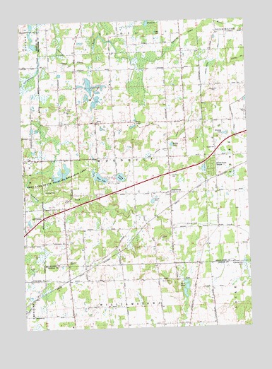
Shaftsburg, MI USGS Topographic Map
Click on map above to begin viewing in our Map Viewer.

This topographic map contains these locations and features:
Feature Name Type Latitude Longitude GNIS ID View Map
Alverson Post Office (historical)Post OfficeN42.7700°W84.3361°2634308View Map
Church of the Bible CovenantChurchN42.7953°W84.3653°623279View Map
Colby LakeLakeN42.8118°W84.3200°623551View Map
Community Bible ChurchChurchN42.8047°W84.2950°2576019View Map
Countryside Village Mobile Home ParkPopulated PlaceN42.8347°W84.2506°2576037View Map
County Line LakeLakeN42.7757°W84.2532°623890View Map
Devore DrainCanalN42.8595°W84.2505°624616View Map
Dunham Memorial LibraryBuildingN42.8044°W84.2983°2576038View Map
Dunn LakesLakeN42.8325°W84.3119°625006View Map
Forest Green EstatesPopulated PlaceN42.8150°W84.2702°626255View Map
Graham CemeteryCemeteryN42.8342°W84.3339°2576136View Map
Graham ChurchChurchN42.8342°W84.3330°627067View Map
Hickory LakeLakeN42.8286°W84.2619°628195View Map
Hickory Lake CampgroundLocaleN42.8283°W84.2650°2576186View Map
Interchange 98CrossingN42.7986°W84.3522°2576160View Map
Kay Family CemeteryCemeteryN42.8334°W84.2861°2576129View Map
Laingsburg Sciota Woodhull Fire and Emergency Services Station 2BuildingN42.8046°W84.2927°2635975View Map
Leisure LakesLakeN42.8441°W84.3385°630293View Map
Loon LakeLakeN42.8703°W84.2997°631043View Map
Marsh LakeLakeN42.8246°W84.2917°631619View Map
Michigan Department of Natural Resources Rose Lake OfficeBuildingN42.8029°W84.3502°2636129View Map
Moon LakeLakeN42.8112°W84.3316°632624View Map
Oak Plain CemeteryCemeteryN42.8114°W84.2925°633853View Map
Osborn Creek DrainCanalN42.8409°W84.2797°634122View Map
Perry Aero Park Airport (historical)AirportN42.8212°W84.2764°2650909View Map
Perry Number Two DrainCanalN42.8403°W84.2569°634678View Map
Perry SchoolSchoolN42.8023°W84.3514°634682View Map
Quiet Cove Mobile Home ParkPopulated PlaceN42.8111°W84.3250°2576078View Map
ShaftsburgPopulated PlaceN42.8048°W84.2930°637641View Map
Shaftsburg Elementary SchoolSchoolN42.8053°W84.2986°2576018View Map
Shaftsburg Post OfficePost OfficeN42.8050°W84.2933°2576021View Map
Shaftsburg StationLocaleN42.7994°W84.2925°2576189View Map
Shaftsburg United Methodist ChurchChurchN42.8072°W84.3128°2576016View Map
Sprague CemeteryCemeteryN42.8555°W84.3444°2576126View Map
Three LakesLakeN42.7666°W84.2850°1614817View Map
Township of WoodhullCivilN42.8189°W84.3187°1627288View Map
Wolf LakeLakeN42.8742°W84.3041°1616706View Map
Woodbury Rest AreaLocaleN42.8144°W84.3059°2571267View Map
Woodhull CemeteryCemeteryN42.7767°W84.3505°1616747View Map

Note: Coordinates in the location and feature list above are referenced to NAD83 datum.


Copyright (C) 2008-2024 Ryan Niemi / Sunset Dynamics ... All Rights Reserved