TopoQuest Logo
Do you find TopoQuest useful?
Help keep TopoQuest running and adding new maps/features by donating!
Bitcoin:  19c7KJd3qBynnjoSw5npx9KScwjBe4ifkT
Litecoin:  LXs6TkuXGGXo1vDsWCkWVdjQX94eUKd6ui
Home View Maps Find Maps Find Places Resources & Links


Laingsburg, Michigan Topographic Map

USGS Map Title: Laingsburg, MI
USGS Map MRC: 42084H3
DRG (GeoTIFF) Download: o42084h3.tif


Neighboring USGS Topographic Map Quads:


  Ovid West, MI  
43084A4
 

  Ovid East, MI  
43084A3
 

  Owosso North, MI  
43084A2
 

  Price, MI  
42084H4
 

  Laingsburg, MI  
42084H3
 

  Owosso South, MI  
42084H2
 

  Bath, MI  
42084G4
 

  Shaftsburg, MI  
42084G3
 

  Perry, MI  
42084G2


Map MRC Location:

N43°
W85°
N43°
W84°
H8 H7 H6 H5 H4 H3 H2 H1
G8 G7 G6 G5 G4 G3 G2 G1
F8 F7 F6 F5 F4 F3 F2 F1
E8 E7 E6 E5 E4 E3 E2 E1
D8 D7 D6 D5 D4 D3 D2 D1
C8 C7 C6 C5 C4 C3 C2 C1
B8 B7 B6 B5 B4 B3 B2 B1
A8 A7 A6 A5 A4 A3 A2 A1
N42°
W85°
N42°
W84°

Laingsburg, MI USGS 1:24K Topographic Map Preview:
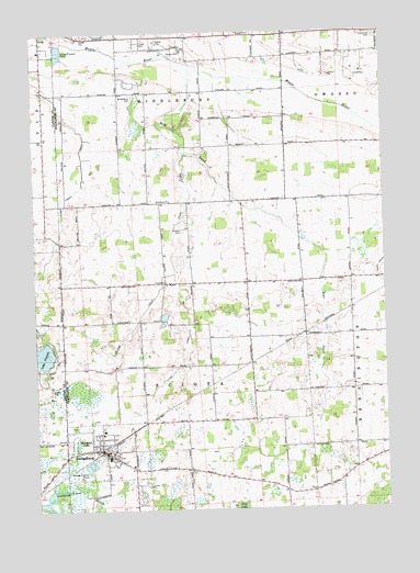
Laingsburg, MI USGS Topographic Map
Click on map above to begin viewing in our Map Viewer.

This topographic map contains these locations and features:
Feature Name Type Latitude Longitude GNIS ID View Map
Alder CreekStreamN42.9134°W84.3750°619920View Map
Bates Scout ParkParkN42.8967°W84.3617°2576194View Map
Bear CreekStreamN42.9914°W84.3186°620822View Map
Church of the NazareneChurchN42.8883°W84.3472°2576013View Map
City of LaingsburgCivilN42.8905°W84.3501°1626570View Map
Clinton Area Fire and Rescue Station 4BuildingN42.9130°W84.3674°2636123View Map
Coon CreekStreamN42.9686°W84.3214°623775View Map
Diamond LakeLakeN42.8923°W84.3605°624635View Map
First Baptist ChurchChurchN42.8867°W84.3408°2576068View Map
First Congregational ChurchChurchN42.8892°W84.3481°2576066View Map
LaingsburgPopulated PlaceN42.8903°W84.3514°629954View Map
Laingsburg - Sciota - Woodhull Emergency Services AuthorityBuildingN42.8843°W84.3399°2636163View Map
Laingsburg CemeteryCemeteryN42.8900°W84.3414°2576111View Map
Laingsburg Christian SchoolSchoolN42.8867°W84.3408°2576077View Map
Laingsburg City HallBuildingN42.8903°W84.3492°2576076View Map
Laingsburg City LibraryBuildingN42.8900°W84.3503°2576075View Map
Laingsburg City Police DeptBuildingN42.8897°W84.3500°2737425View Map
Laingsburg Elementary SchoolSchoolN42.8958°W84.3514°2576072View Map
Laingsburg High SchoolSchoolN42.8761°W84.3417°2576071View Map
Laingsburg Middle SchoolSchoolN42.8889°W84.3494°2576073View Map
Laingsburg Post OfficePost OfficeN42.8903°W84.3503°2576074View Map
Laingsburg StationLocaleN42.8903°W84.3522°2576192View Map
Laingsburg United Methodist ChurchChurchN42.8933°W84.3517°2576015View Map
Lake VictoriaReservoirN42.9182°W84.3749°1615576View Map
Lake Victoria Census Designated PlaceCensusN42.9168°W84.3750°2583748View Map
Lee Field Airport (historical)AirportN42.9223°W84.2822°1623802View Map
McClintock ParkParkN42.8914°W84.3486°2576193View Map
Middlebury CemeteryCemeteryN42.9836°W84.3390°632278View Map
Middlebury ChurchChurchN42.9559°W84.3266°632279View Map
Mount Olivet Catholic CemeteryCemeteryN42.8917°W84.3403°2576108View Map
Mulder Dairy FarmLocaleN42.9561°W84.3564°2725331View Map
Oak Grove CemeteryCemeteryN42.9984°W84.2524°633823View Map
Pine Hills Golf CourseLocaleN42.8939°W84.3333°2576070View Map
Putnam CemeteryCemeteryN42.9482°W84.3218°635527View Map
Putnam DrainCanalN42.9245°W84.3383°635528View Map
Saint Isidore Catholic ChurchChurchN42.8950°W84.3514°2576065View Map
Stork DrainCanalN42.9134°W84.3233°638925View Map
Township of MiddleburyCivilN42.9990°W84.3256°1626735View Map
Township of SciotaCivilN42.9097°W84.3197°1627051View Map
Vermilion CreekStreamN42.8770°W84.3716°1615546View Map

Note: Coordinates in the location and feature list above are referenced to NAD83 datum.


Copyright (C) 2008-2024 Ryan Niemi / Sunset Dynamics ... All Rights Reserved