TopoQuest Logo
Do you find TopoQuest useful?
Help keep TopoQuest running and adding new maps/features by donating!
Bitcoin:  19c7KJd3qBynnjoSw5npx9KScwjBe4ifkT
Litecoin:  LXs6TkuXGGXo1vDsWCkWVdjQX94eUKd6ui
Home View Maps Find Maps Find Places Resources & Links


Petersburg, Indiana Topographic Map

USGS Map Title: Petersburg, IN
USGS Map MRC: 38087D3
DRG (GeoTIFF) Download: o38087d3.tif


Neighboring USGS Topographic Map Quads:


  Iona, IN  
38087E4
 

  Monroe City, IN  
38087E3
 

  Sandy Hook, IN  
38087E2
 

  Union, IN  
38087D4
 

  Petersburg, IN  
38087D3
 

  Winslow, IN  
38087D2
 

  Francisco, IN  
38087C4
 

  Oakland City, IN  
38087C3
 

  Augusta, IN  
38087C2


Map MRC Location:

N39°
W88°
N39°
W87°
H8 H7 H6 H5 H4 H3 H2 H1
G8 G7 G6 G5 G4 G3 G2 G1
F8 F7 F6 F5 F4 F3 F2 F1
E8 E7 E6 E5 E4 E3 E2 E1
D8 D7 D6 D5 D4 D3 D2 D1
C8 C7 C6 C5 C4 C3 C2 C1
B8 B7 B6 B5 B4 B3 B2 B1
A8 A7 A6 A5 A4 A3 A2 A1
N38°
W88°
N38°
W87°

Petersburg, IN USGS 1:24K Topographic Map Preview:
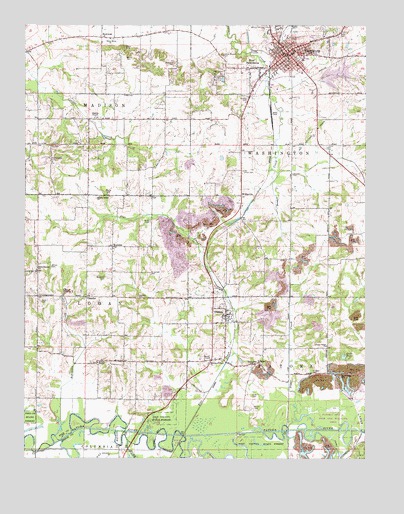
Petersburg, IN USGS Topographic Map
Click on map above to begin viewing in our Map Viewer.

This topographic map contains these locations and features:
Feature Name Type Latitude Longitude GNIS ID View Map
Alford AirparkAirportN38.4646°W87.2503°2677083View Map
Ashby YardsPopulated PlaceN38.4745°W87.2847°449831View Map
Barren DitchCanalN38.3781°W87.2608°430528View Map
Beck CemeteryCemeteryN38.4200°W87.3686°430687View Map
Blaize CemeteryCemeteryN38.4512°W87.3450°431169View Map
BowmanPopulated PlaceN38.4964°W87.3470°431405View Map
ChandlerPopulated PlaceN38.4214°W87.3522°432394View Map
City of PetersburgCivilN38.4919°W87.2810°2396192View Map
Crow CemeteryCemeteryN38.3928°W87.2917°433203View Map
DeJarnett CemeteryCemeteryN38.4281°W87.3289°433375View Map
Flat CreekStreamN38.3817°W87.3167°434556View Map
Fowler CemeteryCemeteryN38.4906°W87.3381°434731View Map
Gladish ChapelChurchN38.4731°W87.3483°435098View Map
GlezenPopulated PlaceN38.4164°W87.3011°435127View Map
Globe PondLakeN38.4045°W87.2580°435130View Map
Harvey Creek ChurchChurchN38.4503°W87.3475°435852View Map
Hedges CemeteryCemeteryN38.3992°W87.2689°435976View Map
Hephzibah ChurchChurchN38.4017°W87.2917°436048View Map
Hornady ParkParkN38.4856°W87.3031°436481View Map
Hurricane CreekStreamN38.3800°W87.3608°436650View Map
Indian Mound CemeteryCemeteryN38.4914°W87.3025°436777View Map
Johnson CemeteryCemeteryN38.4570°W87.2770°437033View Map
LittlesPopulated PlaceN38.4012°W87.2872°438183View Map
Loveless CemeteryCemeteryN38.4212°W87.3336°438347View Map
Martin CemeteryCemeteryN38.3895°W87.2917°438721View Map
McGillem CemeteryCemeteryN38.4275°W87.3456°438873View Map
Mission of Faith ChurchChurchN38.4023°W87.3075°439286View Map
North Patoka Township Volunteer Fire Department Station 2BuildingN38.4086°W87.3057°2626468View Map
Old Town CemeteryCemeteryN38.4909°W87.2739°440607View Map
Old Union CemeteryCemeteryN38.4578°W87.2953°440612View Map
Olive Branch ChurchChurchN38.4289°W87.3703°440638View Map
PetersburgPopulated PlaceN38.4920°W87.2786°449709View Map
Petersburg Fire Department Station 1BuildingN38.4921°W87.2776°2625611View Map
Petersburg Police DepartmentBuildingN38.4895°W87.2815°2758411View Map
Pike Central SchoolSchoolN38.4917°W87.2770°447180View Map
Pike County Sheriff OfficeBuildingN38.4894°W87.2816°2758161View Map
Poplar Grove CemeteryCemeteryN38.4617°W87.3661°441443View Map
Prides Creek LakeReservoirN38.4855°W87.2612°447601View Map
Prides Creek Lake Dam Number 4DamN38.4850°W87.2667°447600View Map
Robinson CreekStreamN38.3814°W87.3636°442178View Map
RumblePopulated PlaceN38.4359°W87.3428°442387View Map
South Fork Patoka RiverStreamN38.3820°W87.3417°443810View Map
Stuckey CemeteryCemeteryN38.4784°W87.2936°444286View Map
Sugar CreekStreamN38.3837°W87.2781°444313View Map
Sugar Ridge CemeteryCemeteryN38.3984°W87.2592°444354View Map
Sugar Ridge ChurchChurchN38.4073°W87.2642°444357View Map
Township of LoganCivilN38.4156°W87.3618°453580View Map
Township of MadisonCivilN38.4914°W87.3519°453596View Map
Township of WashingtonCivilN38.4764°W87.2550°454013View Map
Weathers CemeteryCemeteryN38.4892°W87.3203°445594View Map
Weist CemeteryCemeteryN38.4934°W87.3383°445653View Map
West PetersburgPopulated PlaceN38.4875°W87.2892°445798View Map
White River ChurchChurchN38.4959°W87.3439°445960View Map
Willis CemeteryCemeteryN38.4434°W87.3289°446093View Map
WillisvillePopulated PlaceN38.4509°W87.2956°446094View Map
Wilson CemeteryCemeteryN38.4303°W87.3647°446125View Map
Wyatt CemeteryCemeteryN38.4034°W87.3072°446352View Map

Note: Coordinates in the location and feature list above are referenced to NAD83 datum.


Copyright (C) 2008-2024 Ryan Niemi / Sunset Dynamics ... All Rights Reserved